![](/images/other/stat-length.png)
![Trail Walking Jausiers - batterie de cuguret - Photo](https://media.geolcdn.com/t/1900/400/ext.pjpeg?maxdim=2&url=https%3A%2F%2Fstatic1.geolcdn.com%2Fsiteimages%2Fupload%2Ffiles%2F1553511878bg_sport_marche.png)
batterie de cuguret
jepesmoulin
User
![Length](/images/other/stat-length.png)
Length
12 km
![Max alt](https://static1.geolcdn.com/siteimages/upload/files/1508320355ic_sort_altitude_max_24dp.png)
Max alt
1909 m
![Uphill gradient](https://static1.geolcdn.com/siteimages/upload/files/1508320355ic_sort_den_pos_24dp.png)
Uphill gradient
760 m
![Km-Effort](/images/other/stat-length.png)
Km-Effort
22 km
![Min alt](https://static1.geolcdn.com/siteimages/upload/files/1508320355ic_sort_altitude_min_24dp.png)
Min alt
1210 m
![Downhill gradient](https://static1.geolcdn.com/siteimages/upload/files/1508320355ic_sort_den_neg_24dp.png)
Downhill gradient
683 m
![Boucle](https://static1.geolcdn.com/siteimages/upload/files/16400158638029165_repeat_loop_refresh_sync_direction_icon.png)
Boucle
No
Creation date :
2019-07-18 09:29:45.34
Updated on :
2019-07-19 06:58:50.906
![Walking](https://static1.geolcdn.com/sitytour/trail-icons/101.png)
3h30
Difficulty : Medium
![Scan this QR Code to open this trail in the SityTrail application](https://capi.geolives.com/qq0zvz2zws4bq2lad0pu/sitytour/trails/2143654/qr.png?size=200)
FREE GPS app for hiking
About
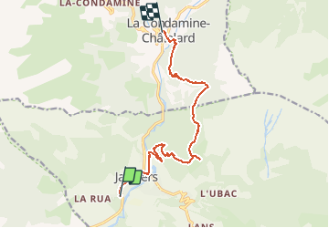
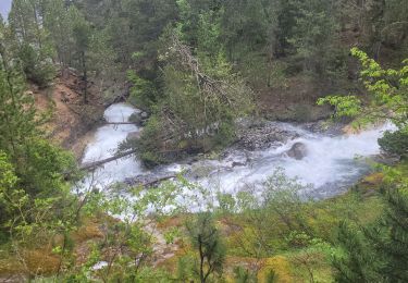
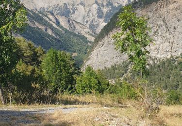
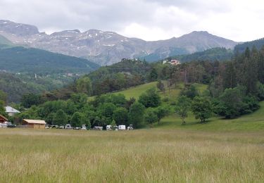
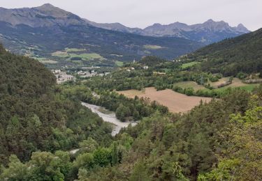
Trail Walking of 12 km to be discovered at Provence-Alpes-Côte d'Azur, Alpes-de-Haute-Provence, Jausiers. This trail is proposed by jepesmoulin.
Description
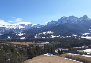
Très jolie balade sur les hauteurs de Jausiers et retour aux Condamines. Chemin bien entretenu mais peu pratiqué. Quelques passages aériens au départ et au passage
Positioning
Country:
France
Region :
Provence-Alpes-Côte d'Azur
Department/Province :
Alpes-de-Haute-Provence
Municipality :
Jausiers
Location:
Unknown
Start:(Dec)
Start:(UTM)
319123 ; 4920382 (32T) N.
Comments
Trails nearby
![Trail Walking Faucon-de-Barcelonnette - Pre de RATA et St Flavie - Photo](https://media.geolcdn.com/t/375/260/154d9cc8-7061-4846-bde4-1f8e811ca32f.jpeg&format=jpg&maxdim=2)
![Walking Walking](https://static1.geolcdn.com/sitytour/trail-icons/101.png)
Pre de RATA et St Flavie
Walking
Difficult
(1)
Faucon-de-Barcelonnette,
Provence-Alpes-Côte d'Azur,
Alpes-de-Haute-Provence,
France
![](/images/other/stat-length.png)
7.8 km | 13.4 km-effort
3h 7min
![](https://static1.geolcdn.com/siteimages/upload/files/16400158638029165_repeat_loop_refresh_sync_direction_icon.png)
Yes
![Trail Mountain bike Jausiers - Espace VTT FFC Vallée de l'Ubaye - Circuit n° 01 - La Tour des Sagnes - Photo](https://media.geolcdn.com/t/375/260/ext.jpg?maxdim=2&url=https%3A%2F%2Fservices.sitytrail.com%2FGeolivesWS%2FDownloadMedia.ashx%3FTrailID%3D102299%26Media%3D2764_1.jpg)
![Mountain bike Mountain bike](https://static1.geolcdn.com/sitytour/trail-icons/202.png)
Espace VTT FFC Vallée de l'Ubaye - Circuit n° 01 - La Tour des Sagnes
Mountain bike
Very difficult
(1)
Jausiers,
Provence-Alpes-Côte d'Azur,
Alpes-de-Haute-Provence,
France
![](/images/other/stat-length.png)
31 km | 45 km-effort
4h 0min
![](https://static1.geolcdn.com/siteimages/upload/files/16400158638029165_repeat_loop_refresh_sync_direction_icon.png)
Yes
![Trail Walking Jausiers - Fontaine de la pissoun 15-08-12 - Photo](https://media.geolcdn.com/t/375/260/ext.jpg?maxdim=2&url=https%3A%2F%2Fstatic1.geolcdn.com%2Fsiteimages%2Fupload%2Ffiles%2F1553511878bg_sport_marche.png)
![Walking Walking](https://static1.geolcdn.com/sitytour/trail-icons/101.png)
Fontaine de la pissoun 15-08-12
Walking
Medium
(1)
Jausiers,
Provence-Alpes-Côte d'Azur,
Alpes-de-Haute-Provence,
France
![](/images/other/stat-length.png)
9.5 km | 16.5 km-effort
3h 16min
![](https://static1.geolcdn.com/siteimages/upload/files/16400158638029165_repeat_loop_refresh_sync_direction_icon.png)
Yes
![Trail Electric bike Jausiers - Flavi Barcelonnette - Photo](https://media.geolcdn.com/t/375/260/c8c960c1-cd70-45b7-be5e-7238e8edcc3d.jpg&format=jpg&maxdim=2)
![Electric bike Electric bike](https://static1.geolcdn.com/sitytour/trail-icons/205.png)
Flavi Barcelonnette
Electric bike
Medium
Jausiers,
Provence-Alpes-Côte d'Azur,
Alpes-de-Haute-Provence,
France
![](/images/other/stat-length.png)
14.1 km | 21 km-effort
1h 47min
![](https://static1.geolcdn.com/siteimages/upload/files/16400158638029165_repeat_loop_refresh_sync_direction_icon.png)
No
![Trail Walking Jausiers - cascadede pissoun 24 06 2024 - Photo](https://media.geolcdn.com/t/375/260/5ad66409-df89-4698-a4d8-4799e98719e1.jpg&format=jpg&maxdim=2)
![Walking Walking](https://static1.geolcdn.com/sitytour/trail-icons/101.png)
cascadede pissoun 24 06 2024
Walking
Medium
Jausiers,
Provence-Alpes-Côte d'Azur,
Alpes-de-Haute-Provence,
France
![](/images/other/stat-length.png)
7.2 km | 13.1 km-effort
2h 21min
![](https://static1.geolcdn.com/siteimages/upload/files/16400158638029165_repeat_loop_refresh_sync_direction_icon.png)
Yes
![Trail Walking Jausiers - Pas de Grégoire /Chatelard - Photo](https://media.geolcdn.com/t/375/260/e3cd2f53-ab66-4d2b-85bb-ff61af04fea5.jpg&format=jpg&maxdim=2)
![Walking Walking](https://static1.geolcdn.com/sitytour/trail-icons/101.png)
Pas de Grégoire /Chatelard
Walking
Medium
Jausiers,
Provence-Alpes-Côte d'Azur,
Alpes-de-Haute-Provence,
France
![](/images/other/stat-length.png)
6.9 km | 11.3 km-effort
2h 1min
![](https://static1.geolcdn.com/siteimages/upload/files/16400158638029165_repeat_loop_refresh_sync_direction_icon.png)
Yes
![Trail Walking Enchastrayes - PETIT TOUR A BARCELONNETTE - Photo](https://media.geolcdn.com/t/375/260/761611be-210f-4c71-b07b-9bcca4672493.jpg&format=jpg&maxdim=2)
![Walking Walking](https://static1.geolcdn.com/sitytour/trail-icons/101.png)
PETIT TOUR A BARCELONNETTE
Walking
Medium
Enchastrayes,
Provence-Alpes-Côte d'Azur,
Alpes-de-Haute-Provence,
France
![](/images/other/stat-length.png)
7.3 km | 8.8 km-effort
2h 20min
![](https://static1.geolcdn.com/siteimages/upload/files/16400158638029165_repeat_loop_refresh_sync_direction_icon.png)
Yes
![Trail Walking Enchastrayes - Aupillon-cabane basse 04 - Photo](https://media.geolcdn.com/t/375/260/c4e540ee-f37d-4ae4-b1f2-58b6027df7e9.jpg&format=jpg&maxdim=2)
![Walking Walking](https://static1.geolcdn.com/sitytour/trail-icons/101.png)
Aupillon-cabane basse 04
Walking
Difficult
Enchastrayes,
Provence-Alpes-Côte d'Azur,
Alpes-de-Haute-Provence,
France
![](/images/other/stat-length.png)
11.1 km | 18 km-effort
3h 24min
![](https://static1.geolcdn.com/siteimages/upload/files/16400158638029165_repeat_loop_refresh_sync_direction_icon.png)
Yes
![Trail Walking Jausiers - Petite ballade autour du pas de Grégoire - Photo](https://media.geolcdn.com/t/375/260/26139b91-bf05-4c45-b67d-aa102294f739.jpg&format=jpg&maxdim=2)
![Walking Walking](https://static1.geolcdn.com/sitytour/trail-icons/101.png)
Petite ballade autour du pas de Grégoire
Walking
Medium
Jausiers,
Provence-Alpes-Côte d'Azur,
Alpes-de-Haute-Provence,
France
![](/images/other/stat-length.png)
4.7 km | 7.9 km-effort
1h 17min
![](https://static1.geolcdn.com/siteimages/upload/files/16400158638029165_repeat_loop_refresh_sync_direction_icon.png)
Yes