![](/images/other/stat-length.png)
![Trail Walking Prats-de-Mollo-la-Preste - Les Conques sources du Tech_T - Photo](https://media.geolcdn.com/t/1900/400/3201f24d-1bdf-4698-a9ae-280abac4a73f.jpg&format=pjpeg&maxdim=2)
Les Conques sources du Tech_T
force
User
![Length](/images/other/stat-length.png)
Length
18.1 km
![Max alt](https://static1.geolcdn.com/siteimages/upload/files/1508320355ic_sort_altitude_max_24dp.png)
Max alt
2382 m
![Uphill gradient](https://static1.geolcdn.com/siteimages/upload/files/1508320355ic_sort_den_pos_24dp.png)
Uphill gradient
980 m
![Km-Effort](/images/other/stat-length.png)
Km-Effort
31 km
![Min alt](https://static1.geolcdn.com/siteimages/upload/files/1508320355ic_sort_altitude_min_24dp.png)
Min alt
1602 m
![Downhill gradient](https://static1.geolcdn.com/siteimages/upload/files/1508320355ic_sort_den_neg_24dp.png)
Downhill gradient
980 m
![Boucle](https://static1.geolcdn.com/siteimages/upload/files/16400158638029165_repeat_loop_refresh_sync_direction_icon.png)
Boucle
Yes
Creation date :
2019-07-16 07:47:46.902
Updated on :
2019-07-17 14:51:47.184
![Walking](https://static1.geolcdn.com/sitytour/trail-icons/101.png)
7h17
Difficulty : Medium
![Scan this QR Code to open this trail in the SityTrail application](https://capi.geolives.com/qq0zvz2zws4bq2lad0pu/sitytour/trails/2142325/qr.png?size=200)
FREE GPS app for hiking
About
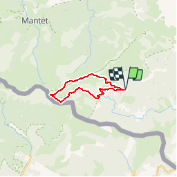
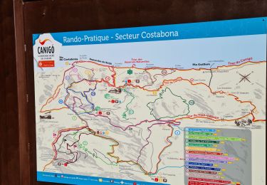
Trail Walking of 18.1 km to be discovered at Occitania, Pyrénées-Orientales, Prats-de-Mollo-la-Preste. This trail is proposed by force.
Description
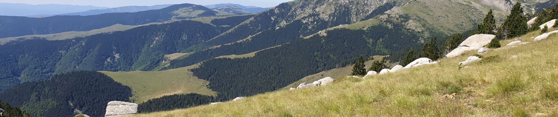
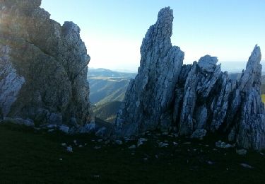
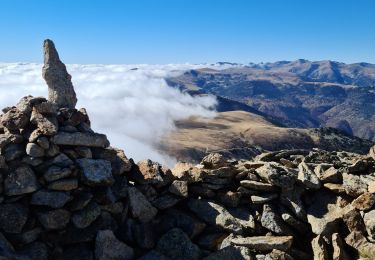
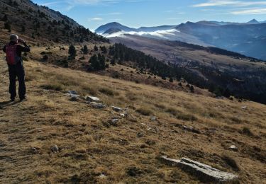
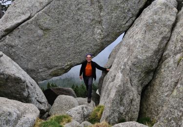
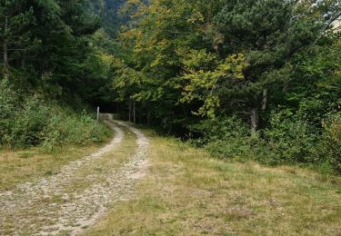
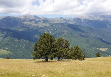
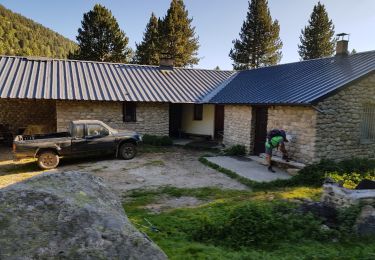
Montée agréable et ombragée, longue traversée en crête, découverte des sources du Tech. A la descente découverte d'une cascade sur le Tech, puis vue sur le Tech au bord de gorges parfois vertigineuse. Retour en montagnes russes vers le refuge des Conques
Positioning
Country:
France
Region :
Occitania
Department/Province :
Pyrénées-Orientales
Municipality :
Prats-de-Mollo-la-Preste
Location:
Unknown
Start:(Dec)
Start:(UTM)
450452 ; 4697323 (31T) N.
Comments
Trails nearby
![Trail Walking Prats-de-Mollo-la-Preste - Pic de Costabonne par les Conques_T - Photo](https://media.geolcdn.com/t/375/260/ext.jpg?maxdim=2&url=https%3A%2F%2Fservices.sitytrail.com%2FGeolivesWS%2FDownloadMedia.ashx%3FTrailID%3D209493%26Media%3Dfix__20130801075840.jpg)
![Walking Walking](https://static1.geolcdn.com/sitytour/trail-icons/101.png)
Pic de Costabonne par les Conques_T
Walking
Medium
(1)
Prats-de-Mollo-la-Preste,
Occitania,
Pyrénées-Orientales,
France
![](/images/other/stat-length.png)
20 km | 36 km-effort
7h 56min
![](https://static1.geolcdn.com/siteimages/upload/files/16400158638029165_repeat_loop_refresh_sync_direction_icon.png)
Yes
![Trail Walking Prats-de-Mollo-la-Preste - Forquet col del vents pic set homme roche blanche retour forquey - Photo](https://media.geolcdn.com/t/375/260/7bbcf549-e385-4d58-8318-7192b6fb54e4.jpg&format=jpg&maxdim=2)
![Walking Walking](https://static1.geolcdn.com/sitytour/trail-icons/101.png)
Forquet col del vents pic set homme roche blanche retour forquey
Walking
Difficult
Prats-de-Mollo-la-Preste,
Occitania,
Pyrénées-Orientales,
France
![](/images/other/stat-length.png)
22 km | 38 km-effort
9h 59min
![](https://static1.geolcdn.com/siteimages/upload/files/16400158638029165_repeat_loop_refresh_sync_direction_icon.png)
Yes
![Trail Walking Prats-de-Mollo-la-Preste - Fourquettes Collada del vent Roches banches retour - Photo](https://media.geolcdn.com/t/375/260/027c601f-0810-42dd-bd2d-23c81e3b9425.jpg&format=jpg&maxdim=2)
![Walking Walking](https://static1.geolcdn.com/sitytour/trail-icons/101.png)
Fourquettes Collada del vent Roches banches retour
Walking
Medium
Prats-de-Mollo-la-Preste,
Occitania,
Pyrénées-Orientales,
France
![](/images/other/stat-length.png)
13.4 km | 23 km-effort
5h 13min
![](https://static1.geolcdn.com/siteimages/upload/files/16400158638029165_repeat_loop_refresh_sync_direction_icon.png)
Yes
![Trail Walking Prats-de-Mollo-la-Preste - Costabone via Siern Esquerdes de roja Rocarodona La Preste - Photo](https://media.geolcdn.com/t/375/260/5a9b2aaa-e81c-4ab0-ba2f-ee276fb16f06.jpg&format=jpg&maxdim=2)
![Walking Walking](https://static1.geolcdn.com/sitytour/trail-icons/101.png)
Costabone via Siern Esquerdes de roja Rocarodona La Preste
Walking
Difficult
Prats-de-Mollo-la-Preste,
Occitania,
Pyrénées-Orientales,
France
![](/images/other/stat-length.png)
22 km | 41 km-effort
10h 53min
![](https://static1.geolcdn.com/siteimages/upload/files/16400158638029165_repeat_loop_refresh_sync_direction_icon.png)
Yes
![Trail Walking Prats-de-Mollo-la-Preste - Le Chalet -La Forge -Col Pregon -Col de Siern - Le Chalet . - Photo](https://media.geolcdn.com/t/375/260/3225b7ee-f250-49e8-b7c0-938203cb4be0.jpg&format=jpg&maxdim=2)
![Walking Walking](https://static1.geolcdn.com/sitytour/trail-icons/101.png)
Le Chalet -La Forge -Col Pregon -Col de Siern - Le Chalet .
Walking
Medium
(1)
Prats-de-Mollo-la-Preste,
Occitania,
Pyrénées-Orientales,
France
![](/images/other/stat-length.png)
11.8 km | 21 km-effort
4h 12min
![](https://static1.geolcdn.com/siteimages/upload/files/16400158638029165_repeat_loop_refresh_sync_direction_icon.png)
Yes
![Trail Walking Prats-de-Mollo-la-Preste - La Preste - Col de Siern - Photo](https://media.geolcdn.com/t/375/260/7a1662cf-910c-4c82-998e-a66ceefc68dc.jpg&format=jpg&maxdim=2)
![Walking Walking](https://static1.geolcdn.com/sitytour/trail-icons/101.png)
La Preste - Col de Siern
Walking
Very easy
Prats-de-Mollo-la-Preste,
Occitania,
Pyrénées-Orientales,
France
![](/images/other/stat-length.png)
9.7 km | 17 km-effort
3h 16min
![](https://static1.geolcdn.com/siteimages/upload/files/16400158638029165_repeat_loop_refresh_sync_direction_icon.png)
No
![Trail Walking Prats-de-Mollo-la-Preste - Siern Pregon Tours de Mir_T - Photo](https://media.geolcdn.com/t/375/260/5ce8bc86-2789-489e-a485-8f5861c03fc4.jpg&format=jpg&maxdim=2)
![Walking Walking](https://static1.geolcdn.com/sitytour/trail-icons/101.png)
Siern Pregon Tours de Mir_T
Walking
Difficult
Prats-de-Mollo-la-Preste,
Occitania,
Pyrénées-Orientales,
France
![](/images/other/stat-length.png)
17.5 km | 29 km-effort
3h 35min
![](https://static1.geolcdn.com/siteimages/upload/files/16400158638029165_repeat_loop_refresh_sync_direction_icon.png)
Yes
![Trail Walking Py - Mantet refuge Da Silva via la Porteille de Rotja Cime de P0marole - Photo](https://media.geolcdn.com/t/375/260/ext.jpg?maxdim=2&url=https%3A%2F%2Fservices.sitytrail.com%2FGeolivesWS%2FDownloadMedia.ashx%3FTrailID%3D995622%26Media%3Dfix__20180627082611.jpg)
![Walking Walking](https://static1.geolcdn.com/sitytour/trail-icons/101.png)
Mantet refuge Da Silva via la Porteille de Rotja Cime de P0marole
Walking
Medium
Py,
Occitania,
Pyrénées-Orientales,
France
![](/images/other/stat-length.png)
10 km | 17.7 km-effort
5h 34min
![](https://static1.geolcdn.com/siteimages/upload/files/16400158638029165_repeat_loop_refresh_sync_direction_icon.png)
Yes
![Trail Walking Py - Mantet refuge Da Silva via la Porteille de Rotja Cime de P0marole - Photo](https://media.geolcdn.com/t/375/260/ext.jpg?maxdim=2&url=https%3A%2F%2Fservices.sitytrail.com%2FGeolivesWS%2FDownloadMedia.ashx%3FTrailID%3D995601%26Media%3Dfix__20180627082611.jpg)
![Walking Walking](https://static1.geolcdn.com/sitytour/trail-icons/101.png)
Mantet refuge Da Silva via la Porteille de Rotja Cime de P0marole
Walking
Medium
Py,
Occitania,
Pyrénées-Orientales,
France
![](/images/other/stat-length.png)
10 km | 17.7 km-effort
5h 34min
![](https://static1.geolcdn.com/siteimages/upload/files/16400158638029165_repeat_loop_refresh_sync_direction_icon.png)
Yes