Trail Walking Saint-Auban-d'Oze - Lac de Peyssier depart Villauret - Photo
© OpenStreetMap contributors
Length
Length
8.3 km
Max alt
Max alt
1430 m
Uphill gradient
Uphill gradient
635 m
Km-Effort
Km-Effort  
15.8 km
Min alt
Min alt
992 m
Downhill gradient
Downhill gradient
335 m
Boucle
Boucle
No
Creation date :
2019-07-13 19:30:57.252
Updated on :
2019-07-13 19:32:32.806

(0 Reviews)

Walking
Walking
3h19
Difficulty : Difficult

Scan this QR Code to open this trail in the SityTrail application

FREE GPS app for hiking

Logo SityTrail SityTrail

IGN / Geographical institutes

Download SityTrail from the App Store Download SityTrail from Google Play

Logo SityTrail SityTrail World

The world is yours!

Download SityTrail from the App Store Download SityTrail from Google Play Download SityTrail on Huawei AppGallery

About

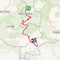
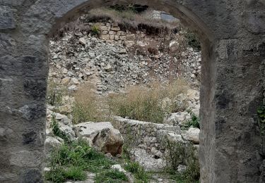
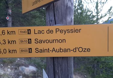
Trail Walking of 8.3 km to be discovered at Provence-Alpes-Côte d'Azur, Hautes-Alpes, Saint-Auban-d'Oze. This trail is proposed by claude nier.

Description

16 kms aller  retour
jolie rando a faire ...

Elevation profile

Positioning

Country:
France
Region :
Provence-Alpes-Côte d'Azur
Department/Province :
Hautes-Alpes
Municipality :
Saint-Auban-d'Oze
Location:
Unknown
Start:(UTM)
726925 ; 4928349 (31T) N.

Trails nearby

Trail Walking Le Saix - R08 La boucle des cascades jaunes - Photo
Walking
GUIDE+

Walking

Very easy
(1)
Le Saix, Provence-Alpes-Côte d'Azur, Hautes-Alpes, France
5.5 km | 10.3 km-effort
2h 10min
Yes
Trail Mountain bike Veynes - VTT03 - Tous les Eygaux - Photo
Mountain bike
GUIDE+

Mountain bike

Medium
(2)
Veynes, Provence-Alpes-Côte d'Azur, Hautes-Alpes, France
23 km | 31 km-effort
1h 31min
Yes
Trail Walking Le Saix - R07   le fai - Photo
Walking
GUIDE+

Walking

Easy
(4)
Le Saix, Provence-Alpes-Côte d'Azur, Hautes-Alpes, France
5.1 km | 8 km-effort
1h 42min
Yes
Trail Running Veynes - Trail 05 - Le Défi des Argouses - Photo
Running
GUIDE+

Running

Difficult
(3)
Veynes, Provence-Alpes-Côte d'Azur, Hautes-Alpes, France
9 km | 11.9 km-effort
48min
Yes
Trail Mountain bike Châteauneuf-d'Oze - ceuse9 avril 2012 - Photo
Mountain bike
GUIDE
harydh

Mountain bike

Medium
(2)
Châteauneuf-d'Oze, Provence-Alpes-Côte d'Azur, Hautes-Alpes, France
18.1 km | 26 km-effort
Unknown
Yes
Trail Walking Le Saix - Lac de Peyssier - Photo
Walking
GUIDE
Marco05

Walking

Medium
Le Saix, Provence-Alpes-Côte d'Azur, Hautes-Alpes, France
12.8 km | 19.6 km-effort
4h 27min
Yes
Trail Walking Le Saix - Montagne d'Aujour - Photo
Walking
GUIDE
nadd73

Walking

Medium
Le Saix, Provence-Alpes-Côte d'Azur, Hautes-Alpes, France
16.4 km | 30 km-effort
5h 33min
No
Trail Running Le Saix - Trail 10 - La Traversée d'Aujour - Photo
Running
GUIDE+

Running

Difficult
Le Saix, Provence-Alpes-Côte d'Azur, Hautes-Alpes, France
16.4 km | 31 km-effort
3h 0min
Yes
Trail Running Saint-Auban-d'Oze - Trail 01 - Le Cirque de Villauret - Photo
Running
GUIDE+

Running

Difficult
Saint-Auban-d'Oze, Provence-Alpes-Côte d'Azur, Hautes-Alpes, France
9.6 km | 19.9 km-effort
2h 0min
Yes


Close
My subscriptions