![](/images/other/stat-length.png)
![Trail Walking Saint-Léger-en-Yvelines - Saint Léger en Yvelines - Le Perray en Yvelines - Photo](https://media.geolcdn.com/t/1900/400/12e7c091-5dfb-494c-a01e-255d1b9f37f3.jpg&format=pjpeg&maxdim=2)
Saint Léger en Yvelines - Le Perray en Yvelines
ABICHE
User
![Length](/images/other/stat-length.png)
Length
24 km
![Max alt](https://static1.geolcdn.com/siteimages/upload/files/1508320355ic_sort_altitude_max_24dp.png)
Max alt
191 m
![Uphill gradient](https://static1.geolcdn.com/siteimages/upload/files/1508320355ic_sort_den_pos_24dp.png)
Uphill gradient
304 m
![Km-Effort](/images/other/stat-length.png)
Km-Effort
28 km
![Min alt](https://static1.geolcdn.com/siteimages/upload/files/1508320355ic_sort_altitude_min_24dp.png)
Min alt
126 m
![Downhill gradient](https://static1.geolcdn.com/siteimages/upload/files/1508320355ic_sort_den_neg_24dp.png)
Downhill gradient
268 m
![Boucle](https://static1.geolcdn.com/siteimages/upload/files/16400158638029165_repeat_loop_refresh_sync_direction_icon.png)
Boucle
No
Creation date :
2019-07-11 06:17:08.623
Updated on :
2019-07-12 09:12:15.486
![Walking](https://static1.geolcdn.com/sitytour/trail-icons/101.png)
5h34
Difficulty : Easy
![Scan this QR Code to open this trail in the SityTrail application](https://capi.geolives.com/qq0zvz2zws4bq2lad0pu/sitytour/trails/2137175/qr.png?size=200)
FREE GPS app for hiking
About
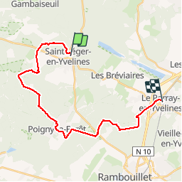
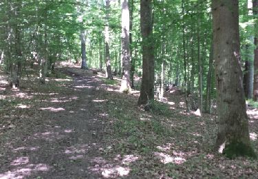
Trail Walking of 24 km to be discovered at Ile-de-France, Yvelines, Saint-Léger-en-Yvelines. This trail is proposed by ABICHE.
Description
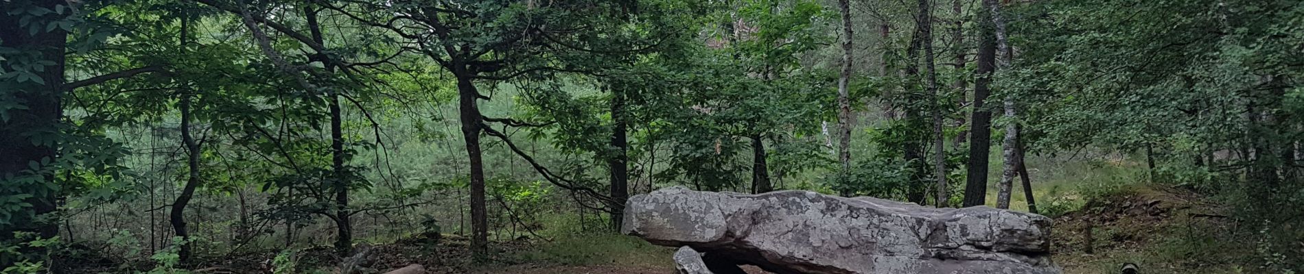
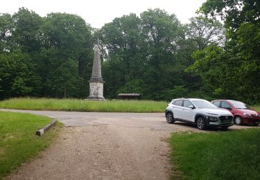
(11/07/2019) Magnifique randonnée quasiment toute en forêt de Rambouillet. Grandes fougères, arbres remarquables sont de la partie.
Positioning
Country:
France
Region :
Ile-de-France
Department/Province :
Yvelines
Municipality :
Saint-Léger-en-Yvelines
Location:
Unknown
Start:(Dec)
Start:(UTM)
409294 ; 5397360 (31U) N.
Comments
Trails nearby
![Trail Walking Saint-Léger-en-Yvelines - Yvelines_Croix-Vilpert=>Rochers-d'Angennes=>Petit-Etang-Neuf - Photo](https://media.geolcdn.com/t/375/260/6d489e7d-9a8c-4142-91a9-ca62eb9af4d0.jpg&format=jpg&maxdim=2)
![Walking Walking](https://static1.geolcdn.com/sitytour/trail-icons/101.png)
Yvelines_Croix-Vilpert=>Rochers-d'Angennes=>Petit-Etang-Neuf
Walking
Medium
(1)
Saint-Léger-en-Yvelines,
Ile-de-France,
Yvelines,
France
![](/images/other/stat-length.png)
21 km | 25 km-effort
3h 35min
![](https://static1.geolcdn.com/siteimages/upload/files/16400158638029165_repeat_loop_refresh_sync_direction_icon.png)
Yes
![Trail Walking Poigny-la-Forêt - poigny - Photo](https://media.geolcdn.com/t/375/260/4048684d-3aec-49d6-ad34-88a4a7b23eb9.jpg&format=jpg&maxdim=2)
![Walking Walking](https://static1.geolcdn.com/sitytour/trail-icons/101.png)
poigny
Walking
Very easy
(1)
Poigny-la-Forêt,
Ile-de-France,
Yvelines,
France
![](/images/other/stat-length.png)
13.9 km | 15.7 km-effort
3h 11min
![](https://static1.geolcdn.com/siteimages/upload/files/16400158638029165_repeat_loop_refresh_sync_direction_icon.png)
Yes
![Trail Walking Gambaiseuil - Gambaiseul Boucle - Photo](https://media.geolcdn.com/t/375/260/ext.jpg?maxdim=2&url=https%3A%2F%2Fstatic1.geolcdn.com%2Fsiteimages%2Fupload%2Ffiles%2F1553511878bg_sport_marche.png)
![Walking Walking](https://static1.geolcdn.com/sitytour/trail-icons/101.png)
Gambaiseul Boucle
Walking
Easy
(1)
Gambaiseuil,
Ile-de-France,
Yvelines,
France
![](/images/other/stat-length.png)
13.6 km | 16.3 km-effort
3h 26min
![](https://static1.geolcdn.com/siteimages/upload/files/16400158638029165_repeat_loop_refresh_sync_direction_icon.png)
No
![Trail Walking Saint-Léger-en-Yvelines - Etang Rompu 03/05/2018 - Photo](https://media.geolcdn.com/t/375/260/ext.jpg?maxdim=2&url=https%3A%2F%2Fservices.sitytrail.com%2FGeolivesWS%2FDownloadMedia.ashx%3FTrailID%3D966605%26Media%3Dfix__20180503121121.jpg)
![Walking Walking](https://static1.geolcdn.com/sitytour/trail-icons/101.png)
Etang Rompu 03/05/2018
Walking
Medium
Saint-Léger-en-Yvelines,
Ile-de-France,
Yvelines,
France
![](/images/other/stat-length.png)
9.9 km | 11.4 km-effort
2h 37min
![](https://static1.geolcdn.com/siteimages/upload/files/16400158638029165_repeat_loop_refresh_sync_direction_icon.png)
Yes
![Trail Other activity Les Bréviaires - 1Je11 - Photo](https://media.geolcdn.com/t/375/260/ext.jpg?maxdim=2&url=https%3A%2F%2Fservices.sitytrail.com%2FGeolivesWS%2FDownloadMedia.ashx%3FTrailID%3D944857%26Media%3Dfix__20180329112938.jpg)
![Other activity Other activity](https://static1.geolcdn.com/sitytour/trail-icons/900.png)
1Je11
Other activity
Very easy
Les Bréviaires,
Ile-de-France,
Yvelines,
France
![](/images/other/stat-length.png)
9.1 km | 10.2 km-effort
2h 18min
![](https://static1.geolcdn.com/siteimages/upload/files/16400158638029165_repeat_loop_refresh_sync_direction_icon.png)
Yes
![Trail Walking Les Bréviaires - rando du 21/05/2015 - Photo](https://media.geolcdn.com/t/375/260/ext.jpg?maxdim=2&url=https%3A%2F%2Fservices.sitytrail.com%2FGeolivesWS%2FDownloadMedia.ashx%3FTrailID%3D423774%26Media%3Dfix__20150521112851.jpg)
![Walking Walking](https://static1.geolcdn.com/sitytour/trail-icons/101.png)
rando du 21/05/2015
Walking
Easy
Les Bréviaires,
Ile-de-France,
Yvelines,
France
![](/images/other/stat-length.png)
8.3 km | 9.4 km-effort
2h 0min
![](https://static1.geolcdn.com/siteimages/upload/files/16400158638029165_repeat_loop_refresh_sync_direction_icon.png)
Yes
![Trail Walking Saint-Léger-en-Yvelines - Bois des Brulins - Photo](https://media.geolcdn.com/t/375/260/ext.jpg?maxdim=2&url=https%3A%2F%2Fservices.sitytrail.com%2FGeolivesWS%2FDownloadMedia.ashx%3FTrailID%3D302941%26Media%3Dfix__20140518155043.jpg)
![Walking Walking](https://static1.geolcdn.com/sitytour/trail-icons/101.png)
Bois des Brulins
Walking
Medium
Saint-Léger-en-Yvelines,
Ile-de-France,
Yvelines,
France
![](/images/other/stat-length.png)
5.1 km | 6.5 km-effort
1h 30min
![](https://static1.geolcdn.com/siteimages/upload/files/16400158638029165_repeat_loop_refresh_sync_direction_icon.png)
Yes
![Trail Walking Saint-Léger-en-Yvelines - Les Mesnuls - Photo](https://media.geolcdn.com/t/375/260/ext.jpg?maxdim=2&url=https%3A%2F%2Fstatic1.geolcdn.com%2Fsiteimages%2Fupload%2Ffiles%2F1553511878bg_sport_marche.png)
![Walking Walking](https://static1.geolcdn.com/sitytour/trail-icons/101.png)
Les Mesnuls
Walking
Easy
(1)
Saint-Léger-en-Yvelines,
Ile-de-France,
Yvelines,
France
![](/images/other/stat-length.png)
12.1 km | 14.9 km-effort
5min
![](https://static1.geolcdn.com/siteimages/upload/files/16400158638029165_repeat_loop_refresh_sync_direction_icon.png)
Yes
![Trail sport Saint-Léger-en-Yvelines - Champignons - Photo](https://media.geolcdn.com/t/375/260/5544d145-a2ae-4b3d-ab46-e21286fc7756.jpg&format=jpg&maxdim=2)
Champignons
sport
Very easy
Saint-Léger-en-Yvelines,
Ile-de-France,
Yvelines,
France
![](/images/other/stat-length.png)
5.6 km | 6.2 km-effort
Unknown
![](https://static1.geolcdn.com/siteimages/upload/files/16400158638029165_repeat_loop_refresh_sync_direction_icon.png)
Yes