![Trail Walking Tunah - ladakh avion - Photo](https://media.geolcdn.com/t/1900/400/ext.pjpeg?maxdim=2&url=https%3A%2F%2Fstatic1.geolcdn.com%2Fsiteimages%2Fupload%2Ffiles%2F1553511878bg_sport_marche.png)
ladakh avion
manue38
User
![Length](/images/other/stat-length.png)
Length
167 km
![Max alt](https://static1.geolcdn.com/siteimages/upload/files/1508320355ic_sort_altitude_max_24dp.png)
Max alt
5940 m
![Uphill gradient](https://static1.geolcdn.com/siteimages/upload/files/1508320355ic_sort_den_pos_24dp.png)
Uphill gradient
20040 m
![Km-Effort](/images/other/stat-length.png)
Km-Effort
437 km
![Min alt](https://static1.geolcdn.com/siteimages/upload/files/1508320355ic_sort_altitude_min_24dp.png)
Min alt
3206 m
![Downhill gradient](https://static1.geolcdn.com/siteimages/upload/files/1508320355ic_sort_den_neg_24dp.png)
Downhill gradient
20860 m
![Boucle](https://static1.geolcdn.com/siteimages/upload/files/16400158638029165_repeat_loop_refresh_sync_direction_icon.png)
Boucle
No
Creation date :
2019-07-10 02:36:54.448
Updated on :
2019-07-10 04:07:43.576
![Walking](https://static1.geolcdn.com/sitytour/trail-icons/101.png)
15m
Difficulty : Very easy
![Scan this QR Code to open this trail in the SityTrail application](https://capi.geolives.com/qq0zvz2zws4bq2lad0pu/sitytour/trails/2135967/qr.png?size=200)
FREE GPS app for hiking
About
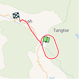
Trail Walking of 167 km to be discovered at Ladakh, Leh. This trail is proposed by manue38.
Positioning
Country:
India
Region :
Ladakh
Department/Province :
Leh
Municipality :
Tunah
Location:
Unknown
Start:(Dec)
Start:(UTM)
762030 ; 3742098 (43S) N.
Comments
Trails nearby