Trail Walking Saint-Riquier - retour gueschart - Photo
© OpenStreetMap contributors
Length
Length
19.9 km
Max alt
Max alt
129 m
Uphill gradient
Uphill gradient
182 m
Km-Effort
Km-Effort  
22 km
Min alt
Min alt
23 m
Downhill gradient
Downhill gradient
112 m
Boucle
Boucle
No
Creation date :
2019-07-07 16:31:22.635
Updated on :
2019-07-07 17:03:06.552

(0 Reviews)

Walking
Walking
30m
Difficulty : Very easy

Scan this QR Code to open this trail in the SityTrail application

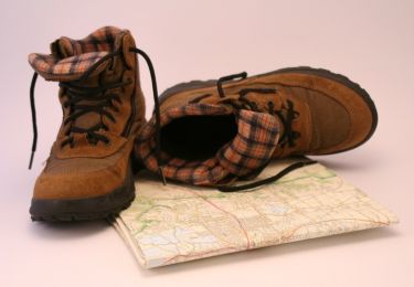
FREE GPS app for hiking

Logo SityTrail SityTrail

IGN / Geographical institutes

Download SityTrail from the App Store Download SityTrail from Google Play

Logo SityTrail SityTrail World

The world is yours!

Download SityTrail from the App Store Download SityTrail from Google Play Download SityTrail on Huawei AppGallery

About

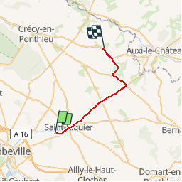
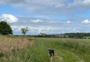
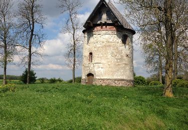
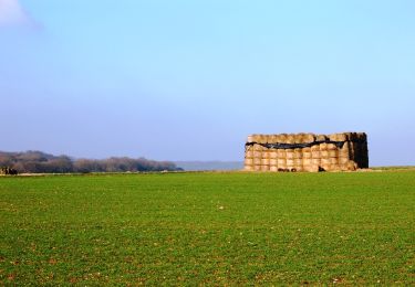
Trail Walking of 19.9 km to be discovered at Hauts-de-France, Somme, Saint-Riquier. This trail is proposed by Martelpierre.

Description

voiture

Elevation profile

Positioning

Country:
France
Region :
Hauts-de-France
Department/Province :
Somme
Municipality :
Saint-Riquier
Location:
Unknown
Start:(UTM)
422901 ; 5553343 (31U) N.

Trails nearby

Trail On foot Saint-Riquier - Balade Centuloise - Photo
On foot
PRO

On foot

Easy
Saint-Riquier, Hauts-de-France, Somme, France
8.9 km | 10.3 km-effort
2h 20min
Yes
Trail Walking Millencourt-en-Ponthieu - le fond de Millencourt - Photo
Walking
Luc Gengoux

Walking

Very easy
Millencourt-en-Ponthieu, Hauts-de-France, Somme, France
7 km | 8.2 km-effort
2h 2min
Yes
Trail Nordic walking Saint-Riquier - La Centuloise 2023 - Photo
Nordic walking
roselinemazeyrat

Nordic walking

Saint-Riquier, Hauts-de-France, Somme, France
13.9 km | 16.2 km-effort
2h 50min
Yes
Trail Walking Saint-Riquier - St riquier-maison roland  - Photo
Walking
docfil

Walking

Very easy
Saint-Riquier, Hauts-de-France, Somme, France
10.4 km | 11.9 km-effort
2h 3min
Yes
Trail Other activity Vauchelles-les-Quesnoy - 1ère étape SOMME  - Photo
Other activity
c.p1970

Other activity

Very easy
Vauchelles-les-Quesnoy, Hauts-de-France, Somme, France
22 km | 24 km-effort
6h 21min
No
Trail Walking Oneux - Le fond d'Oneux - Photo
Walking
tracegps

Walking

Difficult
Oneux, Hauts-de-France, Somme, France
9.4 km | 11 km-effort
3h 0min
Yes
Trail Walking Millencourt-en-Ponthieu - Le fond de Millencourt - Photo
Walking
tracegps

Walking

Medium
(1)
Millencourt-en-Ponthieu, Hauts-de-France, Somme, France
6.9 km | 8.1 km-effort
2h 19min
Yes
Trail Walking Saint-Riquier - Balade centuloise - Photo
Walking
tracegps

Walking

Difficult
Saint-Riquier, Hauts-de-France, Somme, France
8.9 km | 10.4 km-effort
3h 0min
Yes
Trail Walking Saint-Riquier - La traverse du Ponthieu (Saint-Riquier Conteville) - Photo
Walking
tracegps

Walking

Difficult
Saint-Riquier, Hauts-de-France, Somme, France
10.7 km | 12.3 km-effort
3h 30min
No


Close
My subscriptions