


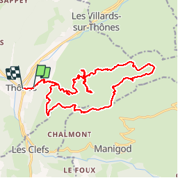

10.7 km | 28 km-effort


User


FREE GPS app for hiking
 SityTrail
IGN / Geographical institutes
SityTrail World
The world is yours!
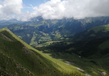
Trail Walking of 21 km to be discovered at Auvergne-Rhône-Alpes, Upper Savoy, Thônes. This trail is proposed by woodywoodfucker.
départ de Thônes par la forêt du mont, puis ascension vers beauregard en passantpar la closette et la ferme des Vonezins
retour par les fretes et le petit novard

Touring skiing

Walking

Walking

Snowshoes

Walking
Walking
Walking

Walking
Walking