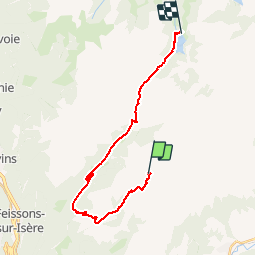
Trail Walking La Léchère - Refuge du Nant du Beurre - St Guerin - Photo

Refuge du Nant du Beurre - St Guerin

 biollay
biollay

User

© OpenStreetMap contributors
Length
Length
22 km
Max alt
Max alt
2117 m
Uphill gradient
Uphill gradient
1185 m
Km-Effort
Km-Effort  
39 km
Min alt
Min alt
1319 m
Downhill gradient
Downhill gradient
1686 m
Boucle
Boucle
No
Creation date :
2019-06-29 13:44:53.728
Updated on :
2019-06-29 13:53:28.95

(0 Reviews)

Walking
Walking
7h38
Difficulty : Very difficult

Scan this QR Code to open this trail in the SityTrail application

FREE GPS app for hiking

Logo SityTrail SityTrail

IGN / Geographical institutes

Download SityTrail from the App Store Download SityTrail from Google Play

Logo SityTrail SityTrail World

The world is yours!

Download SityTrail from the App Store Download SityTrail from Google Play Download SityTrail on Huawei AppGallery

About

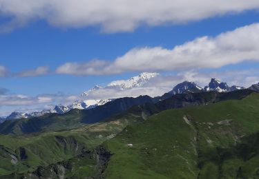
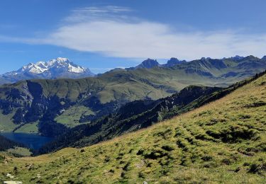
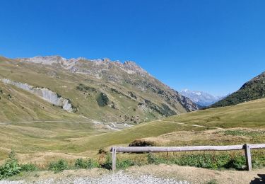
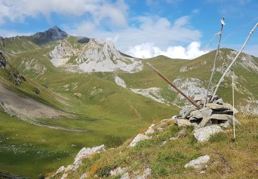
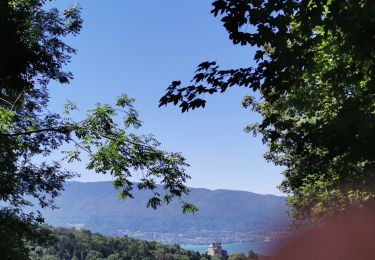
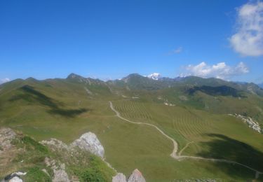
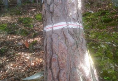
Trail Walking of 22 km to be discovered at Auvergne-Rhône-Alpes, Savoy, La Léchère. This trail is proposed by biollay.

Description

Petit Tour du Beaufortain, jour 2/2

Elevation profile

Positioning

Country:
France
Region :
Auvergne-Rhône-Alpes
Department/Province :
Savoy
Municipality :
La Léchère
Location:
Naves
Start:(UTM)
309603 ; 5050616 (32T) N.

Trails nearby

Trail Walking La Léchère - lacs de la tempête - Photo
Walking
GuyVachet

Walking

Very difficult
La Léchère, Auvergne-Rhône-Alpes, Savoy, France
14.8 km | 25 km-effort
7h 10min
Yes
Trail Walking Aime-la-Plagne - croix de tessins roche de janatan - Photo
Walking
Nolene

Walking

Medium
Aime-la-Plagne, Auvergne-Rhône-Alpes, Savoy, France
7.4 km | 15.2 km-effort
2h 22min
Yes
Trail Walking Aime-la-Plagne - Lac de Presset par la Piera Menta depuis le Cornet d'Arêches - Photo
Walking
tyax93

Walking

Medium
(1)
Aime-la-Plagne, Auvergne-Rhône-Alpes, Savoy, France
17 km | 32 km-effort
6h 49min
Yes
Trail Walking Aime-la-Plagne - Beaufortain: Autour de La Pierra Menta: J6 - Ref. de La Coire - Pk Laval - Photo
Walking
patjobou

Walking

Medium
Aime-la-Plagne, Auvergne-Rhône-Alpes, Savoy, France
10.4 km | 17 km-effort
3h 21min
No
Trail Walking Aime-la-Plagne - château de Menthon - Photo
Walking
François COLLIEUX

Walking

Medium
Aime-la-Plagne, Auvergne-Rhône-Alpes, Savoy, France
55 km | 143 km-effort
1h 26min
No
Trail Walking La Léchère - Tour du Quermoz par Grand Naves  - Photo
Walking
zazie

Walking

Medium
La Léchère, Auvergne-Rhône-Alpes, Savoy, France
16 km | 30 km-effort
4h 30min
No
Trail Walking La Léchère - Ronchat La Cudraz Navette Plan des Heures Balcon des Adrets de Tarentaise  - Photo
Walking
zazie

Walking

Difficult
La Léchère, Auvergne-Rhône-Alpes, Savoy, France
8.3 km | 13.7 km-effort
3h 0min
Yes
Trail Walking Aime-la-Plagne - le Cormet d'Arêches... col du coin... lac d'amour - Photo
Walking
chrifor

Walking

Medium
Aime-la-Plagne, Auvergne-Rhône-Alpes, Savoy, France
8.5 km | 14.5 km-effort
5h 33min
Yes
Trail Walking Aime-la-Plagne - col du coin lac d'amour Areches - Photo
Walking
marchev

Walking

Medium
Aime-la-Plagne, Auvergne-Rhône-Alpes, Savoy, France
8.4 km | 14.2 km-effort
5h 35min
Yes


Close
My subscriptions