Trail Walking Inishowen Municipal District - 190628Malin Head - Photo
 pffrench
pffrench

User

© OpenStreetMap contributors
Length
Length
7.3 km
Max alt
Max alt
23 m
Uphill gradient
Uphill gradient
52 m
Km-Effort
Km-Effort  
8 km
Min alt
Min alt
0 m
Downhill gradient
Downhill gradient
50 m
Boucle
Boucle
Yes
Creation date :
2019-06-28 17:53:39.186
Updated on :
2019-06-28 21:09:45.353

(0 Reviews)

Walking
Walking
3h15
Difficulty : Very easy

Scan this QR Code to open this trail in the SityTrail application

FREE GPS app for hiking

Logo SityTrail SityTrail

IGN / Geographical institutes

Download SityTrail from the App Store Download SityTrail from Google Play

Logo SityTrail SityTrail World

The world is yours!

Download SityTrail from the App Store Download SityTrail from Google Play Download SityTrail on Huawei AppGallery

About

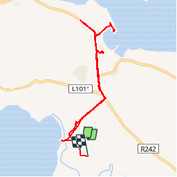
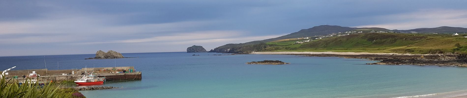
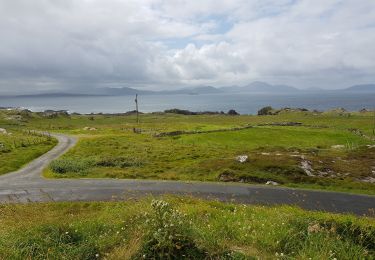
Trail Walking of 7.3 km to be discovered at Unknown, County Donegal, Inishowen Municipal District. This trail is proposed by pffrench.

Elevation profile

Photos

Positioning

Country:
Ireland
Region :
Unknown
Department/Province :
County Donegal
Municipality :
Inishowen Municipal District
Location:
Ardmalin Electoral Division
Start:(UTM)
605071 ; 6135530 (29U) N.

Trails nearby

Trail Car Inishowen Municipal District - 190630 - Photo
Car
pffrench

Car

Very easy
Inishowen Municipal District, Unknown, County Donegal, Ireland
336 km | 382 km-effort
12h 13min
No


Close
My subscriptions