23 juin Le Mêle-sur-Sarthe Plan d-eau SityTrail > Trails > Outdoor > France > Normandy > Orne > Le Mêle-sur-Sarthe SityTrail > Trails > Outdoor > France > Normandy > Orne > Le Mêle-sur-Sarthe 23 juin Le Mêle-sur-Sarthe Plan d-eau Marydelise User 3D © OpenStreetMap contributors Length 3.8 km Max alt 159 m Uphill gradient 32 m Km-Effort 4.2 km Min alt 144 m Downhill gradient 27 m Boucle No Creation date : 2019-06-23 09:30:24.21 Updated on : 2019-06-23 13:49:18.531 (0 Reviews) Walking 1h10 Difficulty : Very easy FREE GPS app for hiking SityTrail IGN / Geographical institutes SityTrail World The world is yours! About 
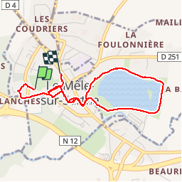
Trail Walking of 3.8 km to be discovered at Normandy, Orne, Le Mêle-sur-Sarthe. This trail is proposed by Marydelise. Legends | More details (PDF) Elevation profile Legends > 15% 15% - 10% 10% - 5% flat 5% - 10% 10% - 15% 15% - 30% > 30% Positioning Country: France Region : Normandy Department/Province : Orne Municipality : Le Mêle-sur-Sarthe Location: Unknown Start:(Dec) 48.51161261 / 0.35022444 Start:(UTM) 304309 ; 5376557 (31U) N. Comments Please log in to post a review or rate the element Trails nearby laurent.drille mares Motor Very easy (1) Laleu, Normandy, Orne, France 35 km | 39 km-effort 53min No jackls Foret de Bourse Other activity Very easy (2) Aunay-les-Bois, Normandy, Orne, France 40 km | 47 km-effort 5h 21min No