![](/images/other/stat-length.png)
CC_Velay_FD_27_Castillon_Sauvelade_20081112
patrickdanilo
User
![Length](/images/other/stat-length.png)
Length
22 km
![Max alt](https://static1.geolcdn.com/siteimages/upload/files/1508320355ic_sort_altitude_max_24dp.png)
Max alt
231 m
![Uphill gradient](https://static1.geolcdn.com/siteimages/upload/files/1508320355ic_sort_den_pos_24dp.png)
Uphill gradient
354 m
![Km-Effort](/images/other/stat-length.png)
Km-Effort
27 km
![Min alt](https://static1.geolcdn.com/siteimages/upload/files/1508320355ic_sort_altitude_min_24dp.png)
Min alt
72 m
![Downhill gradient](https://static1.geolcdn.com/siteimages/upload/files/1508320355ic_sort_den_neg_24dp.png)
Downhill gradient
435 m
![Boucle](https://static1.geolcdn.com/siteimages/upload/files/16400158638029165_repeat_loop_refresh_sync_direction_icon.png)
Boucle
No
Creation date :
2019-06-23 12:33:06.475
Updated on :
2022-09-19 10:03:52.395
![Walking](https://static1.geolcdn.com/sitytour/trail-icons/101.png)
5h15
Difficulty : Easy
![Scan this QR Code to open this trail in the SityTrail application](https://capi.geolives.com/qq0zvz2zws4bq2lad0pu/sitytour/trails/2121715/qr.png?size=200)
FREE GPS app for hiking
About
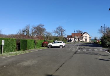
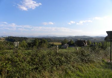
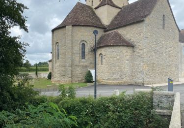
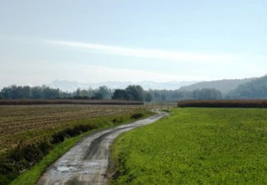
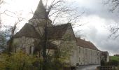
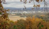
Trail Walking of 22 km to be discovered at New Aquitaine, Pyrénées-Atlantiques, Castillon. This trail is proposed by patrickdanilo.
Description
Randonnée Marche de 22 km à découvrir à Nouvelle-Aquitaine, Pyrénées-Atlantiques, Castillon. Cette randonnée est proposée par patrickdanilo.
Positioning
Country:
France
Region :
New Aquitaine
Department/Province :
Pyrénées-Atlantiques
Municipality :
Castillon
Location:
Unknown
Start:(Dec)
Start:(UTM)
696192 ; 4815475 (30T) N.
Comments
Trails nearby
![Trail Walking Arthez-de-Béarn - ARTHEZ DE BEARN ARGAGNON](https://media.geolcdn.com/t/375/260/c01210f1-bf24-4660-b275-a6589096b802.jpg&format=jpg&maxdim=2)
![Walking Walking](https://static1.geolcdn.com/sitytour/trail-icons/101.png)
ARTHEZ DE BEARN ARGAGNON "3653428" collecte numerique GR65
Walking
Medium
Arthez-de-Béarn,
New Aquitaine,
Pyrénées-Atlantiques,
France
![](/images/other/stat-length.png)
7.5 km | 8.4 km-effort
1h 54min
![](https://static1.geolcdn.com/siteimages/upload/files/16400158638029165_repeat_loop_refresh_sync_direction_icon.png)
No
![Trail Walking Doazon - DOAZON LE LAC labelisation du tour du lac - Photo](https://media.geolcdn.com/t/375/260/da8e6030-d81e-42d4-b111-b9b995e8d338.jpg&format=jpg&maxdim=2)
![Walking Walking](https://static1.geolcdn.com/sitytour/trail-icons/101.png)
DOAZON LE LAC labelisation du tour du lac
Walking
Medium
Doazon,
New Aquitaine,
Pyrénées-Atlantiques,
France
![](/images/other/stat-length.png)
6 km | 7.9 km-effort
1h 48min
![](https://static1.geolcdn.com/siteimages/upload/files/16400158638029165_repeat_loop_refresh_sync_direction_icon.png)
Yes
![Trail Walking Pomps - Mon Compostelle quatorzième étape - Photo](https://media.geolcdn.com/t/375/260/ext.jpg?maxdim=2&url=https%3A%2F%2Fservices.sitytrail.com%2FGeolivesWS%2FDownloadMedia.ashx%3FTrailID%3D685760%26Media%3D98952aa4-16cc-4a09-83b5-b4947a88cb5b.JPG)
![Walking Walking](https://static1.geolcdn.com/sitytour/trail-icons/101.png)
Mon Compostelle quatorzième étape
Walking
Very difficult
Pomps,
New Aquitaine,
Pyrénées-Atlantiques,
France
![](/images/other/stat-length.png)
55 km | 68 km-effort
10h 45min
![](https://static1.geolcdn.com/siteimages/upload/files/16400158638029165_repeat_loop_refresh_sync_direction_icon.png)
No
![Trail Walking Arthez-de-Béarn - GR 65 Artez en Béarn > Sauvelade - Photo](https://media.geolcdn.com/t/375/260/51eb1f53-3e9b-4483-90bc-142f2e479807.jpg&format=jpg&maxdim=2)
![Walking Walking](https://static1.geolcdn.com/sitytour/trail-icons/101.png)
GR 65 Artez en Béarn > Sauvelade
Walking
Easy
Arthez-de-Béarn,
New Aquitaine,
Pyrénées-Atlantiques,
France
![](/images/other/stat-length.png)
19.5 km | 23 km-effort
4h 48min
![](https://static1.geolcdn.com/siteimages/upload/files/16400158638029165_repeat_loop_refresh_sync_direction_icon.png)
No
![Trail Walking Morlanne - MORLANNE Terra aventura 2899492 - Photo](https://media.geolcdn.com/t/375/260/f74a1a53-e16c-43a5-896c-86cc36dcc8d6.jpg&format=jpg&maxdim=2)
![Walking Walking](https://static1.geolcdn.com/sitytour/trail-icons/101.png)
MORLANNE Terra aventura 2899492
Walking
Easy
Morlanne,
New Aquitaine,
Pyrénées-Atlantiques,
France
![](/images/other/stat-length.png)
2.3 km | 2.7 km-effort
47min
![](https://static1.geolcdn.com/siteimages/upload/files/16400158638029165_repeat_loop_refresh_sync_direction_icon.png)
Yes
![Trail Walking Pomps - De Castillon à Arthez de Béarn - Photo](https://media.geolcdn.com/t/375/260/ext.jpg?maxdim=2&url=https%3A%2F%2Fservices.sitytrail.com%2FGeolivesWS%2FDownloadMedia.ashx%3FTrailID%3D111288%26Media%3D6932_1.jpg)
![Walking Walking](https://static1.geolcdn.com/sitytour/trail-icons/101.png)
De Castillon à Arthez de Béarn
Walking
Medium
Pomps,
New Aquitaine,
Pyrénées-Atlantiques,
France
![](/images/other/stat-length.png)
8.1 km | 10 km-effort
1h 45min
![](https://static1.geolcdn.com/siteimages/upload/files/16400158638029165_repeat_loop_refresh_sync_direction_icon.png)
No
![Trail Walking Pomps - Compostelle Pomps Savelade - Photo](https://media.geolcdn.com/t/375/260/ext.jpg?maxdim=2&url=https%3A%2F%2Fstatic1.geolcdn.com%2Fsiteimages%2Fupload%2Ffiles%2F1553511878bg_sport_marche.png)
![Walking Walking](https://static1.geolcdn.com/sitytour/trail-icons/101.png)
Compostelle Pomps Savelade
Walking
Medium
Pomps,
New Aquitaine,
Pyrénées-Atlantiques,
France
![](/images/other/stat-length.png)
33 km | 39 km-effort
6h 22min
![](https://static1.geolcdn.com/siteimages/upload/files/16400158638029165_repeat_loop_refresh_sync_direction_icon.png)
No
![Trail Walking Pomps - 6 pomps - Photo](https://media.geolcdn.com/t/375/260/ext.jpg?maxdim=2&url=https%3A%2F%2Fstatic1.geolcdn.com%2Fsiteimages%2Fupload%2Ffiles%2F1553511878bg_sport_marche.png)
![Walking Walking](https://static1.geolcdn.com/sitytour/trail-icons/101.png)
6 pomps
Walking
Difficult
Pomps,
New Aquitaine,
Pyrénées-Atlantiques,
France
![](/images/other/stat-length.png)
27 km | 33 km-effort
7h 47min
![](https://static1.geolcdn.com/siteimages/upload/files/16400158638029165_repeat_loop_refresh_sync_direction_icon.png)
No
![Trail Walking Arthez-de-Béarn - Camino 1 étape 28 - Photo](https://media.geolcdn.com/t/375/260/ext.jpg?maxdim=2&url=https%3A%2F%2Fstatic1.geolcdn.com%2Fsiteimages%2Fupload%2Ffiles%2F1553511878bg_sport_marche.png)
![Walking Walking](https://static1.geolcdn.com/sitytour/trail-icons/101.png)
Camino 1 étape 28
Walking
Medium
Arthez-de-Béarn,
New Aquitaine,
Pyrénées-Atlantiques,
France
![](/images/other/stat-length.png)
31 km | 38 km-effort
8h 45min
![](https://static1.geolcdn.com/siteimages/upload/files/16400158638029165_repeat_loop_refresh_sync_direction_icon.png)
No