![](/images/other/stat-length.png)
![Trail Walking Chas - Chas_Forts_Villageois - Photo](https://media.geolcdn.com/t/1900/400/69840324-aaf6-4b2c-be10-fd95df00fcc9.jpg&format=pjpeg&maxdim=2)
Chas_Forts_Villageois
jagarnier
User GUIDE
![Length](/images/other/stat-length.png)
![Max alt](https://static1.geolcdn.com/siteimages/upload/files/1508320355ic_sort_altitude_max_24dp.png)
![Uphill gradient](https://static1.geolcdn.com/siteimages/upload/files/1508320355ic_sort_den_pos_24dp.png)
![Km-Effort](/images/other/stat-length.png)
![Min alt](https://static1.geolcdn.com/siteimages/upload/files/1508320355ic_sort_altitude_min_24dp.png)
![Downhill gradient](https://static1.geolcdn.com/siteimages/upload/files/1508320355ic_sort_den_neg_24dp.png)
![Boucle](https://static1.geolcdn.com/siteimages/upload/files/16400158638029165_repeat_loop_refresh_sync_direction_icon.png)
![Walking](https://static1.geolcdn.com/sitytour/trail-icons/101.png)
2h19
Difficulty : Medium
![Scan this QR Code to open this trail in the SityTrail application](https://capi.geolives.com/qq0zvz2zws4bq2lad0pu/sitytour/trails/2118331/qr.png?size=200)
FREE GPS app for hiking
About
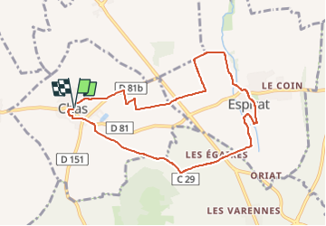
Trail Walking of 8.6 km to be discovered at Auvergne-Rhône-Alpes, Puy-de-Dôme, Chas. This trail is proposed by jagarnier.
Description
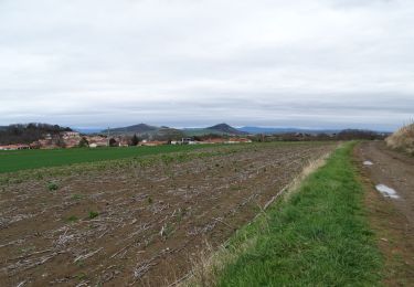
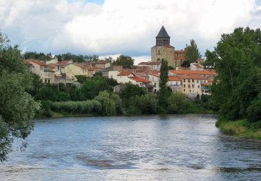
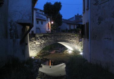
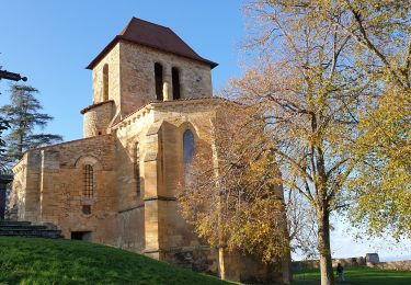
Au cours du XIVème siècle, pendant la Guerre de Cent Ans, les villageois cherchent une réponse aux menacent qu'ils subissent. Ils construisent un quartier indépendant du reste du village, composé de constructions serrées appelées loges, desservies par des ruelles étroites. Chas conserve une porte flanquée d'une tourelle et une maison forte. A Espirat s'élève un donjon du XIIIème siècle.
Positioning
Comments
Trails nearby
![On foot On foot](https://static1.geolcdn.com/sitytour/trail-icons/100.png)
On foot
![](/images/other/stat-length.png)
![](https://static1.geolcdn.com/siteimages/upload/files/16400158638029165_repeat_loop_refresh_sync_direction_icon.png)
![Trail On foot Pont-du-Château - Le Chemin des Batteliers - Photo](https://media.geolcdn.com/t/375/260/637fc0b7-6f7b-4d79-bd2a-b9e0ef453060.jpeg&format=jpg&maxdim=2)
![On foot On foot](https://static1.geolcdn.com/sitytour/trail-icons/100.png)
On foot
![](/images/other/stat-length.png)
![](https://static1.geolcdn.com/siteimages/upload/files/16400158638029165_repeat_loop_refresh_sync_direction_icon.png)
![Trail On foot Chauriat - Les Coteaux de Chauriat - Photo](https://media.geolcdn.com/t/375/260/22764b45-9f0b-44c4-add1-6828685091f3.jpeg&format=jpg&maxdim=2)
![On foot On foot](https://static1.geolcdn.com/sitytour/trail-icons/100.png)
On foot
![](/images/other/stat-length.png)
![](https://static1.geolcdn.com/siteimages/upload/files/16400158638029165_repeat_loop_refresh_sync_direction_icon.png)
![Trail On foot Billom - Le Turluron - Photo](https://media.geolcdn.com/t/375/260/04f9185b-8c18-47a2-9818-7864122e3458.jpeg&format=jpg&maxdim=2)
![On foot On foot](https://static1.geolcdn.com/sitytour/trail-icons/100.png)
On foot
![](/images/other/stat-length.png)
![](https://static1.geolcdn.com/siteimages/upload/files/16400158638029165_repeat_loop_refresh_sync_direction_icon.png)
![Trail On foot Reignat - La Butte de Montaigut - Photo](https://media.geolcdn.com/t/375/260/f8dc19cd-748b-4121-b117-19288ea2e102.jpeg&format=jpg&maxdim=2)
![On foot On foot](https://static1.geolcdn.com/sitytour/trail-icons/100.png)
On foot
![](/images/other/stat-length.png)
![](https://static1.geolcdn.com/siteimages/upload/files/16400158638029165_repeat_loop_refresh_sync_direction_icon.png)
![Trail On foot Mur-sur-Allier - De l'Allier au Puy de Mur - Photo](https://media.geolcdn.com/t/375/260/6c7c4f22-7ed8-4746-b8e8-abf236ae1eb1.jpeg&format=jpg&maxdim=2)
![On foot On foot](https://static1.geolcdn.com/sitytour/trail-icons/100.png)
On foot
![](/images/other/stat-length.png)
![](https://static1.geolcdn.com/siteimages/upload/files/16400158638029165_repeat_loop_refresh_sync_direction_icon.png)
![Walking Walking](https://static1.geolcdn.com/sitytour/trail-icons/101.png)
Walking
![](/images/other/stat-length.png)
![](https://static1.geolcdn.com/siteimages/upload/files/16400158638029165_repeat_loop_refresh_sync_direction_icon.png)
![Trail Walking Pont-du-Château - Pont_Chateau_Machal_Cortal - Photo](https://media.geolcdn.com/t/375/260/c761f57c-ec00-4765-845e-a92cde5d76f7.jpg&format=jpg&maxdim=2)
![Walking Walking](https://static1.geolcdn.com/sitytour/trail-icons/101.png)
Walking
![](/images/other/stat-length.png)
![](https://static1.geolcdn.com/siteimages/upload/files/16400158638029165_repeat_loop_refresh_sync_direction_icon.png)
![Trail Walking Vertaizon - Tour du puy de Mur_T - Photo](https://media.geolcdn.com/t/375/260/68117799-c52e-4e62-ba7d-433e43b465e5.jpg&format=jpg&maxdim=2)
![Walking Walking](https://static1.geolcdn.com/sitytour/trail-icons/101.png)
Walking
![](/images/other/stat-length.png)
![](https://static1.geolcdn.com/siteimages/upload/files/16400158638029165_repeat_loop_refresh_sync_direction_icon.png)