![](/images/other/stat-length.png)
![Trail Walking Eygluy-Escoulin - Balade au long de la Gervanne - Description et photos - Photo](https://media.geolcdn.com/t/1900/400/ext.pjpeg?maxdim=2&url=https%3A%2F%2Fservices.sitytrail.com%2FGeolivesWS%2FDownloadMedia.ashx%3FTrailID%3D211816%26Media%3D7a78f742-30fa-480b-a10b-77b5ec10adf1.jpg)
Balade au long de la Gervanne - Description et photos
bob2023
User
![Length](/images/other/stat-length.png)
![Max alt](https://static1.geolcdn.com/siteimages/upload/files/1508320355ic_sort_altitude_max_24dp.png)
![Uphill gradient](https://static1.geolcdn.com/siteimages/upload/files/1508320355ic_sort_den_pos_24dp.png)
![Km-Effort](/images/other/stat-length.png)
![Min alt](https://static1.geolcdn.com/siteimages/upload/files/1508320355ic_sort_altitude_min_24dp.png)
![Downhill gradient](https://static1.geolcdn.com/siteimages/upload/files/1508320355ic_sort_den_neg_24dp.png)
![Boucle](https://static1.geolcdn.com/siteimages/upload/files/16400158638029165_repeat_loop_refresh_sync_direction_icon.png)
![Walking](https://static1.geolcdn.com/sitytour/trail-icons/101.png)
1h33
Difficulty : Easy
![Scan this QR Code to open this trail in the SityTrail application](https://capi.geolives.com/qq0zvz2zws4bq2lad0pu/sitytour/trails/211816/qr.png?size=200)
FREE GPS app for hiking
About
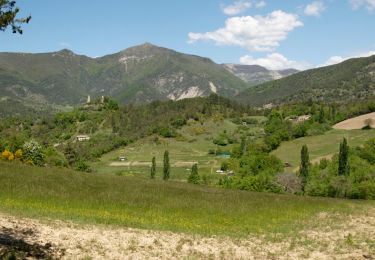
Trail Walking of 4.3 km to be discovered at Auvergne-Rhône-Alpes, Drôme, Eygluy-Escoulin. This trail is proposed by bob2023.
Description
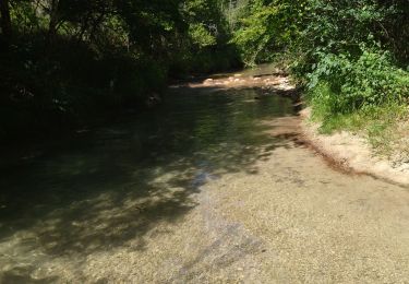
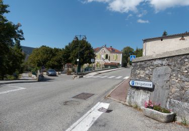
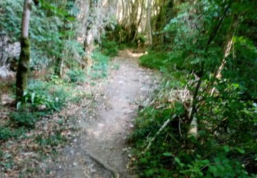
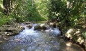
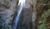
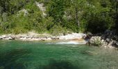
Se garer en bordure de route. Très belle rando. à faire par temps chaud. Nombreux passages dans l'eau (prévoir chaussures adéquates). Plutôt que de suivre le sentier il est possible et très agréable de remonter la Gervanne les pieds dans l'eau, vous arriverez au pied de la chute de la Druise. Les bâtons seront très utiles pour marcher dans le lit de la rivière. Pour le retour, même chemin, total environ 9 km. Note 9/10.
Positioning
Comments
Trails nearby
![Trail Walking Eygluy-Escoulin - 26 bec pointu zel 10.11.22 - Photo](https://media.geolcdn.com/t/375/260/ext.jpg?maxdim=2&url=https%3A%2F%2Fstatic1.geolcdn.com%2Fsiteimages%2Fupload%2Ffiles%2F1553511878bg_sport_marche.png)
![Walking Walking](https://static1.geolcdn.com/sitytour/trail-icons/101.png)
Walking
![](/images/other/stat-length.png)
![](https://static1.geolcdn.com/siteimages/upload/files/16400158638029165_repeat_loop_refresh_sync_direction_icon.png)
![Trail Walking Beaufort-sur-Gervanne - 26 gervanne druise plan de baix - Photo](https://media.geolcdn.com/t/375/260/cef04867-033e-4aa7-8c70-c5079a2317fe.jpg&format=jpg&maxdim=2)
![Walking Walking](https://static1.geolcdn.com/sitytour/trail-icons/101.png)
Walking
![](/images/other/stat-length.png)
![](https://static1.geolcdn.com/siteimages/upload/files/16400158638029165_repeat_loop_refresh_sync_direction_icon.png)
![Trail Walking Beaufort-sur-Gervanne - Beaufort St Pancrace 17km - Photo](https://media.geolcdn.com/t/375/260/ext.jpg?maxdim=2&url=https%3A%2F%2Fstatic1.geolcdn.com%2Fsiteimages%2Fupload%2Ffiles%2F1553511878bg_sport_marche.png)
![Walking Walking](https://static1.geolcdn.com/sitytour/trail-icons/101.png)
Walking
![](/images/other/stat-length.png)
![](https://static1.geolcdn.com/siteimages/upload/files/16400158638029165_repeat_loop_refresh_sync_direction_icon.png)
![Trail Walking Eygluy-Escoulin - 26 escoulin berches ayes - Photo](https://media.geolcdn.com/t/375/260/5381e54b-64ec-4f45-8508-60345424d51d.jpg&format=jpg&maxdim=2)
![Walking Walking](https://static1.geolcdn.com/sitytour/trail-icons/101.png)
Walking
![](/images/other/stat-length.png)
![](https://static1.geolcdn.com/siteimages/upload/files/16400158638029165_repeat_loop_refresh_sync_direction_icon.png)
![Trail Walking Beaufort-sur-Gervanne - Beaufort - Gigors - Lozeron - Photo](https://media.geolcdn.com/t/375/260/8cacbdb2-dbdb-432d-83ba-9c60bb3f8279.jpg&format=jpg&maxdim=2)
![Walking Walking](https://static1.geolcdn.com/sitytour/trail-icons/101.png)
Walking
![](/images/other/stat-length.png)
![](https://static1.geolcdn.com/siteimages/upload/files/16400158638029165_repeat_loop_refresh_sync_direction_icon.png)
![Trail Walking Beaufort-sur-Gervanne - BEAUFORT ET GERVANNE - Photo](https://media.geolcdn.com/t/375/260/9acf945f-4780-431b-bb4b-3d77cb822b0f.jpg&format=jpg&maxdim=2)
![Walking Walking](https://static1.geolcdn.com/sitytour/trail-icons/101.png)
Walking
![](/images/other/stat-length.png)
![](https://static1.geolcdn.com/siteimages/upload/files/16400158638029165_repeat_loop_refresh_sync_direction_icon.png)
![Trail Walking Eygluy-Escoulin - Le Taillefer - Escoulin-18969835 - Photo](https://media.geolcdn.com/t/375/260/a320a5a5-0487-4886-a0f3-90a4c7c70715.jpg&format=jpg&maxdim=2)
![Walking Walking](https://static1.geolcdn.com/sitytour/trail-icons/101.png)
Walking
![](/images/other/stat-length.png)
![](https://static1.geolcdn.com/siteimages/upload/files/16400158638029165_repeat_loop_refresh_sync_direction_icon.png)
![Trail Walking Plan-de-Baix - Canyon des Gueulards - Plateau du Vellan - Photo](https://media.geolcdn.com/t/375/260/df942d02-3843-4e15-b86a-2050f17fdf62.jpg&format=jpg&maxdim=2)
![Walking Walking](https://static1.geolcdn.com/sitytour/trail-icons/101.png)
Walking
![](/images/other/stat-length.png)
![](https://static1.geolcdn.com/siteimages/upload/files/16400158638029165_repeat_loop_refresh_sync_direction_icon.png)
![Trail Walking Plan-de-Baix - Le Canyon des Gueulards - Photo](https://media.geolcdn.com/t/375/260/138e2d3e-d109-4451-9e9f-dc740c8ceb56.jpg&format=jpg&maxdim=2)
![Walking Walking](https://static1.geolcdn.com/sitytour/trail-icons/101.png)
Walking
![](/images/other/stat-length.png)
![](https://static1.geolcdn.com/siteimages/upload/files/16400158638029165_repeat_loop_refresh_sync_direction_icon.png)