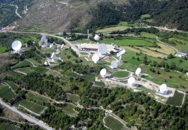
Trail Other activity Albinen - Loèche-les-Bains - Kandersteg par Restipass - Photo

Loèche-les-Bains - Kandersteg par Restipass

© OpenStreetMap contributors
Length
Length
19 km
Max alt
Max alt
2693 m
Uphill gradient
Uphill gradient
1164 m
Km-Effort
Km-Effort  
37 km
Min alt
Min alt
1540 m
Downhill gradient
Downhill gradient
1916 m
Boucle
Boucle
No
Creation date :
2014-12-11 00:00:00.0
Updated on :
2014-12-11 00:00:00.0

(0 Reviews)

Other activity
Other activity
--
Difficulty : Unknown

Scan this QR Code to open this trail in the SityTrail application

FREE GPS app for hiking

Logo SityTrail SityTrail

IGN / Geographical institutes

Download SityTrail from the App Store Download SityTrail from Google Play

Logo SityTrail SityTrail World

The world is yours!

Download SityTrail from the App Store Download SityTrail from Google Play Download SityTrail on Huawei AppGallery

About

Trail Other activity of 19 km to be discovered at Valais/Wallis, Leuk, Albinen. This trail is proposed by haerri-arnold.

Description

Ci-dessous une esquisse du programme de la sortie AN de mi-août, à savoir le di  14 et le lu 15 (cela m''arrange de rester à 2 jours uniquement). Je vous propose de la faire en transports publics, sinon c''est tout un "trapèze" avec les voitures.

Lundi 15 août
Lausanne - départ train:  8h20 / Aigle - départ train: 8h51
Leukerbad - arrivée du bus: 10h16

Montée en télécabine au Torrenthorn et traversée à pied jusqu''à Kummenalp par Restipass. Nuit à Kummenalp.

Mardi 16 août
Montée au Lötschepass et descente jusqu''à Selden/Gasterntal. De Selden à Kandersteg avec un petit bus (à resever)

Selden/Gasterntal - départ du bus: 14h55 ou 16h55
Kandersteg - départ train via Berne: 15h49 ou  17h49
Lausanne - arrivée train: 18h15 ou 20h15
Aigle - arrivée train 18h50 ou 20h50

Kandersteg - départ train via Brig: 16h12 ou 18h12
Aigle - arrivée du train: 18h08 ou 20h08
Lausanne - arrivée du train: 18h40 ou 20h40

Elevation profile

Positioning

Country:
Switzerland
Region :
Valais/Wallis
Department/Province :
Leuk
Municipality :
Albinen
Location:
Unknown
Start:(UTM)
396067 ; 5135924 (32T) N.

Trails nearby

Trail On foot Albinen - Wanderweg Albinen-Leuk Station - Photo
On foot
GUIDE+

On foot

Easy
Albinen, Valais/Wallis, Leuk, Switzerland
5.5 km | 7.8 km-effort
1h 45min
No
Trail Walking Leukerbad - hike36 - Photo
Walking
GUIDE+

Walking

Very easy
Leukerbad, Valais/Wallis, Leuk, Switzerland
12.8 km | 26 km-effort
Unknown
No
Trail Walking Leukerbad - st_gemmi - Photo
Walking
GUIDE+

Walking

Very easy
Leukerbad, Valais/Wallis, Leuk, Switzerland
12.3 km | 26 km-effort
2h 54min
No
Trail Mountain bike Leukerbad - Gemmipass - Photo
Mountain bike
GUIDE+

Mountain bike

Very easy
Leukerbad, Valais/Wallis, Leuk, Switzerland
19.7 km | 29 km-effort
5h 40min
Yes
Trail Walking Albinen - vs_hike781d - Photo
Walking
GUIDE+

Walking

Very easy
Albinen, Valais/Wallis, Leuk, Switzerland
5.9 km | 14.6 km-effort
2h 15min
Yes
Trail Walking Leukerbad - vs_hike781c - Photo
Walking
GUIDE+

Walking

Very easy
Leukerbad, Valais/Wallis, Leuk, Switzerland
3.1 km | 5.5 km-effort
58min
Yes
Trail Walking Leukerbad - vs_hike781b - Photo
Walking
GUIDE+

Walking

Very easy
Leukerbad, Valais/Wallis, Leuk, Switzerland
12.9 km | 23 km-effort
4h 7min
Yes
Trail Walking Leukerbad - vs_hike781a - Photo
Walking
GUIDE+

Walking

Very easy
Leukerbad, Valais/Wallis, Leuk, Switzerland
5.1 km | 8.7 km-effort
1h 31min
No
Trail Walking Leukerbad - st_koreatv08_05x - Photo
Walking
GUIDE+

Walking

Very easy
Leukerbad, Valais/Wallis, Leuk, Switzerland
32 km | 64 km-effort
11h 14min
No


Close
My subscriptions