Trail Walking Val-d'Aigoual - Valleraugue (30) : les 4000 marches  - Photo

Valleraugue (30) : les 4000 marches

© OpenStreetMap contributors
Length
Length
28 km
Max alt
Max alt
1561 m
Uphill gradient
Uphill gradient
1417 m
Km-Effort
Km-Effort  
47 km
Min alt
Min alt
354 m
Downhill gradient
Downhill gradient
1417 m
Boucle
Boucle
Yes
Creation date :
2019-05-31 05:31:43.903
Updated on :
2019-06-02 06:54:49.637

(0 Reviews)

Walking
Walking
8h51
Difficulty : Difficult

Scan this QR Code to open this trail in the SityTrail application

FREE GPS app for hiking

Logo SityTrail SityTrail

IGN / Geographical institutes

Download SityTrail from the App Store Download SityTrail from Google Play

Logo SityTrail SityTrail World

The world is yours!

Download SityTrail from the App Store Download SityTrail from Google Play Download SityTrail on Huawei AppGallery

About

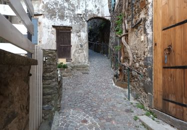
Trail Walking of 28 km to be discovered at Occitania, Gard, Val-d'Aigoual. This trail is proposed by Frayssinet.

Description

montée par les 4000 marches (1200m de dénivelé sur 8,3 kms).
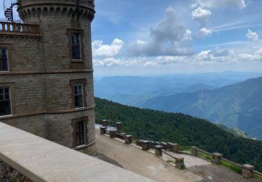
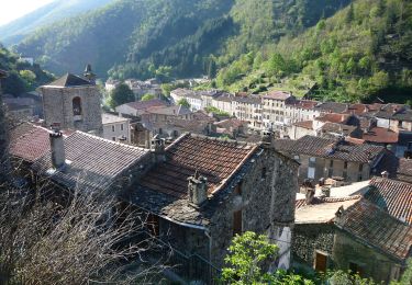
Visite du Mont Aigoual et environs du mont aigoual
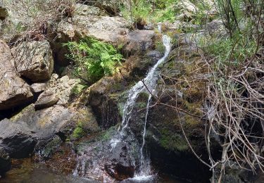
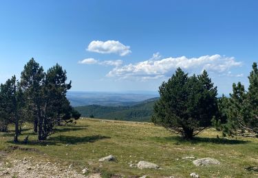
descente très longue et caillouteuse après l'aire de cote.
Faites le plein d'eau au mont Aigoual pour la descente.

Elevation profile

Positioning

Country:
France
Region :
Occitania
Department/Province :
Gard
Municipality :
Val-d'Aigoual
Location:
Valleraugue
Start:(UTM)
551268 ; 4880976 (31T) N.

Trails nearby

Trail Walking Arphy - Cascade d'Orgon/ monument André Chamson  - Photo
Walking
GUIDE
nadinebondoux

Walking

Medium
Arphy, Occitania, Gard, France
13.9 km | 19.6 km-effort
5h 45min
Yes
Trail Walking Val-d'Aigoual - col de la Lusette - Pic de Barette - col de Montals - L'Espérou - Photo
Walking
vertygo

Walking

Medium
(1)
Val-d'Aigoual, Occitania, Gard, France
17.6 km | 23 km-effort
4h 56min
Yes
Trail Walking Les Plantiers - Sentier du Mouflon - Les Plantiers  - Photo
Walking
GUIDE
randotines

Walking

Difficult
Les Plantiers, Occitania, Gard, France
11.2 km | 18.6 km-effort
3h 30min
Yes
Trail Walking Bassurels - Mont Aigoual Meyrues - Photo
Walking
GUIDE
Roger Philippe Wallez

Walking

Very difficult
Bassurels, Occitania, Lozère, France
37 km | 53 km-effort
11h 50min
Yes
Trail Walking Bassurels - Observatoire Mont Aigoual / Meyrueis - Photo
Walking
GUIDE
nadinebondoux

Walking

Medium
Bassurels, Occitania, Lozère, France
16.7 km | 22 km-effort
4h 44min
No
Trail Walking Val-d'Aigoual - Cascade d'Orgon-15-06-22 - Photo
Walking
Christiancordin

Walking

Difficult
Val-d'Aigoual, Occitania, Gard, France
22 km | 40 km-effort
6h 17min
Yes
Trail Walking Val-d'Aigoual - 4000 marches-14-06-22 - Photo
Walking
Christiancordin

Walking

Very difficult
Val-d'Aigoual, Occitania, Gard, France
30 km | 50 km-effort
7h 47min
Yes
Trail On foot Val-d'Aigoual - Les 4000 marches - Photo
On foot
GUIDE+

On foot

Easy
Val-d'Aigoual, Occitania, Gard, France
8 km | 19.7 km-effort
4h 28min
No
Trail Walking Val-d'Aigoual - Petit tout au Mont Aigoual - Photo
Walking
Patrice Grange

Walking

Very easy
Val-d'Aigoual, Occitania, Gard, France
6.2 km | 8 km-effort
1h 36min
Yes


Close
My subscriptions