


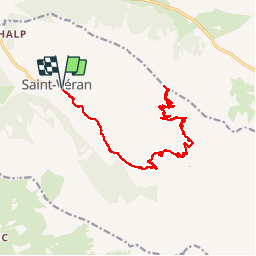

13.1 km | 23 km-effort


User


FREE GPS app for hiking
 SityTrail
IGN / Geographical institutes
SityTrail World
The world is yours!
Trail Mountain bike of 25 km to be discovered at Provence-Alpes-Côte d'Azur, Hautes-Alpes, Saint-Véran. This trail is proposed by lechner.
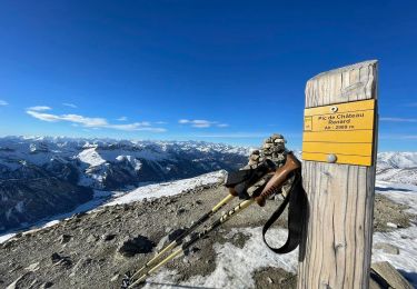
Montée à l'observatoire de Chateaurenard depuis St-Véran. Depuis le village, suivre la route de Clausis, puis prendre à gauche en direction de l'observatoire

Walking

Walking

Walking

Snowshoes
Snowshoes

Walking

Walking

Walking

Other activity