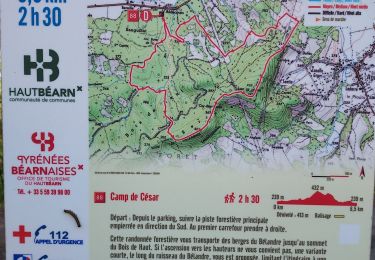
8.7 km | 12.4 km-effort
Randuroloron 2010
lrentb
User
Length
35 km
Max alt
636 m
Uphill gradient
1183 m
Km-Effort
51 km
Min alt
230 m
Downhill gradient
1180 m
Boucle
Yes
Creation date :
2014-12-10 00:00:00.0
Updated on :
2014-12-10 00:00:00.0
--
Difficulty : Unknown
FREE GPS app for hiking
About
Trail Other activity of 35 km to be discovered at New Aquitaine, Pyrénées-Atlantiques, Oloron-Sainte-Marie. This trail is proposed by lrentb.
Positioning
Country:
France
Region :
New Aquitaine
Department/Province :
Pyrénées-Atlantiques
Municipality :
Oloron-Sainte-Marie
Location:
Unknown
Start:(Dec)
Start:(UTM)
692870 ; 4783724 (30T) N.
Comments
Trails nearby
OLORON Le camp de Cesar G4 "4022567"
Running
Very easy
Oloron-Sainte-Marie,
New Aquitaine,
Pyrénées-Atlantiques,
France
2h 58min
Yes
OLORON / LURBE - SAINT CHRISTAUD balisage GR 653 balisage
On foot
Easy
Oloron-Sainte-Marie,
New Aquitaine,
Pyrénées-Atlantiques,
France
12.9 km | 17.2 km-effort
3h 54min
No
2023 10 12 CHEMIN du PIÉMONT PYRÉNÉEN - 20ème étape 1ere partie : Oloron-Ste...
Walking
Difficult
Oloron-Sainte-Marie,
New Aquitaine,
Pyrénées-Atlantiques,
France
42 km | 54 km-effort
18h 1min
No
OLORON ST MARIE Terra aventura
Walking
Very easy
Oloron-Sainte-Marie,
New Aquitaine,
Pyrénées-Atlantiques,
France
4.6 km | 6.1 km-effort
3h 18min
Yes
OLORON Ecomobilité "Gare Goes Precilhon sentier de la chaux" 4h20 effectif 31...
On foot
Medium
Oloron-Sainte-Marie,
New Aquitaine,
Pyrénées-Atlantiques,
France
15.5 km | 20 km-effort
4h 20min
Yes
Tour crètes jusqu'à Louvie
Mountain bike
Very difficult
(1)
Estos,
New Aquitaine,
Pyrénées-Atlantiques,
France
58 km | 70 km-effort
4h 49min
No
hors G4 fait
Walking
Very easy
Goès,
New Aquitaine,
Pyrénées-Atlantiques,
France
8.9 km | 12.1 km-effort
4h 36min
Yes
G4 Haut doloron
Walking
Difficult
Oloron-Sainte-Marie,
New Aquitaine,
Pyrénées-Atlantiques,
France
8.6 km | 12.3 km-effort
5h 14min
Yes
Move
On foot
Easy
Oloron-Sainte-Marie,
New Aquitaine,
Pyrénées-Atlantiques,
France
8.4 km | 12.2 km-effort
2h 45min
Yes