Trail Walking Puyvalador - petite balade  - Photo
© OpenStreetMap contributors
Length
Length
3.8 km
Max alt
Max alt
1897 m
Uphill gradient
Uphill gradient
144 m
Km-Effort
Km-Effort  
5.7 km
Min alt
Min alt
1760 m
Downhill gradient
Downhill gradient
142 m
Boucle
Boucle
Yes
Creation date :
2014-12-10 00:00:00.0
Updated on :
2014-12-10 00:00:00.0

(2 Reviews)

Walking
Walking
2h56
Difficulty : Unknown

Scan this QR Code to open this trail in the SityTrail application

FREE GPS app for hiking

Logo SityTrail SityTrail

IGN / Geographical institutes

Download SityTrail from the App Store Download SityTrail from Google Play

Logo SityTrail SityTrail World

The world is yours!

Download SityTrail from the App Store Download SityTrail from Google Play Download SityTrail on Huawei AppGallery

About

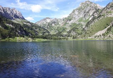
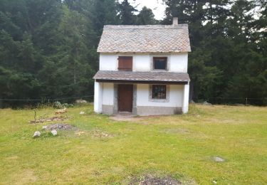
Trail Walking of 3.8 km to be discovered at Occitania, Pyrénées-Orientales, Puyvalador. This trail is proposed by celebrindal.

Description

Sentier Émilie avec bifurcation .

Elevation profile

Photos

Positioning

Country:
France
Region :
Occitania
Department/Province :
Pyrénées-Orientales
Municipality :
Puyvalador
Location:
Unknown
Start:(UTM)
424676 ; 4722522 (31T) N.

Comments

Please log in to post a review or rate the element


je teste pour le moment ça a l'air pas mal


Bien


Trails nearby

Trail Snowshoes Réal - madres - Photo
Snowshoes
mongo

Snowshoes

Difficult
(1)
Réal, Occitania, Pyrénées-Orientales, France
13.1 km | 26 km-effort
6h 48min
Yes
Trail Walking Formiguères - Les Camporells par la Lladure  - Photo
Walking
jcmartin

Walking

Medium
(1)
Formiguères, Occitania, Pyrénées-Orientales, France
15.1 km | 24 km-effort
5h 7min
Yes
Trail Walking Le Pla - Roc Blanc par Laurenti - Photo
Walking
jcmartin

Walking

Difficult
(1)
Le Pla, Occitania, Ariège, France
11.9 km | 24 km-effort
4h 48min
Yes
Trail sport Formiguères - 20240728 Station Formiguères - Camporeils - Photo
sport
ThonyM

sport

Very easy
Formiguères, Occitania, Pyrénées-Orientales, France
16 km | 27 km-effort
Unknown
Yes
Trail Walking Puyvalador - Puyvalador tour du lac  - Photo
Walking
GUIDE
antignacs

Walking

Very easy
Puyvalador, Occitania, Pyrénées-Orientales, France
12.1 km | 15.9 km-effort
3h 39min
Yes
Trail Walking Formiguères - 20210819 Porteille d’Orlu, étang du diable - Photo
Walking
ThonyM

Walking

Difficult
Formiguères, Occitania, Pyrénées-Orientales, France
16.4 km | 29 km-effort
5h 3min
Yes
Trail Walking Formiguères - 20210710 pla del bosc - Foumigueres - Photo
Walking
ThonyM

Walking

Easy
Formiguères, Occitania, Pyrénées-Orientales, France
12.5 km | 18.3 km-effort
2h 47min
Yes
Trail Snowshoes Formiguères - Formigueres el collet  - Photo
Snowshoes
GUIDE
antignacs

Snowshoes

Very easy
Formiguères, Occitania, Pyrénées-Orientales, France
6.4 km | 8.7 km-effort
2h 47min
Yes
Trail Walking Le Pla - Roc blanc .étang du Laurenti (Ariège ) - Photo
Walking
MarieFrancoise

Walking

Difficult
Le Pla, Occitania, Ariège, France
13.1 km | 26 km-effort
9h 32min
Yes


Close
My subscriptions