![](/images/other/stat-length.png)
![Trail Walking Courpalay - Randonnées des lavoirs Courpalay - Photo](https://media.geolcdn.com/t/1900/400/ext.pjpeg?maxdim=2&url=https%3A%2F%2Fstatic1.geolcdn.com%2Fsiteimages%2Fupload%2Ffiles%2F1553511878bg_sport_marche.png)
Randonnées des lavoirs Courpalay
pikibangi
User
![Length](/images/other/stat-length.png)
Length
23 km
![Max alt](https://static1.geolcdn.com/siteimages/upload/files/1508320355ic_sort_altitude_max_24dp.png)
Max alt
113 m
![Uphill gradient](https://static1.geolcdn.com/siteimages/upload/files/1508320355ic_sort_den_pos_24dp.png)
Uphill gradient
194 m
![Km-Effort](/images/other/stat-length.png)
Km-Effort
25 km
![Min alt](https://static1.geolcdn.com/siteimages/upload/files/1508320355ic_sort_altitude_min_24dp.png)
Min alt
78 m
![Downhill gradient](https://static1.geolcdn.com/siteimages/upload/files/1508320355ic_sort_den_neg_24dp.png)
Downhill gradient
194 m
![Boucle](https://static1.geolcdn.com/siteimages/upload/files/16400158638029165_repeat_loop_refresh_sync_direction_icon.png)
Boucle
Yes
Creation date :
2019-05-01 06:47:12.331
Updated on :
2019-05-01 16:59:50.07
![Walking](https://static1.geolcdn.com/sitytour/trail-icons/101.png)
6h32
Difficulty : Very easy
![Scan this QR Code to open this trail in the SityTrail application](https://capi.geolives.com/qq0zvz2zws4bq2lad0pu/sitytour/trails/2070208/qr.png?size=200)
FREE GPS app for hiking
About
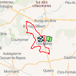
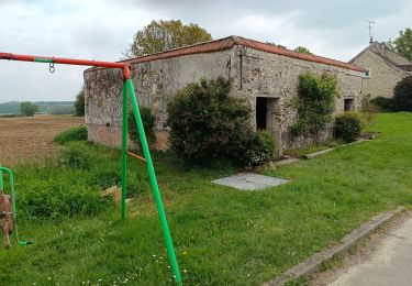
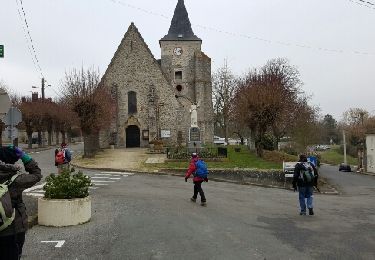
Trail Walking of 23 km to be discovered at Ile-de-France, Seine-et-Marne, Courpalay. This trail is proposed by pikibangi.
Description
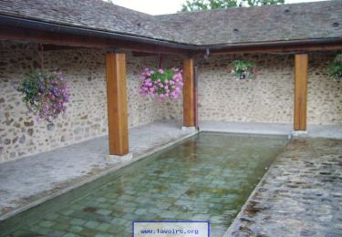
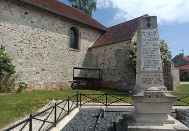
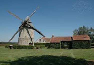
Randonnées des lavoirs au départ de Courpalay. Édition 1er mai 2019.
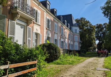
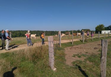
Randonnée agréable avec une belle journée ensoleillée et l'arrivée avec la bière locale, pour redonner des forces après l'effort.
Positioning
Country:
France
Region :
Ile-de-France
Department/Province :
Seine-et-Marne
Municipality :
Courpalay
Location:
Unknown
Start:(Dec)
Start:(UTM)
497226 ; 5388156 (31U) N.
Comments
Trails nearby
![Trail Walking Courtomer - Boucle Courtomer - chaumes en Brie - - Photo](https://media.geolcdn.com/t/375/260/4c724cf3-58fd-4de3-a054-aacb416cef6c.jpg&format=jpg&maxdim=2)
![Walking Walking](https://static1.geolcdn.com/sitytour/trail-icons/101.png)
Boucle Courtomer - chaumes en Brie -
Walking
Easy
Courtomer,
Ile-de-France,
Seine-et-Marne,
France
![](/images/other/stat-length.png)
20 km | 23 km-effort
4h 34min
![](https://static1.geolcdn.com/siteimages/upload/files/16400158638029165_repeat_loop_refresh_sync_direction_icon.png)
Yes
![Trail Walking Bernay-Vilbert - Boucle de Bernay - Photo](https://media.geolcdn.com/t/375/260/0badd9bc-4790-4ce2-8ad5-41233d0a2e71.jpg&format=jpg&maxdim=2)
![Walking Walking](https://static1.geolcdn.com/sitytour/trail-icons/101.png)
Boucle de Bernay
Walking
Medium
Bernay-Vilbert,
Ile-de-France,
Seine-et-Marne,
France
![](/images/other/stat-length.png)
7.9 km | 9 km-effort
2h 6min
![](https://static1.geolcdn.com/siteimages/upload/files/16400158638029165_repeat_loop_refresh_sync_direction_icon.png)
Yes
![Trail Walking La Chapelle-Iger - Les côteaux Capelligérois - La Chapelle-Iger - Photo](https://media.geolcdn.com/t/375/260/ext.jpg?maxdim=2&url=https%3A%2F%2Fservices.sitytrail.com%2FGeolivesWS%2FDownloadMedia.ashx%3FTrailID%3D111434%26Media%3D7247_3.jpg)
![Walking Walking](https://static1.geolcdn.com/sitytour/trail-icons/101.png)
Les côteaux Capelligérois - La Chapelle-Iger
Walking
Difficult
La Chapelle-Iger,
Ile-de-France,
Seine-et-Marne,
France
![](/images/other/stat-length.png)
13.5 km | 15.3 km-effort
3h 19min
![](https://static1.geolcdn.com/siteimages/upload/files/16400158638029165_repeat_loop_refresh_sync_direction_icon.png)
Yes
![Trail Walking Courpalay - courpalay - Photo](https://media.geolcdn.com/t/375/260/ext.jpg?maxdim=2&url=https%3A%2F%2Fstatic1.geolcdn.com%2Fsiteimages%2Fupload%2Ffiles%2F1553511878bg_sport_marche.png)
![Walking Walking](https://static1.geolcdn.com/sitytour/trail-icons/101.png)
courpalay
Walking
Easy
(1)
Courpalay,
Ile-de-France,
Seine-et-Marne,
France
![](/images/other/stat-length.png)
13.7 km | 15.3 km-effort
3h 20min
![](https://static1.geolcdn.com/siteimages/upload/files/16400158638029165_repeat_loop_refresh_sync_direction_icon.png)
Yes
![Trail Walking Courpalay - Courpalay - Photo](https://media.geolcdn.com/t/375/260/8b75a87c-9af5-4c3b-a34c-55caf118b693.jpg&format=jpg&maxdim=2)
![Walking Walking](https://static1.geolcdn.com/sitytour/trail-icons/101.png)
Courpalay
Walking
Medium
Courpalay,
Ile-de-France,
Seine-et-Marne,
France
![](/images/other/stat-length.png)
8.6 km | 9.8 km-effort
2h 39min
![](https://static1.geolcdn.com/siteimages/upload/files/16400158638029165_repeat_loop_refresh_sync_direction_icon.png)
Yes
![Trail Walking Courpalay - SityTrail - J 96 - Randonnées des lavoirs - 19 km - Photo](https://media.geolcdn.com/t/375/260/fa54443c-4720-4cee-9756-9184d788307c.jpg&format=jpg&maxdim=2)
![Walking Walking](https://static1.geolcdn.com/sitytour/trail-icons/101.png)
SityTrail - J 96 - Randonnées des lavoirs - 19 km
Walking
Difficult
Courpalay,
Ile-de-France,
Seine-et-Marne,
France
![](/images/other/stat-length.png)
19.2 km | 22 km-effort
4h 58min
![](https://static1.geolcdn.com/siteimages/upload/files/16400158638029165_repeat_loop_refresh_sync_direction_icon.png)
Yes
![Trail Walking La Chapelle-Iger - Chapelle Iger - Photo](https://media.geolcdn.com/t/375/260/94ccf62d-3c42-4d7c-83a6-5d59eec3bc13.jpg&format=jpg&maxdim=2)
![Walking Walking](https://static1.geolcdn.com/sitytour/trail-icons/101.png)
Chapelle Iger
Walking
Medium
La Chapelle-Iger,
Ile-de-France,
Seine-et-Marne,
France
![](/images/other/stat-length.png)
10.2 km | 11.4 km-effort
2h 3min
![](https://static1.geolcdn.com/siteimages/upload/files/16400158638029165_repeat_loop_refresh_sync_direction_icon.png)
Yes
![Trail Walking La Chapelle-Iger - la chapelle Iger - Photo](https://media.geolcdn.com/t/375/260/a5724690-204d-473f-ab68-a5fbec7ba8ce.jpg&format=jpg&maxdim=2)
![Walking Walking](https://static1.geolcdn.com/sitytour/trail-icons/101.png)
la chapelle Iger
Walking
Difficult
La Chapelle-Iger,
Ile-de-France,
Seine-et-Marne,
France
![](/images/other/stat-length.png)
18.8 km | 21 km-effort
4h 18min
![](https://static1.geolcdn.com/siteimages/upload/files/16400158638029165_repeat_loop_refresh_sync_direction_icon.png)
Yes
![Trail Other activity Courpalay - courpalay - Photo](https://media.geolcdn.com/t/375/260/ext.jpg?maxdim=2&url=https%3A%2F%2Fservices.sitytrail.com%2FGeolivesWS%2FDownloadMedia.ashx%3FTrailID%3D689301%26Media%3Dfix__20170125141357.jpg)
![Other activity Other activity](https://static1.geolcdn.com/sitytour/trail-icons/900.png)
courpalay
Other activity
Very easy
Courpalay,
Ile-de-France,
Seine-et-Marne,
France
![](/images/other/stat-length.png)
16.1 km | 18.3 km-effort
3h 51min
![](https://static1.geolcdn.com/siteimages/upload/files/16400158638029165_repeat_loop_refresh_sync_direction_icon.png)
Yes