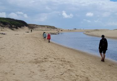
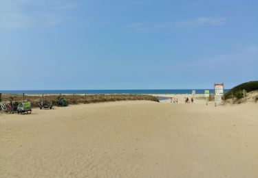
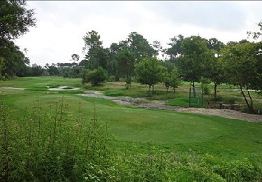
Trail Walking Moliets-et-Maâ - La Chapelle Saint Laurent de Maa _ 8,5 km_Trace GPS - Photo

La Chapelle Saint Laurent de Maa _ 8,5 km_Trace GPS

© OpenStreetMap contributors
Length
Length
8.5 km
Max alt
Max alt
30 m
Uphill gradient
Uphill gradient
102 m
Km-Effort
Km-Effort  
9.9 km
Min alt
Min alt
10 m
Downhill gradient
Downhill gradient
101 m
Boucle
Boucle
Yes
Creation date :
2014-12-10 00:00:00.0
Updated on :
2014-12-10 00:00:00.0

(0 Reviews)

Walking
Walking
2h02
Difficulty : Easy

Scan this QR Code to open this trail in the SityTrail application

FREE GPS app for hiking

Logo SityTrail SityTrail

IGN / Geographical institutes

Download SityTrail from the App Store Download SityTrail from Google Play

Logo SityTrail SityTrail World

The world is yours!

Download SityTrail from the App Store Download SityTrail from Google Play Download SityTrail on Huawei AppGallery

About

Trail Walking of 8.5 km to be discovered at New Aquitaine, Landes, Moliets-et-Maâ. This trail is proposed by Pousscailleux.

Description

Lavoir et fontaine (Pourrut) de Maâ, Chapelle Saint Laurent sur le site d'une ancienne commanderie des Templiers.

Elevation profile

Photos

Points of interest

Point of interest Moliets-et-Maâ - Fontaine Saint Orens - Photo
Pousscailleux
MOLIETS-ET-MA 
Point of interest Moliets-et-Maâ - Chapelle datant de l'époque des Templiers - Photo
Pousscailleux
Point of interest Moliets-et-Maâ - Croix - Photo
Pousscailleux
MOLIETS-ET-MA 
Point of interest Moliets-et-Maâ - Lavoir et Fontaine Notre Dame - Photo
Pousscailleux
Point of interest Moliets-et-Maâ - Petit pont sur ru - Photo
Pousscailleux
MOLIETS-ET-MA 
Point of interest Moliets-et-Maâ - Etang de Moliets - Photo
Pousscailleux
MOLIETS-ET-MA 
Point of interest Moliets-et-Maâ - Lavoir - Photo
Pousscailleux
MOLIETS-ET-MA 
Point of interest Moliets-et-Maâ - Arrière Chapelle St Laurent - Photo
Pousscailleux
Point of interest Moliets-et-Maâ - Chapelle Saint Laurent - Photo
Pousscailleux
MOLIETS-ET-MA 

Positioning

Country:
France
Region :
New Aquitaine
Department/Province :
Landes
Municipality :
Moliets-et-Maâ
Location:
Unknown
Start:(UTM)
630891 ; 4856473 (30T) N.

Trails nearby

Trail Walking Moliets-et-Maâ - MOLIETS le courant d huchet    290 7700 - Photo
Walking
GUIDE
marmotte65

Walking

Easy
Moliets-et-Maâ, New Aquitaine, Landes, France
5.8 km | 6.5 km-effort
1h 51min
No
Trail Walking Léon - Etang VSP 10km - Photo
Walking
Marie Dony

Walking

Easy
(1)
Léon, New Aquitaine, Landes, France
10.2 km | 12.1 km-effort
2h 1min
Yes
Trail Walking Moliets-et-Maâ - balade dans les pins avec vue sur dune - Photo
Walking
loca.yves

Walking

Easy
Moliets-et-Maâ, New Aquitaine, Landes, France
9.2 km | 10.2 km-effort
2h 31min
Yes
Trail Walking Léon - Courant du Huchet - Photo
Walking
jaja64

Walking

Very easy
Léon, New Aquitaine, Landes, France
18.6 km | 21 km-effort
5h 30min
No
Trail Walking Moliets-et-Maâ - circuit des Cigales camping au courant d'Uchet et retour - Photo
Walking
Forsans

Walking

Easy
Moliets-et-Maâ, New Aquitaine, Landes, France
6.5 km | 7.2 km-effort
1h 46min
Yes
Trail Walking Moliets-et-Maâ - Le Courant d' Huchet _ 5,3 km_Trace GPS - Photo
Walking
Pousscailleux

Walking

Very easy
Moliets-et-Maâ, New Aquitaine, Landes, France
5.3 km | 6.1 km-effort
1h 18min
Yes
Trail Walking Moliets-et-Maâ - Courant Huchet complet - Photo
Walking
eliott3

Walking

Very easy
(2)
Moliets-et-Maâ, New Aquitaine, Landes, France
15.1 km | 17.4 km-effort
3h 45min
Yes
Trail Walking Vielle-Saint-Girons - Ballade Courant Huchet - Photo
Walking
eliott3

Walking

Easy
(2)
Vielle-Saint-Girons, New Aquitaine, Landes, France
6.1 km | 7.2 km-effort
1h 34min
Yes
Trail Mountain bike Moliets-et-Maâ - molliet - Photo
Mountain bike
daliot

Mountain bike

Very easy
Moliets-et-Maâ, New Aquitaine, Landes, France
8.7 km | 9.7 km-effort
48min
No


Close
My subscriptions