![](/images/other/stat-length.png)
![Trail Mountain bike Mutzig - Circuit VTT.A.E ELMERFORST - Photo](https://media.geolcdn.com/t/1900/400/ext.pjpeg?maxdim=2&url=https%3A%2F%2Fstatic1.geolcdn.com%2Fsiteimages%2Fupload%2Ffiles%2F1524743154velo.jpg)
Circuit VTT.A.E ELMERFORST
jbclevenot
User
![Length](/images/other/stat-length.png)
Length
36 km
![Max alt](https://static1.geolcdn.com/siteimages/upload/files/1508320355ic_sort_altitude_max_24dp.png)
Max alt
467 m
![Uphill gradient](https://static1.geolcdn.com/siteimages/upload/files/1508320355ic_sort_den_pos_24dp.png)
Uphill gradient
922 m
![Km-Effort](/images/other/stat-length.png)
Km-Effort
49 km
![Min alt](https://static1.geolcdn.com/siteimages/upload/files/1508320355ic_sort_altitude_min_24dp.png)
Min alt
186 m
![Downhill gradient](https://static1.geolcdn.com/siteimages/upload/files/1508320355ic_sort_den_neg_24dp.png)
Downhill gradient
922 m
![Boucle](https://static1.geolcdn.com/siteimages/upload/files/16400158638029165_repeat_loop_refresh_sync_direction_icon.png)
Boucle
Yes
Creation date :
2019-04-22 19:43:21.817
Updated on :
2019-04-24 19:10:32.312
![Mountain bike](https://static1.geolcdn.com/sitytour/trail-icons/202.png)
3h10
Difficulty : Medium
![Electric bike](https://static1.geolcdn.com/sitytour/trail-icons/205.png)
2m
Difficulty : Medium
![Scan this QR Code to open this trail in the SityTrail application](https://capi.geolives.com/qq0zvz2zws4bq2lad0pu/sitytour/trails/2065559/qr.png?size=200)
FREE GPS app for hiking
About
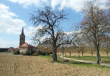
Trail Mountain bike of 36 km to be discovered at Grand Est, Bas-Rhin, Mutzig. This trail is proposed by jbclevenot.
Description
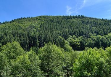
Circuit VTT Electrique pouvant se faire à la journée avec une pause dans une ancienne maison forestière devenue auberge et gîte en pleine forêt.
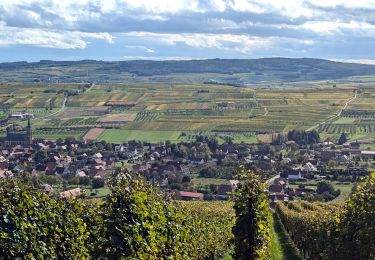
parcours entre champs et forêts
Positioning
Country:
France
Region :
Grand Est
Department/Province :
Bas-Rhin
Municipality :
Mutzig
Location:
Unknown
Start:(Dec)
Start:(UTM)
386506 ; 5376793 (32U) N.
Comments
Trails nearby
![Trail Walking Mutzig - Les sanctuaires autour de Mutzig - Photo](https://media.geolcdn.com/t/375/260/ext.jpg?maxdim=2&url=https%3A%2F%2Fservices.sitytrail.com%2FGeolivesWS%2FDownloadMedia.ashx%3FTrailID%3D757212%26Media%3Dfix__20170521144513.jpg)
![Walking Walking](https://static1.geolcdn.com/sitytour/trail-icons/101.png)
Les sanctuaires autour de Mutzig
Walking
Medium
(1)
Mutzig,
Grand Est,
Bas-Rhin,
France
![](/images/other/stat-length.png)
13.6 km | 17.9 km-effort
5h 0min
![](https://static1.geolcdn.com/siteimages/upload/files/16400158638029165_repeat_loop_refresh_sync_direction_icon.png)
Yes
![Trail Walking Wolxheim - wolxheim, chapelle st-denis. - Photo](https://media.geolcdn.com/t/375/260/ext.jpg?maxdim=2&url=https%3A%2F%2Fservices.sitytrail.com%2FGeolivesWS%2FDownloadMedia.ashx%3FTrailID%3D212187%26Media%3D20130505140350.jpeg)
![Walking Walking](https://static1.geolcdn.com/sitytour/trail-icons/101.png)
wolxheim, chapelle st-denis.
Walking
Medium
(1)
Wolxheim,
Grand Est,
Bas-Rhin,
France
![](/images/other/stat-length.png)
6.9 km | 8.3 km-effort
2h 19min
![](https://static1.geolcdn.com/siteimages/upload/files/16400158638029165_repeat_loop_refresh_sync_direction_icon.png)
Yes
![Trail Walking Mutzig - Les sanctuaires autour de Mutzig - Photo](https://media.geolcdn.com/t/375/260/ext.jpg?maxdim=2&url=https%3A%2F%2Fservices.sitytrail.com%2FGeolivesWS%2FDownloadMedia.ashx%3FTrailID%3D191554%26Media%3D15170_5.jpg)
![Walking Walking](https://static1.geolcdn.com/sitytour/trail-icons/101.png)
Les sanctuaires autour de Mutzig
Walking
Difficult
(1)
Mutzig,
Grand Est,
Bas-Rhin,
France
![](/images/other/stat-length.png)
12.7 km | 16.8 km-effort
4h 0min
![](https://static1.geolcdn.com/siteimages/upload/files/16400158638029165_repeat_loop_refresh_sync_direction_icon.png)
Yes
![Trail Walking Dorlisheim - Escapade dans le vignoble de Dorlisheim - Photo](https://media.geolcdn.com/t/375/260/ext.jpg?maxdim=2&url=https%3A%2F%2Fservices.sitytrail.com%2FGeolivesWS%2FDownloadMedia.ashx%3FTrailID%3D191544%26Media%3D15156_5.jpg)
![Walking Walking](https://static1.geolcdn.com/sitytour/trail-icons/101.png)
Escapade dans le vignoble de Dorlisheim
Walking
Medium
(1)
Dorlisheim,
Grand Est,
Bas-Rhin,
France
![](/images/other/stat-length.png)
9.7 km | 12.6 km-effort
3h 0min
![](https://static1.geolcdn.com/siteimages/upload/files/16400158638029165_repeat_loop_refresh_sync_direction_icon.png)
Yes
![Trail Walking Mutzig - Autour du Fort de Mutzig - Photo](https://media.geolcdn.com/t/375/260/ext.jpg?maxdim=2&url=https%3A%2F%2Fservices.sitytrail.com%2FGeolivesWS%2FDownloadMedia.ashx%3FTrailID%3D184932%26Media%3D20130414160934.jpeg)
![Walking Walking](https://static1.geolcdn.com/sitytour/trail-icons/101.png)
Autour du Fort de Mutzig
Walking
Difficult
(2)
Mutzig,
Grand Est,
Bas-Rhin,
France
![](/images/other/stat-length.png)
18.7 km | 26 km-effort
6h 30min
![](https://static1.geolcdn.com/siteimages/upload/files/16400158638029165_repeat_loop_refresh_sync_direction_icon.png)
Yes
![Trail Walking Molsheim - Les Chapelles entre vignoble et canal - Photo](https://media.geolcdn.com/t/375/260/ext.jpg?maxdim=2&url=https%3A%2F%2Fservices.sitytrail.com%2FGeolivesWS%2FDownloadMedia.ashx%3FTrailID%3D183542%26Media%3D2646587c-a01c-401b-8b31-6064124244bc.jpeg)
![Walking Walking](https://static1.geolcdn.com/sitytour/trail-icons/101.png)
Les Chapelles entre vignoble et canal
Walking
Medium
(2)
Molsheim,
Grand Est,
Bas-Rhin,
France
![](/images/other/stat-length.png)
14.8 km | 17 km-effort
3h 43min
![](https://static1.geolcdn.com/siteimages/upload/files/16400158638029165_repeat_loop_refresh_sync_direction_icon.png)
Yes
![Trail Mountain bike Dinsheim-sur-Bruche - Les Grandes Manoeuvres - Photo](https://media.geolcdn.com/t/375/260/ext.jpg?maxdim=2&url=https%3A%2F%2Fservices.sitytrail.com%2FGeolivesWS%2FDownloadMedia.ashx%3FTrailID%3D101149%26Media%3D637_1.jpg)
![Mountain bike Mountain bike](https://static1.geolcdn.com/sitytour/trail-icons/202.png)
Les Grandes Manoeuvres
Mountain bike
Very difficult
(1)
Dinsheim-sur-Bruche,
Grand Est,
Bas-Rhin,
France
![](/images/other/stat-length.png)
45 km | 59 km-effort
4h 0min
![](https://static1.geolcdn.com/siteimages/upload/files/16400158638029165_repeat_loop_refresh_sync_direction_icon.png)
Yes
![Trail Horseback riding Rosenwiller - suuntoapp-HorsebackRiding-2024-10-13T07-08-28Z - Photo](https://media.geolcdn.com/t/375/260/5e0f037b-8c10-49d5-8e85-7ccefd4ab616.jpg&format=jpg&maxdim=2)
![Horseback riding Horseback riding](https://static1.geolcdn.com/sitytour/trail-icons/301.png)
suuntoapp-HorsebackRiding-2024-10-13T07-08-28Z
Horseback riding
Medium
Rosenwiller,
Grand Est,
Bas-Rhin,
France
![](/images/other/stat-length.png)
35 km | 44 km-effort
5h 46min
![](https://static1.geolcdn.com/siteimages/upload/files/16400158638029165_repeat_loop_refresh_sync_direction_icon.png)
Yes
![Trail Walking Still - 2024-02-07_22h30m09_B3 - Photo](https://media.geolcdn.com/t/375/260/ext.jpg?maxdim=2&url=https%3A%2F%2Fstatic1.geolcdn.com%2Fsiteimages%2Fupload%2Ffiles%2F1553511878bg_sport_marche.png)
![Walking Walking](https://static1.geolcdn.com/sitytour/trail-icons/101.png)
2024-02-07_22h30m09_B3
Walking
Medium
(1)
Still,
Grand Est,
Bas-Rhin,
France
![](/images/other/stat-length.png)
16.8 km | 22 km-effort
4h 56min
![](https://static1.geolcdn.com/siteimages/upload/files/16400158638029165_repeat_loop_refresh_sync_direction_icon.png)
Yes