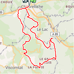
![](/images/other/stat-length.png)
Tracé actuel: 18 AVR 2019 08:39
GilGry
User
![Length](/images/other/stat-length.png)
![Max alt](https://static1.geolcdn.com/siteimages/upload/files/1508320355ic_sort_altitude_max_24dp.png)
![Uphill gradient](https://static1.geolcdn.com/siteimages/upload/files/1508320355ic_sort_den_pos_24dp.png)
![Km-Effort](/images/other/stat-length.png)
![Min alt](https://static1.geolcdn.com/siteimages/upload/files/1508320355ic_sort_altitude_min_24dp.png)
![Downhill gradient](https://static1.geolcdn.com/siteimages/upload/files/1508320355ic_sort_den_neg_24dp.png)
![Boucle](https://static1.geolcdn.com/siteimages/upload/files/16400158638029165_repeat_loop_refresh_sync_direction_icon.png)
![Walking](https://static1.geolcdn.com/sitytour/trail-icons/101.png)
7h00
Difficulty : Medium
![Scan this QR Code to open this trail in the SityTrail application](https://capi.geolives.com/qq0zvz2zws4bq2lad0pu/sitytour/trails/2063693/qr.png?size=200)
FREE GPS app for hiking
About
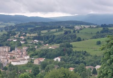
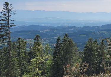
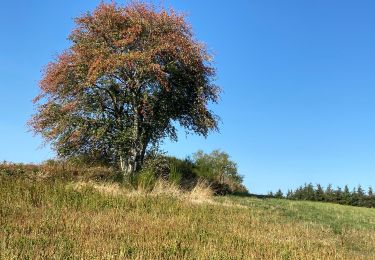
Trail Walking of 22 km to be discovered at Auvergne-Rhône-Alpes, Puy-de-Dôme, Chabreloche. This trail is proposed by GilGry.
Description
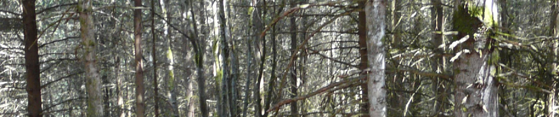
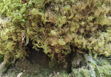
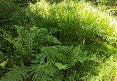
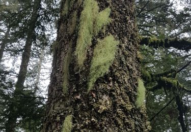
Parcours sans grosses difficultés. Quelques passages hors pistes parce que j'aime ca. Passage sur le site du crash d'avion en 1972. Découverte de 2 bornes royales. J'ai pas trouvé la 3ème.
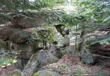
Pour le Roc du Guet. C'est beaucoup d'effort pour ne rien voir. On est sportif et aventureux ou pas. Peut-être que depuis la vue à été dégagée. Descente en hors piste et emprunt du lit d'une rivière.
Si vous suivez la trace, c'est à vos risques et périls.
Positioning
Comments
Trails nearby
![Trail Walking Arconsat - Col de la Charme - Photo](https://media.geolcdn.com/t/375/260/83cd7712-19e5-489a-bc72-c7327eb4a13c.jpg&format=jpg&maxdim=2)
![Walking Walking](https://static1.geolcdn.com/sitytour/trail-icons/101.png)
Walking
![](/images/other/stat-length.png)
![](https://static1.geolcdn.com/siteimages/upload/files/16400158638029165_repeat_loop_refresh_sync_direction_icon.png)
![Trail On foot Arconsat - Montlune - Photo](https://media.geolcdn.com/t/375/260/c657d6f2-0003-4090-a052-219487f3be3a.jpeg&format=jpg&maxdim=2)
![On foot On foot](https://static1.geolcdn.com/sitytour/trail-icons/100.png)
On foot
![](/images/other/stat-length.png)
![](https://static1.geolcdn.com/siteimages/upload/files/16400158638029165_repeat_loop_refresh_sync_direction_icon.png)
![Trail Walking Saint-Priest-la-Prugne - Col de la Charme - Photo](https://media.geolcdn.com/t/375/260/7482aed9-3f58-400d-95c6-5af863d7ad1a.jpg&format=jpg&maxdim=2)
![Walking Walking](https://static1.geolcdn.com/sitytour/trail-icons/101.png)
Walking
![](/images/other/stat-length.png)
![](https://static1.geolcdn.com/siteimages/upload/files/16400158638029165_repeat_loop_refresh_sync_direction_icon.png)
![Trail Walking Saint-Priest-la-Prugne - Col de la Charme 2020 - Photo](https://media.geolcdn.com/t/375/260/db673239-bfc6-461b-a458-7aa5bd1e7c98.jpg&format=jpg&maxdim=2)
![Walking Walking](https://static1.geolcdn.com/sitytour/trail-icons/101.png)
Walking
![](/images/other/stat-length.png)
![](https://static1.geolcdn.com/siteimages/upload/files/16400158638029165_repeat_loop_refresh_sync_direction_icon.png)
![Trail Walking Chausseterre - retour TOP 03 - Photo](https://media.geolcdn.com/t/375/260/0e639819-d824-4c70-9258-9551f02b9c2e.jpg&format=jpg&maxdim=2)
![Walking Walking](https://static1.geolcdn.com/sitytour/trail-icons/101.png)
Walking
![](/images/other/stat-length.png)
![](https://static1.geolcdn.com/siteimages/upload/files/16400158638029165_repeat_loop_refresh_sync_direction_icon.png)
![Trail Walking Celles-sur-Durolle - Le Puy de Montoncel_T - Photo](https://media.geolcdn.com/t/375/260/d73873a8-736e-4bf5-9cdb-da7751bfb868.jpg&format=jpg&maxdim=2)
![Walking Walking](https://static1.geolcdn.com/sitytour/trail-icons/101.png)
Walking
![](/images/other/stat-length.png)
![](https://static1.geolcdn.com/siteimages/upload/files/16400158638029165_repeat_loop_refresh_sync_direction_icon.png)
![Trail On foot Chabreloche - Le Roc du Guet - Photo](https://media.geolcdn.com/t/375/260/ext.jpg?maxdim=2&url=https%3A%2F%2Fstatic1.geolcdn.com%2Fsiteimages%2Fupload%2Ffiles%2F1545311037marcheuse_200dpi.jpg)
![On foot On foot](https://static1.geolcdn.com/sitytour/trail-icons/100.png)
On foot
![](/images/other/stat-length.png)
![](https://static1.geolcdn.com/siteimages/upload/files/16400158638029165_repeat_loop_refresh_sync_direction_icon.png)
![Trail Walking Palladuc - Barra de - Photo](https://media.geolcdn.com/t/375/260/84b958c3-ab46-4605-b9a4-52c67b7eb2e0.jpg&format=jpg&maxdim=2)
![Walking Walking](https://static1.geolcdn.com/sitytour/trail-icons/101.png)
Walking
![](/images/other/stat-length.png)
![](https://static1.geolcdn.com/siteimages/upload/files/16400158638029165_repeat_loop_refresh_sync_direction_icon.png)
![Trail Walking Chabreloche - Chabreloche_Roc_Guet_1 - Photo](https://media.geolcdn.com/t/375/260/6e9d5269-2e1d-4a00-95e3-9a384f7782a1.jpg&format=jpg&maxdim=2)
![Walking Walking](https://static1.geolcdn.com/sitytour/trail-icons/101.png)
Walking
![](/images/other/stat-length.png)
![](https://static1.geolcdn.com/siteimages/upload/files/16400158638029165_repeat_loop_refresh_sync_direction_icon.png)