Trail Walking Bulgnéville - Bulgneville : Sur les traces du passé - Photo

Bulgneville : Sur les traces du passé

 ABICHE
ABICHE

User

© OpenStreetMap contributors
Length
Length
12.5 km
Max alt
Max alt
444 m
Uphill gradient
Uphill gradient
239 m
Km-Effort
Km-Effort  
15.7 km
Min alt
Min alt
346 m
Downhill gradient
Downhill gradient
230 m
Boucle
Boucle
Yes
Creation date :
2019-04-12 11:34:36.852
Updated on :
2019-04-14 08:34:23.459

(0 Reviews)

Walking
Walking
3h12
Difficulty : Very easy

Scan this QR Code to open this trail in the SityTrail application

FREE GPS app for hiking

Logo SityTrail SityTrail

IGN / Geographical institutes

Download SityTrail from the App Store Download SityTrail from Google Play

Logo SityTrail SityTrail World

The world is yours!

Download SityTrail from the App Store Download SityTrail from Google Play Download SityTrail on Huawei AppGallery

About

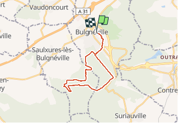
Trail Walking of 12.5 km to be discovered at Grand Est, Vosges, Bulgnéville. This trail is proposed by ABICHE.

Description

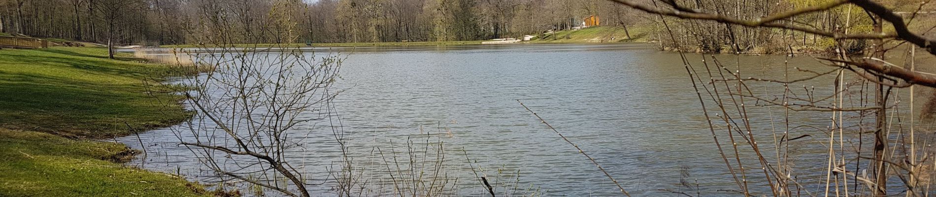
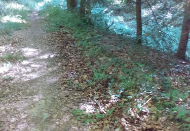
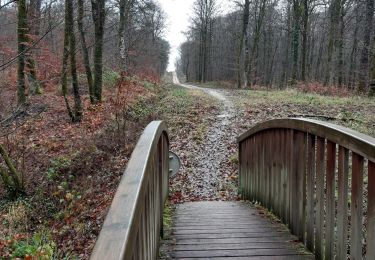
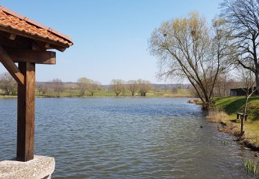
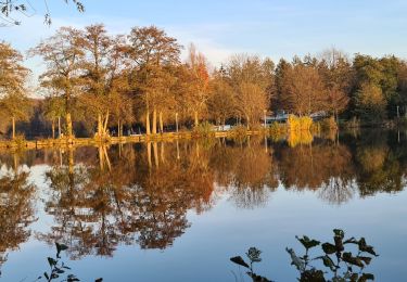
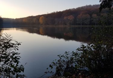
Mis à part la partie commune à l'aller et au retour, toute la randonnée s'effectue dans une belle forêt. Vous irez de l'étang des récollets au très joli étang de Saulxure dont vous ferez le tour sur un chemin aménagé.

Elevation profile

Photos

Positioning

Country:
France
Region :
Grand Est
Department/Province :
Vosges
Municipality :
Bulgnéville
Location:
Unknown
Start:(UTM)
710887 ; 5343318 (31U) N.

Trails nearby

Trail Walking Contrexéville - Ccontrex-Bulgnéville-Contrex - Photo
Walking
parastat

Walking

Very difficult
Contrexéville, Grand Est, Vosges, France
15.2 km | 19.2 km-effort
3h 49min
Yes
Trail Walking Bulgnéville - PR3 Bigneville étang des récollets . Contrexeville lac de conge - Photo
Walking
GUIDE
stef789

Walking

Very easy
Bulgnéville, Grand Est, Vosges, France
12 km | 15 km-effort
3h 6min
Yes
Trail Walking Bulgnéville - Bulgnéville : Circuit court des 2 lacs - Photo
Walking
ABICHE

Walking

Very easy
Bulgnéville, Grand Est, Vosges, France
11.6 km | 14.4 km-effort
2h 54min
Yes
Trail Walking Contrexéville - Contrexéville : Vair et voie romaine  - Photo
Walking
ABICHE

Walking

Very easy
Contrexéville, Grand Est, Vosges, France
11 km | 13.5 km-effort
2h 30min
Yes
Trail Walking Contrexéville - Circuit entre forêts, thermes, et sentier des lacs au parc - Photo
Walking
Samuel88300

Walking

Easy
Contrexéville, Grand Est, Vosges, France
19.9 km | 23 km-effort
5h 4min
Yes
Trail Walking Contrexéville - Contrexeville - Les lacs de la Folie, de saulxures et des récollets - Photo
Walking
jean-marie.parachini

Walking

Easy
Contrexéville, Grand Est, Vosges, France
19.4 km | 24 km-effort
8h 18min
Yes
Trail Walking Contrexéville - CONTREXEVILLE - LE SENTIER DES 3 LACS - Photo
Walking
jean-marie.parachini

Walking

Medium
Contrexéville, Grand Est, Vosges, France
19.6 km | 24 km-effort
8h 6min
Yes
Trail Walking Contrexéville - c23 - Photo
Walking
parastat

Walking

Medium
Contrexéville, Grand Est, Vosges, France
9.2 km | 11.2 km-effort
2h 7min
Yes
Trail Walking Contrexéville - contrexeville/ vittel et retour - Photo
Walking
cbelfort90

Walking

Medium
Contrexéville, Grand Est, Vosges, France
14.5 km | 17.3 km-effort
3h 40min
No


Close
My subscriptions