


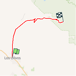
figueroa mountain road

raymondfn
User

Length
19.5 km

Max alt
1068 m

Uphill gradient
910 m
Km-Effort
29 km

Min alt
255 m

Downhill gradient
106 m
Boucle
No
Creation date :
2019-04-04 15:54:21.828
Updated on :
2019-04-04 16:05:57.47
6h29
Difficulty : Very difficult

FREE GPS app for hiking
 SityTrail
IGN / Geographical institutes
SityTrail World
The world is yours!
About
Trail Walking of 19.5 km to be discovered at California, Santa Barbara County. This trail is proposed by raymondfn.
Description
los olivos CA
Positioning
Country:
United States
Region :
California
Department/Province :
Santa Barbara County
Municipality :
Los Olivos
Location:
Unknown
Start:(Dec)
Start:(UTM)
764338 ; 3840008 (10S) N.
Comments
Trails nearby