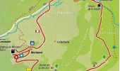
Trail Walking Oberlarg - 9168282-Oberlarg  : Château de Morimont - Photo

9168282-Oberlarg : Château de Morimont

 E.BURCK
E.BURCK

User

© OpenStreetMap contributors
Length
Length
9 km
Max alt
Max alt
721 m
Uphill gradient
Uphill gradient
279 m
Km-Effort
Km-Effort  
12.8 km
Min alt
Min alt
490 m
Downhill gradient
Downhill gradient
283 m
Boucle
Boucle
Yes
Creation date :
2019-04-01 09:41:00.413
Updated on :
2019-12-17 14:18:01.991

(0 Reviews)

Walking
Walking
2h46
Difficulty : Difficult

Scan this QR Code to open this trail in the SityTrail application

FREE GPS app for hiking

Logo SityTrail SityTrail

IGN / Geographical institutes

Download SityTrail from the App Store Download SityTrail from Google Play

Logo SityTrail SityTrail World

The world is yours!

Download SityTrail from the App Store Download SityTrail from Google Play Download SityTrail on Huawei AppGallery

About

Trail Walking of 9 km to be discovered at Grand Est, Haut-Rhin, Oberlarg. This trail is proposed by E.BURCK.

Description

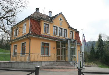
La ballade prendra son départ au pied de la Mairie d’Oberlarg
N 47,457847 - E 7,234409 ou N 47° 27' 28" - E 7° 14' 3,9"
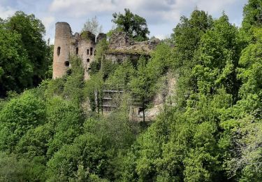
et se terminera au Château de Morimont.
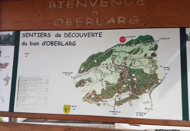
« Les paysages traversés ici comptent parmi les plus beaux du Jura alsacien ».* Nous traverserons un des derniers gués subsistant en Alsace, avant de passer par le site archéologique de la Grotte du Mannlefelsen et par la source de la Largue (549 m).
Une montée douce mais continue nous amènera au bout de moins d’une heure à la Ferme des Ebourbettes (730m), devenue célèbre par l’évasion du Général Giraud en avril 1942. De là on continue en direction du Morimont que l’on atteint au bout d’un peu plus de 2 km.
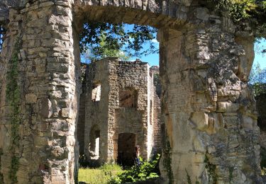
En fin de parcours nous nous retrouverons pour le déjeuner à l’Auberge du Morimont à proximité de la magnifique ruine du château que nous visiterons après le déjeuner.
10h00 : Rendez-vous au parking près de l’école d’Oberlarg
* Citation et plan du parcours de Marc Glotz

Elevation profile

Photos

Points of interest

Point of interest Oberlarg - Grotte - Photo
E.BURCK
OBERLARG 
Point of interest Oberlarg - Source de la Largue - Photo
E.BURCK
Point of interest Oberlarg - Ferme des Ébourbettes - Photo
E.BURCK

Positioning

Country:
France
Region :
Grand Est
Department/Province :
Haut-Rhin
Municipality :
Oberlarg
Location:
Unknown
Start:(UTM)
366911 ; 5257550 (32T) N.

Trails nearby

Trail Walking Levoncourt - Sortie les Copains d'abord.. 24/03/2022 - Photo
Walking
boubou68

Walking

Medium
Levoncourt, Grand Est, Haut-Rhin, France
24 km | 34 km-effort
4h 57min
Yes
Trail On foot Pleigne - Lucelle Douane - Pleigne - Photo
On foot
GUIDE+

On foot

Easy
Pleigne, Jura, District de Delémont, Switzerland
5.3 km | 8 km-effort
1h 48min
No
Trail Walking Oberlarg - Oberlarg - sa grotte - la ferme des Ebourbettes - le château de Morimont - Photo
Walking
Bart2015

Walking

Medium
Oberlarg, Grand Est, Haut-Rhin, France
9.5 km | 13.3 km-effort
3h 22min
Yes
Trail Walking Oberlarg - oberlag- château de morimont  - Photo
Walking
jcguew

Walking

Easy
Oberlarg, Grand Est, Haut-Rhin, France
9.9 km | 13.7 km-effort
3h 49min
Yes
Trail Walking Oberlarg - Château de Morimont avec Patrice - Photo
Walking
olivier080956

Walking

Medium
Oberlarg, Grand Est, Haut-Rhin, France
6.2 km | 8.1 km-effort
2h 10min
Yes
Trail On foot Bendorf - Rando CLAS du 20/06/2024 par PBo - Photo
On foot
boubou68

On foot

Medium
Bendorf, Grand Est, Haut-Rhin, France
18.8 km | 26 km-effort
5h 56min
Yes
Trail Walking Bendorf - Rando Bendorf 30/05/2024 - Photo
Walking
Alain28/01

Walking

Very difficult
Bendorf, Grand Est, Haut-Rhin, France
19.7 km | 27 km-effort
4h 15min
Yes
Trail Walking Winkel - Winkel-Petit Kohlberg variante - Photo
Walking
JCLUTT

Walking

Very easy
Winkel, Grand Est, Haut-Rhin, France
6.8 km | 8.7 km-effort
1h 58min
Yes
Trail Walking Winkel - Winkel-Petit Kohlberg_wpt_trk - Photo
Walking
JCLUTT

Walking

Very easy
Winkel, Grand Est, Haut-Rhin, France
6.2 km | 8.2 km-effort
1h 51min
Yes


Close
My subscriptions