


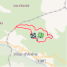


6 km | 9.4 km-effort

User


FREE GPS app for hiking
 SityTrail
IGN / Geographical institutes
SityTrail World
The world is yours!
Trail Walking of 6 km to be discovered at Provence-Alpes-Côte d'Azur, Hautes-Alpes, Villar-d'Arêne. This trail is proposed by boboazur.
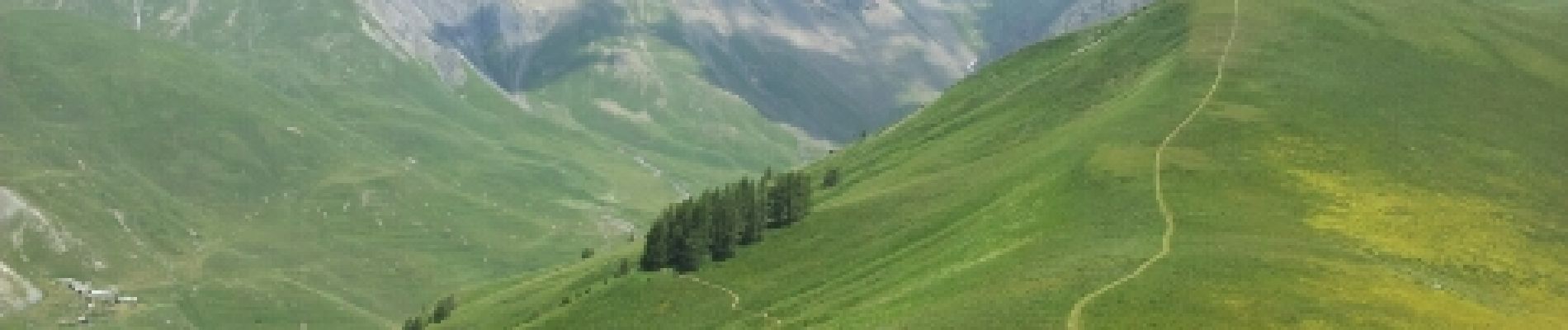
Balade familiale face au massif de la Meije. Idéale pour un pic nique autour du lac du pontet. Tres beau point de vue sur la Meije depuis le banc installé à l'Aiguillon.


Walking

Walking

Touring skiing

Walking

Walking

Walking

Walking

On foot

Walking