Trail Nordic walking Saint-Affrique - Vendeloves Clipis Lapeyre  - Photo

Vendeloves Clipis Lapeyre

 nanie
nanie

User

© OpenStreetMap contributors
Length
Length
10.5 km
Max alt
Max alt
597 m
Uphill gradient
Uphill gradient
310 m
Km-Effort
Km-Effort  
14.6 km
Min alt
Min alt
336 m
Downhill gradient
Downhill gradient
311 m
Boucle
Boucle
Yes
Creation date :
2019-03-26 10:51:04.767
Updated on :
2019-03-26 20:26:31.974

(0 Reviews)

Nordic walking
Nordic walking
--
Difficulty : Medium

Scan this QR Code to open this trail in the SityTrail application

FREE GPS app for hiking

Logo SityTrail SityTrail

IGN / Geographical institutes

Download SityTrail from the App Store Download SityTrail from Google Play

Logo SityTrail SityTrail World

The world is yours!

Download SityTrail from the App Store Download SityTrail from Google Play Download SityTrail on Huawei AppGallery

About

Trail Nordic walking of 10.5 km to be discovered at Occitania, Aveyron, Saint-Affrique. This trail is proposed by nanie.

Description

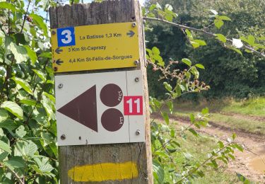
Au départ du stade de Vendelove prendre la direction de la ferme du Colombier (balisage jaune) traverser celle ci suivre le chemin vers le Guilhaumet, sauter le ruisseau au dessous du Guillaumet prendre le sentier au dessus du champs pour rejoindre la piste jusqu’auchemin qui monte sur votre droite(itinéraire balisé avec un fer à cheval rouge) vous suivez ce balisage jusqu’à la ferme de Clipis, Au haut du champs  prendre la sente sur votre gauche,au bout  dirigez vous vers Lapeyre, traverser un grand chemin passez devant un étang et vous descendez en longeant le ruisseau de la Bourgade jusqu'au large chemin qui longe la Sorgues et qui vous conduit vers votre point de départ.


Elevation profile

Positioning

Country:
France
Region :
Occitania
Department/Province :
Aveyron
Municipality :
Saint-Affrique
Location:
Unknown
Start:(UTM)
491422 ; 4864013 (31T) N.

Trails nearby

Trail Walking Saint-Affrique - s - Photo
Walking
CASSISFRAMBOISE

Walking

Difficult
Saint-Affrique, Occitania, Aveyron, France
20 km | 30 km-effort
5h 33min
No
Trail Nordic walking Saint-Affrique - piste verte - Photo
Nordic walking
jeanfcd

Nordic walking

Easy
(1)
Saint-Affrique, Occitania, Aveyron, France
8.9 km | 10.2 km-effort
2h 5min
Yes
Trail Nordic walking Saint-Affrique - St AFFRIQUE / TIERGUES - Photo
Nordic walking
nanie

Nordic walking

Medium
(1)
Saint-Affrique, Occitania, Aveyron, France
12.4 km | 18 km-effort
3h 50min
Yes
Trail Walking Gissac - montaigut (la croix del pas, Serre del cabros,aygue lebade)  - Photo
Walking
nanie

Walking

Medium
Gissac, Occitania, Aveyron, France
8.6 km | 13 km-effort
1h 41min
Yes
Trail Walking Saint-Affrique - Les Pressoirs - Photo
Walking
nanie

Walking

Medium
Saint-Affrique, Occitania, Aveyron, France
9.1 km | 13.9 km-effort
2h 52min
Yes
Trail Walking Vabres-l'Abbaye - RS Vabres ferme de la Cazotte - Photo
Walking
sergedurand

Walking

Easy
(1)
Vabres-l'Abbaye, Occitania, Aveyron, France
5.2 km | 5.7 km-effort
1h 17min
Yes
Trail Walking Versols-et-Lapeyre - Versols 2024- 11 10 - Photo
Walking
Frayssinet

Walking

Very difficult
Versols-et-Lapeyre, Occitania, Aveyron, France
22 km | 31 km-effort
7h 5min
Yes
Trail sport Saint-Affrique - Saint AFFRIQUE 12 - Photo
sport
papajp

sport

Very easy
Saint-Affrique, Occitania, Aveyron, France
2.2 km | 2.5 km-effort
Unknown
Yes
Trail Walking Saint-Affrique - camaras Toulouse camaras  - Photo
Walking
lablaquiere

Walking

Difficult
Saint-Affrique, Occitania, Aveyron, France
10 km | 14.6 km-effort
3h 10min
Yes


Close
My subscriptions