![](/images/other/stat-length.png)
![Trail Walking Conchil-le-Temple - LP62-Conchil le Temple - La Madelon 8km - Photo](https://media.geolcdn.com/t/1900/400/ddbf0887-e2f9-4fc9-ab3d-36d9d1787844.jpg&format=pjpeg&maxdim=2)
LP62-Conchil le Temple - La Madelon 8km
BAIE de SOMME & alentours
Autour de la Baie à pieds
![Length](/images/other/stat-length.png)
![Max alt](https://static1.geolcdn.com/siteimages/upload/files/1508320355ic_sort_altitude_max_24dp.png)
![Uphill gradient](https://static1.geolcdn.com/siteimages/upload/files/1508320355ic_sort_den_pos_24dp.png)
![Km-Effort](/images/other/stat-length.png)
![Min alt](https://static1.geolcdn.com/siteimages/upload/files/1508320355ic_sort_altitude_min_24dp.png)
![Downhill gradient](https://static1.geolcdn.com/siteimages/upload/files/1508320355ic_sort_den_neg_24dp.png)
![Boucle](https://static1.geolcdn.com/siteimages/upload/files/16400158638029165_repeat_loop_refresh_sync_direction_icon.png)
![Walking](https://static1.geolcdn.com/sitytour/trail-icons/101.png)
1h45
Difficulty : Medium
![Scan this QR Code to open this trail in the SityTrail application](https://capi.geolives.com/qq0zvz2zws4bq2lad0pu/sitytour/trails/2047896/qr.png?size=200)
FREE GPS app for hiking
About
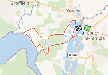
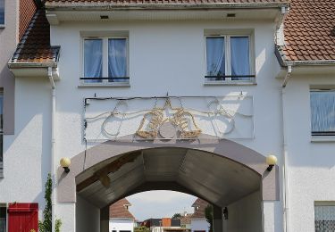
Trail Walking of 7.4 km to be discovered at Hauts-de-France, Pas-de-Calais, Conchil-le-Temple. This trail is proposed by BAIE de SOMME & alentours.
Description
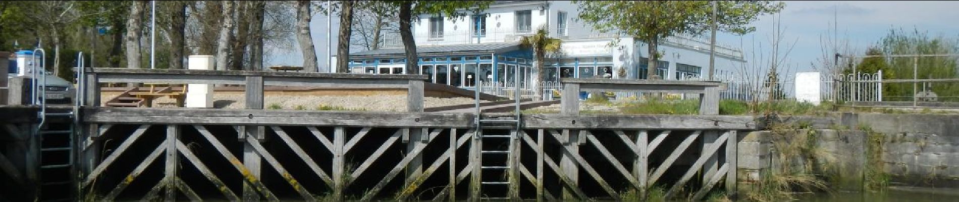
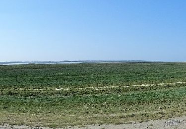
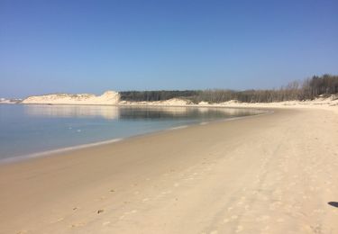
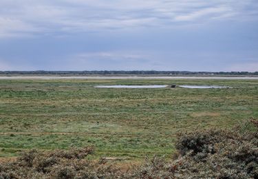
De la base nautique au restaurant La Madelon, le plus petit port de la cote entre les champs et prairies et par la bord de l'Authie (peut être mouillé suivant les horaires de marée)..
Positioning
Comments
Trails nearby
![Trail On foot Rang-du-Fliers - Sentier du Petit Marais - Photo](https://media.geolcdn.com/t/375/260/4d634643-aaf1-4b4f-8e31-f1e446378f6c.jpeg&format=jpg&maxdim=2)
![On foot On foot](https://static1.geolcdn.com/sitytour/trail-icons/100.png)
On foot
![](/images/other/stat-length.png)
![](https://static1.geolcdn.com/siteimages/upload/files/16400158638029165_repeat_loop_refresh_sync_direction_icon.png)
![Trail On foot Groffliers - Tour de Groffliers - Photo](https://media.geolcdn.com/t/375/260/0dee6b58-3c69-4a3e-8786-fb5f94c93ed2.jpeg&format=jpg&maxdim=2)
![On foot On foot](https://static1.geolcdn.com/sitytour/trail-icons/100.png)
On foot
![](/images/other/stat-length.png)
![](https://static1.geolcdn.com/siteimages/upload/files/16400158638029165_repeat_loop_refresh_sync_direction_icon.png)
![Trail Road bike Conchil-le-Temple - Conchil-le-Temple/Fort-Mahon - Photo](https://media.geolcdn.com/t/375/260/ext.jpg?maxdim=2&url=https%3A%2F%2Fstatic1.geolcdn.com%2Fsiteimages%2Fupload%2Ffiles%2F1524743154velo.jpg)
![Road bike Road bike](https://static1.geolcdn.com/sitytour/trail-icons/201.png)
Road bike
![](/images/other/stat-length.png)
![](https://static1.geolcdn.com/siteimages/upload/files/16400158638029165_repeat_loop_refresh_sync_direction_icon.png)
![Trail On foot Verton - Sentier des 100 détours - Photo](https://media.geolcdn.com/t/375/260/193743be-1b33-49a0-81bd-a3d9f96bed3e.jpeg&format=jpg&maxdim=2)
![On foot On foot](https://static1.geolcdn.com/sitytour/trail-icons/100.png)
On foot
![](/images/other/stat-length.png)
![](https://static1.geolcdn.com/siteimages/upload/files/16400158638029165_repeat_loop_refresh_sync_direction_icon.png)
![Trail Walking Groffliers - rando autour de Berck via la côte. - Photo](https://media.geolcdn.com/t/375/260/ext.jpg?maxdim=2&url=https%3A%2F%2Fservices.sitytrail.com%2FGeolivesWS%2FDownloadMedia.ashx%3FTrailID%3D729575%26Media%3D20170409133836.jpg)
![Walking Walking](https://static1.geolcdn.com/sitytour/trail-icons/101.png)
Walking
![](/images/other/stat-length.png)
![](https://static1.geolcdn.com/siteimages/upload/files/16400158638029165_repeat_loop_refresh_sync_direction_icon.png)
![Trail Walking Waben - Le Tour de Groffliers à pied - Photo](https://media.geolcdn.com/t/375/260/ext.jpg?maxdim=2&url=https%3A%2F%2Fservices.sitytrail.com%2FGeolivesWS%2FDownloadMedia.ashx%3FTrailID%3D112284%26Media%3D10292_6.jpg)
![Walking Walking](https://static1.geolcdn.com/sitytour/trail-icons/101.png)
Walking
![](/images/other/stat-length.png)
![](https://static1.geolcdn.com/siteimages/upload/files/16400158638029165_repeat_loop_refresh_sync_direction_icon.png)
![Trail Walking Conchil-le-Temple - LP80_Conchil-Le-Temple_6km - Photo](https://media.geolcdn.com/t/375/260/221a0db5-569a-44f9-9082-33811f1d6883.jpg&format=jpg&maxdim=2)
![Walking Walking](https://static1.geolcdn.com/sitytour/trail-icons/101.png)
Walking
![](/images/other/stat-length.png)
![](https://static1.geolcdn.com/siteimages/upload/files/16400158638029165_repeat_loop_refresh_sync_direction_icon.png)
![Trail Road bike Quend - La ferme de la Grande Retz parc du Marcantère - Photo](https://media.geolcdn.com/t/375/260/c45981aa-d3e8-4430-9d79-6c4513a5c497.jpg&format=jpg&maxdim=2)
![Road bike Road bike](https://static1.geolcdn.com/sitytour/trail-icons/201.png)
Road bike
![](/images/other/stat-length.png)
![](https://static1.geolcdn.com/siteimages/upload/files/16400158638029165_repeat_loop_refresh_sync_direction_icon.png)
![Trail Walking Waben - Port de la Madelon à la Pointe de Peroquet - Photo](https://media.geolcdn.com/t/375/260/d3061049-7d97-4066-b6a2-5576a2bc1f41.jpg&format=jpg&maxdim=2)
![Walking Walking](https://static1.geolcdn.com/sitytour/trail-icons/101.png)
Walking
![](/images/other/stat-length.png)
![](https://static1.geolcdn.com/siteimages/upload/files/16400158638029165_repeat_loop_refresh_sync_direction_icon.png)