Trail Walking Embrun - Tour du Roc Embrun - Photo
 gildascb
gildascb

User

© OpenStreetMap contributors
Length
Length
3.1 km
Max alt
Max alt
869 m
Uphill gradient
Uphill gradient
114 m
Km-Effort
Km-Effort  
4.6 km
Min alt
Min alt
789 m
Downhill gradient
Downhill gradient
105 m
Boucle
Boucle
Yes
Creation date :
2019-03-08 16:21:16.118
Updated on :
2021-08-12 16:09:55.535

(0 Reviews)

Walking
Walking
57m
Difficulty : Very easy

Scan this QR Code to open this trail in the SityTrail application

FREE GPS app for hiking

Logo SityTrail SityTrail

IGN / Geographical institutes

Download SityTrail from the App Store Download SityTrail from Google Play

Logo SityTrail SityTrail World

The world is yours!

Download SityTrail from the App Store Download SityTrail from Google Play Download SityTrail on Huawei AppGallery

About

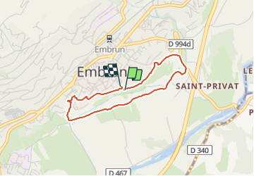
Trail Walking of 3.1 km to be discovered at Provence-Alpes-Côte d'Azur, Hautes-Alpes, Embrun. This trail is proposed by gildascb.

Description

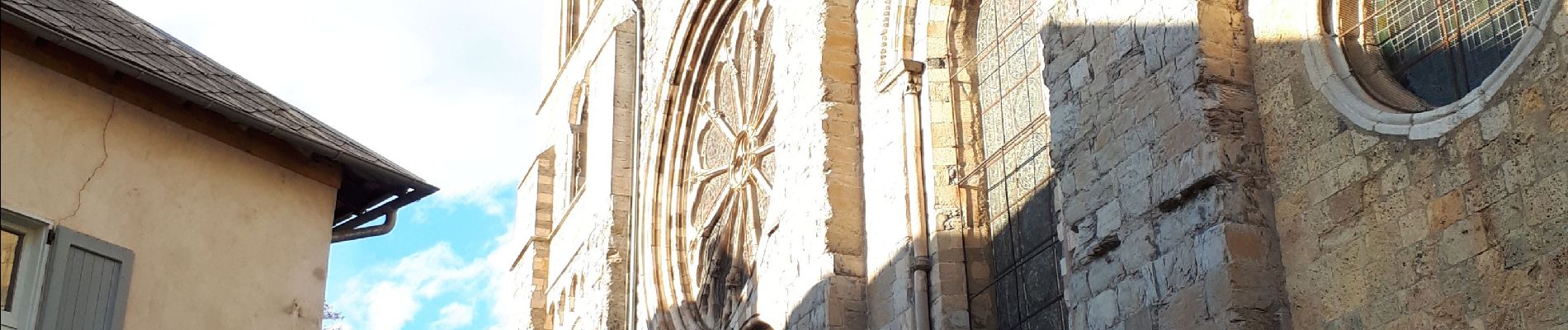
Une autre façon de découvrir Embrun. Balade sur le roc depuis le belvédère, puis sous le roc avec ses jardins et ses canaux, avant de terminer la boucle sur Embrun en passant par la cathédrale et le jardin de l'archevêché.

Pour rappel, la ville d'Embrun est juchée sur son roc, un oppidum en surplomb sur la Durance. Sur le roc, les jardins de l'archevêché desquels on peut observer la Plaine du Roc, les aménagements du plan d'eau d'Embrun, mais aussi les sommets environnants :
  - le Mont Orel,
  - le Mont Méale,
  - le clocher de Saint-Sauveur,
  - la station des Orres,
  - la tête de la Mazelières
et bien sûr le Morgon qui surplombe le lac de Serre-Ponçon.

Trois tables d'orientation, offertes il y a fort longtemps par la Direction de la Construction et Armes Navales de Toulon, permettent de se repérer.

Elevation profile

Photos

Positioning

Country:
France
Region :
Provence-Alpes-Côte d'Azur
Department/Province :
Hautes-Alpes
Municipality :
Embrun
Location:
Unknown
Start:(UTM)
301360 ; 4937406 (32T) N.

Trails nearby

Trail Walking Embrun - Lac de l'Hivernet - Photo
Walking
gildascb

Walking

Easy
(1)
Embrun, Provence-Alpes-Côte d'Azur, Hautes-Alpes, France
10.6 km | 21 km-effort
3h 55min
Yes
Trail Walking Embrun - Mont Guillaume-Col de Chanté Perdrix-Lac de l'Hivernet(07-09-16) - Photo
Walking
Dervalmarc

Walking

Difficult
(2)
Embrun, Provence-Alpes-Côte d'Azur, Hautes-Alpes, France
15.4 km | 31 km-effort
7h 4min
Yes
Trail Walking Saint-Sauveur - 2012-08-07 Méale - Photo
Walking
Tchoubi

Walking

Difficult
(1)
Saint-Sauveur, Provence-Alpes-Côte d'Azur, Hautes-Alpes, France
8.3 km | 14.9 km-effort
3h 34min
Yes
Trail Walking Embrun - Mont Guillaume - Col de Trempa-Latz - 2671 - 10/09/23 - Photo
Walking
GUIDE
R@ph

Walking

Very difficult
Embrun, Provence-Alpes-Côte d'Azur, Hautes-Alpes, France
13.6 km | 28 km-effort
6h 20min
Yes
Trail Walking Embrun - Mont Guillaume - Photo
Walking
GUIDE
Marco05

Walking

Difficult
Embrun, Provence-Alpes-Côte d'Azur, Hautes-Alpes, France
12.6 km | 26 km-effort
5h 55min
Yes
Trail Walking Embrun - Mt Guillaume - Lac de l'Hivernet - Photo
Walking
GUIDE
David25400

Walking

Difficult
Embrun, Provence-Alpes-Côte d'Azur, Hautes-Alpes, France
12.7 km | 28 km-effort
4h 8min
Yes
Trail Walking Embrun - lac de l hivernet - Photo
Walking
gibello

Walking

Easy
(1)
Embrun, Provence-Alpes-Côte d'Azur, Hautes-Alpes, France
9.4 km | 19.5 km-effort
4h 1min
Yes
Trail Walking Embrun - Embrun - 3.4km 90m 1h00 - 2018 06 26 - privé - Photo
Walking
GUIDE
Orcal37

Walking

Very easy
Embrun, Provence-Alpes-Côte d'Azur, Hautes-Alpes, France
3.1 km | 4.1 km-effort
1h 15min
Yes
Trail Walking Embrun - Lac de l'Hivernet 16.6.24 - Photo
Walking
GUIDE
fredetpascale

Walking

Medium
Embrun, Provence-Alpes-Côte d'Azur, Hautes-Alpes, France
8.7 km | 18.6 km-effort
3h 40min
Yes


Close
My subscriptions