![](/images/other/stat-length.png)
![Trail On foot Saint-Georges-de-Didonne - St Georges-Vallières 17 8km200 - Photo](https://media.geolcdn.com/t/1900/400/99ecf766-7a66-4d45-9b46-41ea3f51dcff.jpg&format=pjpeg&maxdim=2)
St Georges-Vallières 17 8km200
Jos17
User
![Length](/images/other/stat-length.png)
![Max alt](https://static1.geolcdn.com/siteimages/upload/files/1508320355ic_sort_altitude_max_24dp.png)
![Uphill gradient](https://static1.geolcdn.com/siteimages/upload/files/1508320355ic_sort_den_pos_24dp.png)
![Km-Effort](/images/other/stat-length.png)
![Min alt](https://static1.geolcdn.com/siteimages/upload/files/1508320355ic_sort_altitude_min_24dp.png)
![Downhill gradient](https://static1.geolcdn.com/siteimages/upload/files/1508320355ic_sort_den_neg_24dp.png)
![Boucle](https://static1.geolcdn.com/siteimages/upload/files/16400158638029165_repeat_loop_refresh_sync_direction_icon.png)
![On foot](https://static1.geolcdn.com/sitytour/trail-icons/100.png)
2h03
Difficulty : Easy
![Scan this QR Code to open this trail in the SityTrail application](https://capi.geolives.com/qq0zvz2zws4bq2lad0pu/sitytour/trails/2040675/qr.png?size=200)
FREE GPS app for hiking
About
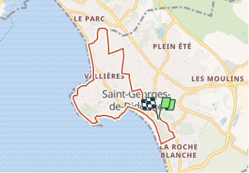
Trail On foot of 8.2 km to be discovered at New Aquitaine, Charente-Maritime, Saint-Georges-de-Didonne. This trail is proposed by Jos17.
Description
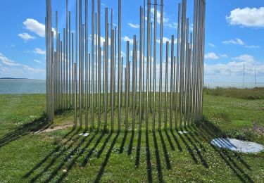
Le parcours traverse le centre de St.Georges, puis les avenues du Parc de Vallières avec leurs résidences secondaires ombragées par les pins ayant résistés à la tempête de 1999, pour arriver au Riveau de Boubes.
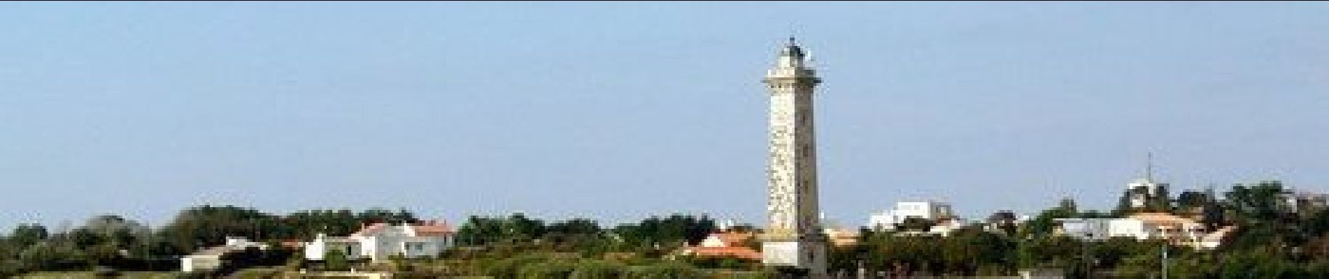
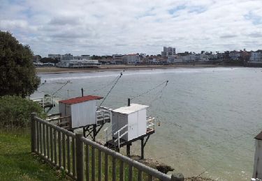
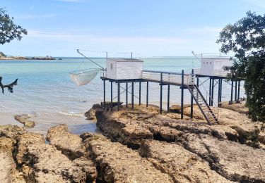
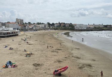
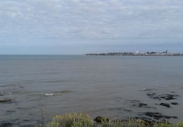
Le parcours suit le filet d'eau jusqu'à la plage et revient sur St Georges en longeant la plage et la corniche jusqu'au port.
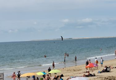
Le parcours peut se poursuivre jusqu'au bout de la plage et revenir par l'avenue intérieure.
Positioning
Comments
Trails nearby
![On foot On foot](https://static1.geolcdn.com/sitytour/trail-icons/100.png)
On foot
![](/images/other/stat-length.png)
![](https://static1.geolcdn.com/siteimages/upload/files/16400158638029165_repeat_loop_refresh_sync_direction_icon.png)
![On foot On foot](https://static1.geolcdn.com/sitytour/trail-icons/100.png)
On foot
![](/images/other/stat-length.png)
![](https://static1.geolcdn.com/siteimages/upload/files/16400158638029165_repeat_loop_refresh_sync_direction_icon.png)
![Trail Walking Royan - Royan-La Palmyre - Photo](https://media.geolcdn.com/t/375/260/ext.jpg?maxdim=2&url=https%3A%2F%2Fservices.sitytrail.com%2FGeolivesWS%2FDownloadMedia.ashx%3FTrailID%3D278052%26Media%3Dfix__20140508114344.jpg)
![Walking Walking](https://static1.geolcdn.com/sitytour/trail-icons/101.png)
Walking
![](/images/other/stat-length.png)
![](https://static1.geolcdn.com/siteimages/upload/files/16400158638029165_repeat_loop_refresh_sync_direction_icon.png)
![Trail Walking Royan - Gr4 De Royan au phrare de Terre Nègre - Photo](https://media.geolcdn.com/t/375/260/e2e1be40-3353-49e2-9bdd-4bdd833373c6.jpg&format=jpg&maxdim=2)
![Walking Walking](https://static1.geolcdn.com/sitytour/trail-icons/101.png)
Walking
![](/images/other/stat-length.png)
![](https://static1.geolcdn.com/siteimages/upload/files/16400158638029165_repeat_loop_refresh_sync_direction_icon.png)
![Trail Electric bike Royan - sortie vtt 20072024 - Photo](https://media.geolcdn.com/t/375/260/76a60497-0453-4055-b50d-57ae6303986f.jpg&format=jpg&maxdim=2)
![Electric bike Electric bike](https://static1.geolcdn.com/sitytour/trail-icons/205.png)
Electric bike
![](/images/other/stat-length.png)
![](https://static1.geolcdn.com/siteimages/upload/files/16400158638029165_repeat_loop_refresh_sync_direction_icon.png)
![Trail Electric bike Royan - sortie vtt 16072024 la Palmyre - Photo](https://media.geolcdn.com/t/375/260/84127a57-102b-4e0a-8195-b081cde28e83.jpg&format=jpg&maxdim=2)
![Electric bike Electric bike](https://static1.geolcdn.com/sitytour/trail-icons/205.png)
Electric bike
![](/images/other/stat-length.png)
![](https://static1.geolcdn.com/siteimages/upload/files/16400158638029165_repeat_loop_refresh_sync_direction_icon.png)
![Trail Electric bike Royan - sortie vtt 12072024 Royan - Photo](https://media.geolcdn.com/t/375/260/77c31eff-c5ee-413c-937e-28b18e967a2d.jpg&format=jpg&maxdim=2)
![Electric bike Electric bike](https://static1.geolcdn.com/sitytour/trail-icons/205.png)
Electric bike
![](/images/other/stat-length.png)
![](https://static1.geolcdn.com/siteimages/upload/files/16400158638029165_repeat_loop_refresh_sync_direction_icon.png)
![Trail Electric bike Royan - sortie vtt 10072023 Talmont - Photo](https://media.geolcdn.com/t/375/260/d50067ff-0139-4e54-bde6-c079831c8427.jpg&format=jpg&maxdim=2)
![Electric bike Electric bike](https://static1.geolcdn.com/sitytour/trail-icons/205.png)
Electric bike
![](/images/other/stat-length.png)
![](https://static1.geolcdn.com/siteimages/upload/files/16400158638029165_repeat_loop_refresh_sync_direction_icon.png)
![Trail Electric bike Royan - sortie vtt 08072023 phare de la Coubre - Photo](https://media.geolcdn.com/t/375/260/b0726125-8197-428b-b44b-e0cf73c5f2f7.jpg&format=jpg&maxdim=2)
![Electric bike Electric bike](https://static1.geolcdn.com/sitytour/trail-icons/205.png)
Electric bike
![](/images/other/stat-length.png)
![](https://static1.geolcdn.com/siteimages/upload/files/16400158638029165_repeat_loop_refresh_sync_direction_icon.png)