


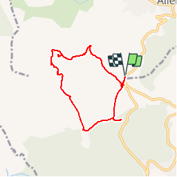

7.1 km | 9 km-effort

User


FREE GPS app for hiking
 SityTrail
IGN / Geographical institutes
SityTrail World
The world is yours!
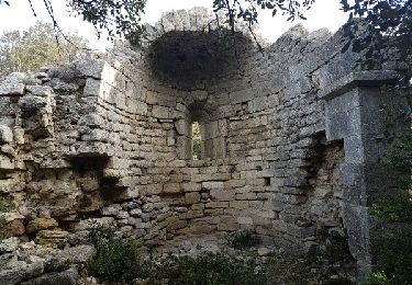
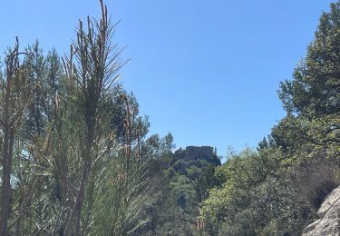
Trail Walking of 6.8 km to be discovered at Provence-Alpes-Côte d'Azur, Bouches-du-Rhône, Alleins. This trail is proposed by morthy25.
Promenade facile sur la plateau du Sonnaillet. Profitez-en pour déguster l'excellent vin produit par le château du Petite Sonnaillet !


Walking
Walking
Walking

Other activity

Walking

Walking

Mountain bike
Walking
Walking