Trail On foot Avioth - La Charmouthienne_boucle_Avioth_23km_2019-02-16 - Photo

La Charmouthienne_boucle_Avioth_23km_2019-02-16

© OpenStreetMap contributors
Length
Length
23 km
Max alt
Max alt
355 m
Uphill gradient
Uphill gradient
409 m
Km-Effort
Km-Effort  
29 km
Min alt
Min alt
193 m
Downhill gradient
Downhill gradient
418 m
Boucle
Boucle
Yes
Creation date :
2019-02-17 10:04:33.536
Updated on :
2019-10-14 17:54:51.259

(0 Reviews)

On foot
On foot
--
Difficulty : Difficult

Scan this QR Code to open this trail in the SityTrail application

FREE GPS app for hiking

Logo SityTrail SityTrail

IGN / Geographical institutes

Download SityTrail from the App Store Download SityTrail from Google Play

Logo SityTrail SityTrail World

The world is yours!

Download SityTrail from the App Store Download SityTrail from Google Play Download SityTrail on Huawei AppGallery

About

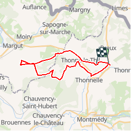
Trail On foot of 23 km to be discovered at Grand Est, Meuse, Avioth. This trail is proposed by bernardcollignon.

Description

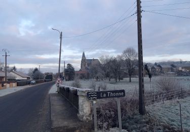
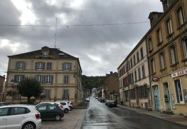
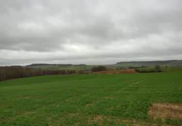
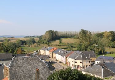
Découvrir par la randonnée à pieds la Lorraine belge (Arelerland et Gaume) par ses monts et ses vaux,  en prenant l'épine dorsale de la 2° cuesta, la "Charmouthienne", comme fil conducteur.

La Charmouthienne se veut aérienne, en offrant aux randonneurs un maximum d'horizons.

La Charmouthienne se veut athlétique en proposant aux randonneurs de gravir tous les fronts et revers possible que propose la cuesta.

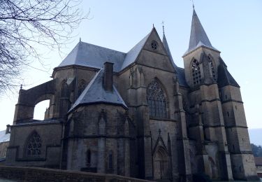
La Charmouthienne se veut épicurienne, en suggérant des bons coins exposés sud avec belle vue pour piquer-niquer et se laisser aller dans une bonne sieste, des bonnes terrasses pour boire une des nombreuses bières locales, des bonnes tables où finir une bonne journée de randonnée.

N.B. : La Charmouthienne décline toute responsabilité en cas d'accident.
Chaque marcheur se déplace vers le lieu de rendez-vous et randonne sous sa propre responsabilité.

Elevation profile

Photos

Positioning

Country:
France
Region :
Grand Est
Department/Province :
Meuse
Municipality :
Avioth
Location:
Unknown
Start:(UTM)
672903 ; 5493184 (31U) N.

Trails nearby

Trail On foot Breux - La basilique des Champs - Photo
On foot
GUIDE+

On foot

Easy
Breux, Grand Est, Meuse, France
13.1 km | 16.4 km-effort
3h 42min
Yes
Trail On foot Breux - Boucle de promenade à Avioth 2, France - Photo
On foot
GUIDE+

On foot

Easy
Breux, Grand Est, Meuse, France
9.3 km | 11.3 km-effort
2h 33min
Yes
Trail On foot Avioth - Boucle de promenade à Avioth 1, France - Photo
On foot
GUIDE+

On foot

Easy
(1)
Avioth, Grand Est, Meuse, France
7.4 km | 9.2 km-effort
2h 4min
Yes
Trail On foot Montmédy - Boucle de promenade à Montmédy - Photo
On foot
GUIDE+

On foot

Easy
Montmédy, Grand Est, Meuse, France
5.8 km | 7.8 km-effort
1h 46min
No
Trail On foot Meix-devant-Virton - de Sommethonne à Montquintin  - Photo
On foot
dragonchef

On foot

Very difficult
(1)
Meix-devant-Virton, Wallonia, Luxembourg, Belgium
13.8 km | 17.9 km-effort
Unknown
Yes
Trail Walking Thonnelle - Avioth 3 - Photo
Walking
vijl

Walking

Medium
(1)
Thonnelle, Grand Est, Meuse, France
11.7 km | 14.9 km-effort
3h 0min
Yes
Trail Walking Meix-devant-Virton - Gite-de-gaume : Entre France et Belgique  - Photo
Walking
dragonchef

Walking

Difficult
Meix-devant-Virton, Wallonia, Luxembourg, Belgium
26 km | 33 km-effort
4h 56min
Yes
Trail On foot Meix-devant-Virton - “Walk in the hollow of the woods” - Photo
On foot
GUIDE+

On foot

Easy
Meix-devant-Virton, Wallonia, Luxembourg, Belgium
4.7 km | 5.9 km-effort
1h 19min
Yes
Trail Walking Meix-devant-Virton - de sommethonne à florenville - Photo
Walking
dragonchef

Walking

Difficult
Meix-devant-Virton, Wallonia, Luxembourg, Belgium
33 km | 41 km-effort
5h 45min
No


Close
My subscriptions