


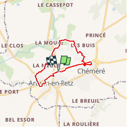

27 km | 30 km-effort


User


FREE GPS app for hiking
 SityTrail
IGN / Geographical institutes
SityTrail World
The world is yours!
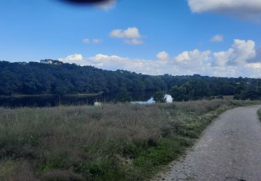
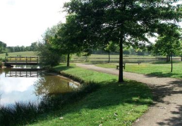
Trail On foot of 9.6 km to be discovered at Pays de la Loire, Loire-Atlantique, Chaumes-en-Retz. This trail is proposed by JCYOL44.
Petite boucle d'environ 10km sans difficulté..
Départ / arrivée du parking de la salle de sports. Partir en longeant la D751 puis passer le pont sur votre droite .Sur la D5. Traverser la D5 en direction de La Meule. Sur votre gauche prendre un chemin qui vous emmène vers La Danjollerie. Arrivé au Plessis, tourner à droite jusqu'au parc de Chéméré; en faire le tour puis longer à nouveau la D751 jusqu'au parking.

On foot

On foot
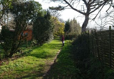
Walking

Mountain bike
Hybrid bike

On foot
On foot

Mountain bike
Walking