Trail Bicycle tourism Watten - Watten/Watten (2) 66Km Dén P 237m - Photo

Watten/Watten (2) 66Km Dén P 237m

© OpenStreetMap contributors
Length
Length
66 km
Max alt
Max alt
55 m
Uphill gradient
Uphill gradient
237 m
Km-Effort
Km-Effort  
69 km
Min alt
Min alt
-3 m
Downhill gradient
Downhill gradient
236 m
Boucle
Boucle
Yes
Creation date :
2019-02-14 13:58:10.367
Updated on :
2019-02-15 09:49:15.676

(0 Reviews)

Bicycle tourism
Bicycle tourism
2h33
Difficulty : Easy

Scan this QR Code to open this trail in the SityTrail application

FREE GPS app for hiking

Logo SityTrail SityTrail

IGN / Geographical institutes

Download SityTrail from the App Store Download SityTrail from Google Play

Logo SityTrail SityTrail World

The world is yours!

Download SityTrail from the App Store Download SityTrail from Google Play Download SityTrail on Huawei AppGallery

About

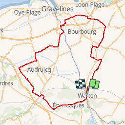
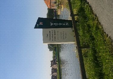
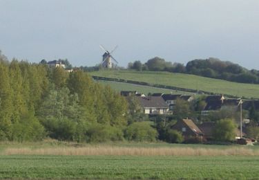
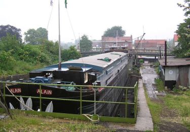
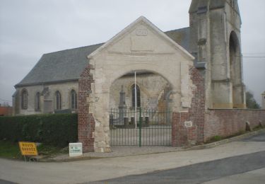
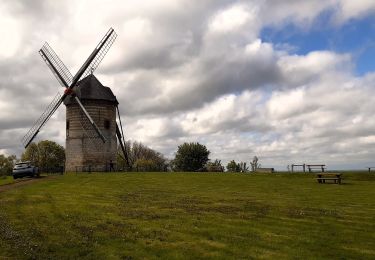
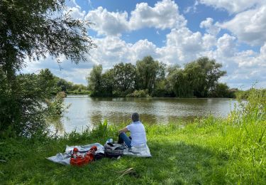
Trail Bicycle tourism of 66 km to be discovered at Hauts-de-France, Nord, Watten. This trail is proposed by alain62rando.

Elevation profile

Positioning

Country:
France
Region :
Hauts-de-France
Department/Province :
Nord
Municipality :
Watten
Location:
Unknown
Start:(UTM)
444497 ; 5631673 (31U) N.

Trails nearby

Trail Walking Nieurlet - Circuit de Booneghem -Nieurlet - Photo
Walking
tracegps

Walking

Medium
(1)
Nieurlet, Hauts-de-France, Nord, France
9.6 km | 10.1 km-effort
2h 30min
Yes
Trail Walking Houlle - Au fil de la Houlle - Photo
Walking
tracegps

Walking

Medium
(1)
Houlle, Hauts-de-France, Pas-de-Calais, France
9.2 km | 9.8 km-effort
2h 30min
Yes
Trail Walking Serques - marais audomarois - Photo
Walking
labotte

Walking

Easy
Serques, Hauts-de-France, Pas-de-Calais, France
8.1 km | 8.5 km-effort
2h 7min
Yes
Trail Walking Watten - Watten  - Photo
Walking
sanjumelo

Walking

Easy
Watten, Hauts-de-France, Nord, France
3.3 km | 4.1 km-effort
1h 8min
Yes
Trail Cycle Watten - De Watten au talus côtier       - Photo
Cycle
tracegps

Cycle

Medium
Watten, Hauts-de-France, Nord, France
29 km | 33 km-effort
2h 0min
Yes
Trail Walking Watten - Watten - Saint-Momelin - Photo
Walking
tracegps

Walking

Difficult
Watten, Hauts-de-France, Nord, France
16.2 km | 18.3 km-effort
3h 19min
Yes
Trail Walking Moulle - Bayenghem les Eperlecques - Photo
Walking
tracegps

Walking

Medium
Moulle, Hauts-de-France, Pas-de-Calais, France
11.9 km | 12.6 km-effort
2h 30min
Yes
Trail Walking Éperlecques - Watten Eperlecques - Photo
Walking
Greg813

Walking

Medium
Éperlecques, Hauts-de-France, Pas-de-Calais, France
17.1 km | 19.7 km-effort
4h 2min
Yes
Trail Walking Nieurlet - Circuit des marais de Booneghem - Photo
Walking
griffet

Walking

Easy
Nieurlet, Hauts-de-France, Nord, France
10.7 km | 11.2 km-effort
3h 25min
Yes


Close
My subscriptions