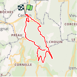
Trail Walking Cerdon - Les cascades de Cerdon PR® - Photo

Les cascades de Cerdon PR®

 tippex01
tippex01

User

© OpenStreetMap contributors
Length
Length
16.4 km
Max alt
Max alt
747 m
Uphill gradient
Uphill gradient
841 m
Km-Effort
Km-Effort  
28 km
Min alt
Min alt
320 m
Downhill gradient
Downhill gradient
839 m
Boucle
Boucle
Yes
Creation date :
2014-12-10 00:00:00.0
Updated on :
2014-12-10 00:00:00.0

(1 Reviews)

Walking
Walking
5h39
Difficulty : Difficult

Scan this QR Code to open this trail in the SityTrail application

FREE GPS app for hiking

Logo SityTrail SityTrail

IGN / Geographical institutes

Download SityTrail from the App Store Download SityTrail from Google Play

Logo SityTrail SityTrail World

The world is yours!

Download SityTrail from the App Store Download SityTrail from Google Play Download SityTrail on Huawei AppGallery

About

Trail Walking of 16.4 km to be discovered at Auvergne-Rhône-Alpes, Ain, Cerdon. This trail is proposed by tippex01.

Description

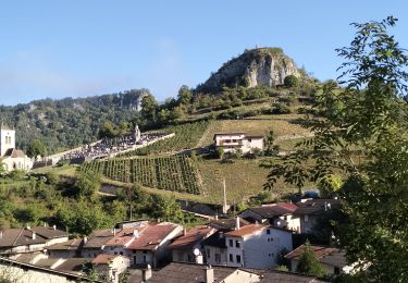
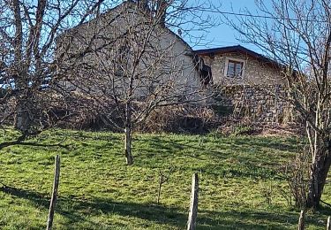
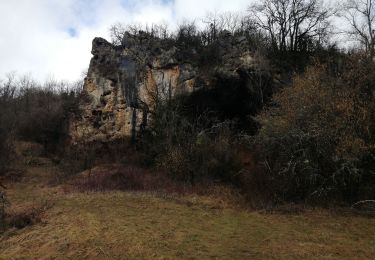
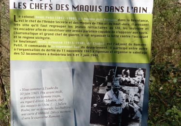
Sur la grande route de Lyon à Genève, au pied d’un col qui effrayait les voyageurs d’autrefois, Cerdon dissémine ses atouts : vignoble, fontaines et cascades, monuments aux Morts du Maquis, cuivrerie…

Elevation profile

Positioning

Country:
France
Region :
Auvergne-Rhône-Alpes
Department/Province :
Ain
Municipality :
Cerdon
Location:
Unknown
Start:(UTM)
690646 ; 5105997 (31T) N.

Comments

Please log in to post a review or rate the element


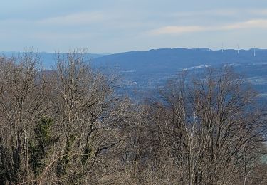
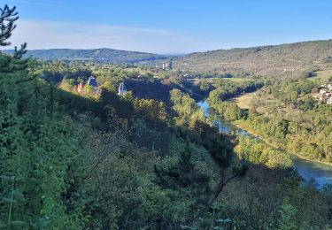
très sympathique balade


Trails nearby

Trail On foot Vieu-d'Izenave - les pentes de l'Avocat - Photo
On foot
Fabulous26

On foot

Medium
(1)
Vieu-d'Izenave, Auvergne-Rhône-Alpes, Ain, France
11.4 km | 16.9 km-effort
Unknown
Yes
Trail Walking Izenave - l'avocat les eolienes - Photo
Walking
loca.yves

Walking

Difficult
Izenave, Auvergne-Rhône-Alpes, Ain, France
11.4 km | 15.6 km-effort
3h 21min
Yes
Trail Walking Challes-la-Montagne - challes la montagne barrage lallement la cueille sameriat - Photo
Walking
loca.yves

Walking

Easy
Challes-la-Montagne, Auvergne-Rhône-Alpes, Ain, France
10 km | 14.3 km-effort
3h 10min
Yes
Trail Walking Cerdon - 01_CERDON_CASCADE_FOUGE_18 km_780m - Photo
Walking
SyMA

Walking

Difficult
Cerdon, Auvergne-Rhône-Alpes, Ain, France
17.8 km | 28 km-effort
6h 22min
Yes
Trail Walking Poncin - les bords de l ain depart povin - Photo
Walking
colomb24

Walking

Very difficult
Poncin, Auvergne-Rhône-Alpes, Ain, France
23 km | 32 km-effort
6h 25min
Yes
Trail Walking Jujurieux - 01-Jujurieux-Neuville-restau-18-7km-440m-fev22 - Photo
Walking
SyMA

Walking

Medium
Jujurieux, Auvergne-Rhône-Alpes, Ain, France
18.6 km | 25 km-effort
4h 54min
Yes
Trail Walking Cerdon - Le cerdon parr le drapeau  - Photo
Walking
colomb24

Walking

Difficult
Cerdon, Auvergne-Rhône-Alpes, Ain, France
19.1 km | 31 km-effort
6h 41min
Yes
Trail Road bike Poncin - Circuit l'Ain à vélo n° 22 - Et au milieu coule une rivière... - Photo
Road bike
jpfrobert

Road bike

Very difficult
Poncin, Auvergne-Rhône-Alpes, Ain, France
59 km | 72 km-effort
4h 9min
No
Trail Walking Cerdon - Cerdon  : La cascade de Fouges (18 km - D. 823 m)  - Photo
Walking
Thomasdanielle

Walking

Very difficult
Cerdon, Auvergne-Rhône-Alpes, Ain, France
17.9 km | 29 km-effort
6h 36min
Yes


Close
My subscriptions