![Trail Walking Khandbari - 3cols - Photo](https://media.geolcdn.com/t/1900/400/ext.pjpeg?maxdim=2&url=https%3A%2F%2Fstatic1.geolcdn.com%2Fsiteimages%2Fupload%2Ffiles%2F1553511878bg_sport_marche.png)
3cols
Frings
User
![Length](/images/other/stat-length.png)
Length
154 km
![Max alt](https://static1.geolcdn.com/siteimages/upload/files/1508320355ic_sort_altitude_max_24dp.png)
Max alt
6162 m
![Uphill gradient](https://static1.geolcdn.com/siteimages/upload/files/1508320355ic_sort_den_pos_24dp.png)
Uphill gradient
13009 m
![Km-Effort](/images/other/stat-length.png)
Km-Effort
320 km
![Min alt](https://static1.geolcdn.com/siteimages/upload/files/1508320355ic_sort_altitude_min_24dp.png)
Min alt
319 m
![Downhill gradient](https://static1.geolcdn.com/siteimages/upload/files/1508320355ic_sort_den_neg_24dp.png)
Downhill gradient
10608 m
![Boucle](https://static1.geolcdn.com/siteimages/upload/files/16400158638029165_repeat_loop_refresh_sync_direction_icon.png)
Boucle
No
Creation date :
2019-01-20 11:16:17.554
Updated on :
2019-11-18 12:58:58.816
![Walking](https://static1.geolcdn.com/sitytour/trail-icons/101.png)
64h36
Difficulty : Very difficult
![Scan this QR Code to open this trail in the SityTrail application](https://capi.geolives.com/qq0zvz2zws4bq2lad0pu/sitytour/trails/2024491/qr.png?size=200)
FREE GPS app for hiking
About
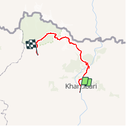
Trail Walking of 154 km to be discovered at Unknown, Sankhuwasabha, Khandbari. This trail is proposed by Frings.
Description
approx. description!
Points of interest
Positioning
Country:
Nepal
Region :
Unknown
Department/Province :
Sankhuwasabha
Municipality :
Khandbari
Location:
Unknown
Start:(Dec)
Start:(UTM)
519612 ; 3021468 (45R) N.
Comments
Trails nearby