


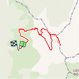


27 km | 31 km-effort


User


FREE GPS app for hiking
 SityTrail
IGN / Geographical institutes
SityTrail World
The world is yours!
Trail Walking of 11.3 km to be discovered at Auvergne-Rhône-Alpes, Upper Savoy, Talloires-Montmin. This trail is proposed by djeepee74.
BOUCLE
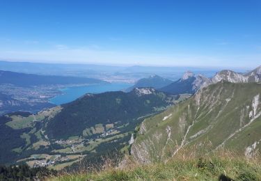
Le haut du "fauteuil" de la Tournette culmine à 2351 m.
La montée, par les rochers des "Varos", est un peu délicate par temps humide... d'ailleurs guère plus que les barres rocheuses de la Tournette, elles-mêmes !

Mountain bike

Walking

Touring skiing

Walking

Walking

Walking
Walking

Walking

Cycle