![](/images/other/stat-length.png)
![Trail Other activity Walenstadt - Walenstadt - Quinten - Photo](https://media.geolcdn.com/t/1900/400/ext.pjpeg?maxdim=2&url=https%3A%2F%2Fstatic1.geolcdn.com%2Fsiteimages%2Fupload%2Ffiles%2F1545311037marcheuse_200dpi.jpg)
Walenstadt - Quinten
jschna
User
![Length](/images/other/stat-length.png)
Length
7.9 km
![Max alt](https://static1.geolcdn.com/siteimages/upload/files/1508320355ic_sort_altitude_max_24dp.png)
Max alt
881 m
![Uphill gradient](https://static1.geolcdn.com/siteimages/upload/files/1508320355ic_sort_den_pos_24dp.png)
Uphill gradient
560 m
![Km-Effort](/images/other/stat-length.png)
Km-Effort
15.4 km
![Min alt](https://static1.geolcdn.com/siteimages/upload/files/1508320355ic_sort_altitude_min_24dp.png)
Min alt
418 m
![Downhill gradient](https://static1.geolcdn.com/siteimages/upload/files/1508320355ic_sort_den_neg_24dp.png)
Downhill gradient
578 m
![Boucle](https://static1.geolcdn.com/siteimages/upload/files/16400158638029165_repeat_loop_refresh_sync_direction_icon.png)
Boucle
No
Creation date :
2014-12-11 00:00:00.0
Updated on :
2014-12-11 00:00:00.0
![Other activity](https://static1.geolcdn.com/sitytour/trail-icons/900.png)
--
Difficulty : Unknown
![Scan this QR Code to open this trail in the SityTrail application](https://capi.geolives.com/qq0zvz2zws4bq2lad0pu/sitytour/trails/20238/qr.png?size=200)
FREE GPS app for hiking
About
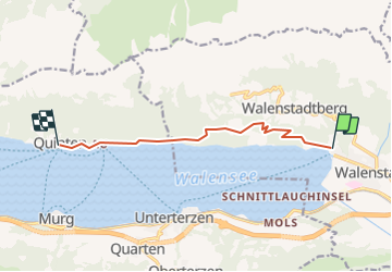
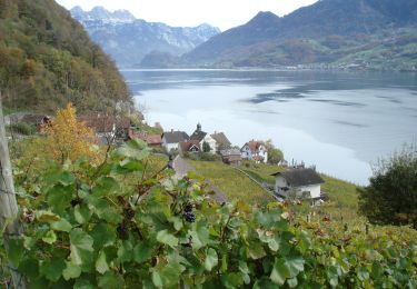
Trail Other activity of 7.9 km to be discovered at Sankt Gallen, Wahlkreis Sarganserland, Walenstadt. This trail is proposed by jschna.
Description
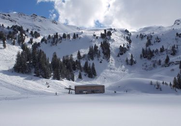
Mit der Bahn auf den Chäserrugg - wundeerbare Aussicht ins Sarganserland und auf den Säntis (Steinbockkolonie) - der erste Teil ist etwas steil und steinig, dann aber leicht und gut zum Gehen bis zur Gamsalp, wo der Wirt - Dres Forrer die Gäste verwöhnt.
Positioning
Country:
Switzerland
Region :
Sankt Gallen
Department/Province :
Wahlkreis Sarganserland
Municipality :
Walenstadt
Location:
Unknown
Start:(Dec)
Start:(UTM)
522936 ; 5219517 (32T) N.
Comments
Trails nearby
![Trail Walking Quarten - Höhenwanderung Maschgenkamm-Murgsee - Photo](https://media.geolcdn.com/t/375/260/ext.jpg?maxdim=2&url=https%3A%2F%2Fstatic1.geolcdn.com%2Fsiteimages%2Fupload%2Ffiles%2F1553511878bg_sport_marche.png)
![Walking Walking](https://static1.geolcdn.com/sitytour/trail-icons/101.png)
Höhenwanderung Maschgenkamm-Murgsee
Walking
Very easy
(1)
Quarten,
Sankt Gallen,
Wahlkreis Sarganserland,
Switzerland
![](/images/other/stat-length.png)
28 km | 48 km-effort
Unknown
![](https://static1.geolcdn.com/siteimages/upload/files/16400158638029165_repeat_loop_refresh_sync_direction_icon.png)
No
![Trail On foot Walenstadt - Walenstadt - Pluder - Photo](https://media.geolcdn.com/t/375/260/f2f44868-cecd-4f43-90e0-8033a6707992.jpeg&format=jpg&maxdim=2)
![On foot On foot](https://static1.geolcdn.com/sitytour/trail-icons/100.png)
Walenstadt - Pluder
On foot
Easy
Walenstadt,
Sankt Gallen,
Wahlkreis Sarganserland,
Switzerland
![](/images/other/stat-length.png)
3 km | 3.3 km-effort
45min
![](https://static1.geolcdn.com/siteimages/upload/files/16400158638029165_repeat_loop_refresh_sync_direction_icon.png)
No
![Trail On foot Walenstadt - Pluder - Bergheim Vadella - Photo](https://media.geolcdn.com/t/375/260/a41923a2-5a3b-4b8d-8a8a-9e4f6c4dbf8b.jpeg&format=jpg&maxdim=2)
![On foot On foot](https://static1.geolcdn.com/sitytour/trail-icons/100.png)
Pluder - Bergheim Vadella
On foot
Easy
Walenstadt,
Sankt Gallen,
Wahlkreis Sarganserland,
Switzerland
![](/images/other/stat-length.png)
4.4 km | 9.7 km-effort
2h 12min
![](https://static1.geolcdn.com/siteimages/upload/files/16400158638029165_repeat_loop_refresh_sync_direction_icon.png)
No
![Trail On foot Flums - Bergheim Vadella - Bildbrugg - Photo](https://media.geolcdn.com/t/375/260/a41923a2-5a3b-4b8d-8a8a-9e4f6c4dbf8b.jpeg&format=jpg&maxdim=2)
![On foot On foot](https://static1.geolcdn.com/sitytour/trail-icons/100.png)
Bergheim Vadella - Bildbrugg
On foot
Easy
Flums,
Sankt Gallen,
Wahlkreis Sarganserland,
Switzerland
![](/images/other/stat-length.png)
3.7 km | 4.7 km-effort
1h 4min
![](https://static1.geolcdn.com/siteimages/upload/files/16400158638029165_repeat_loop_refresh_sync_direction_icon.png)
No
![Trail On foot Walenstadt - Hochrugg - Tschingla - Photo](https://media.geolcdn.com/t/375/260/4e3e585d-dcea-4eee-82b3-d518025e1ba9.jpeg&format=jpg&maxdim=2)
![On foot On foot](https://static1.geolcdn.com/sitytour/trail-icons/100.png)
Hochrugg - Tschingla
On foot
Easy
Walenstadt,
Sankt Gallen,
Wahlkreis Sarganserland,
Switzerland
![](/images/other/stat-length.png)
3.1 km | 6.8 km-effort
1h 32min
![](https://static1.geolcdn.com/siteimages/upload/files/16400158638029165_repeat_loop_refresh_sync_direction_icon.png)
No
![Trail On foot Walenstadt - Hochrugg - Tschingla - Photo](https://media.geolcdn.com/t/375/260/53d53d06-e363-4149-ab8a-6920b0164781.jpeg&format=jpg&maxdim=2)
![On foot On foot](https://static1.geolcdn.com/sitytour/trail-icons/100.png)
Hochrugg - Tschingla
On foot
Easy
Walenstadt,
Sankt Gallen,
Wahlkreis Sarganserland,
Switzerland
![](/images/other/stat-length.png)
5.1 km | 11.4 km-effort
2h 35min
![](https://static1.geolcdn.com/siteimages/upload/files/16400158638029165_repeat_loop_refresh_sync_direction_icon.png)
No
![Trail On foot Walenstadt - Walenstadtberg - Quinten - Photo](https://media.geolcdn.com/t/375/260/a4a8e10a-f071-4fc8-879d-94c4af5a5995.jpeg&format=jpg&maxdim=2)
![On foot On foot](https://static1.geolcdn.com/sitytour/trail-icons/100.png)
Walenstadtberg - Quinten
On foot
Easy
Walenstadt,
Sankt Gallen,
Wahlkreis Sarganserland,
Switzerland
![](/images/other/stat-length.png)
7 km | 11.3 km-effort
2h 33min
![](https://static1.geolcdn.com/siteimages/upload/files/16400158638029165_repeat_loop_refresh_sync_direction_icon.png)
No
![Trail On foot Quarten - Oberterzen - Hessenberg - Photo](https://media.geolcdn.com/t/375/260/635ff4d9-89f4-4d2f-8049-7fc584df7199.jpeg&format=jpg&maxdim=2)
![On foot On foot](https://static1.geolcdn.com/sitytour/trail-icons/100.png)
Oberterzen - Hessenberg
On foot
Easy
Quarten,
Sankt Gallen,
Wahlkreis Sarganserland,
Switzerland
![](/images/other/stat-length.png)
3.3 km | 7.7 km-effort
1h 45min
![](https://static1.geolcdn.com/siteimages/upload/files/16400158638029165_repeat_loop_refresh_sync_direction_icon.png)
No
![Trail On foot Quarten - Oberterzen - Heusee - Photo](https://media.geolcdn.com/t/375/260/9af17ee1-00f1-4340-9b59-dc260aba1df2.jpeg&format=jpg&maxdim=2)
![On foot On foot](https://static1.geolcdn.com/sitytour/trail-icons/100.png)
Oberterzen - Heusee
On foot
Easy
Quarten,
Sankt Gallen,
Wahlkreis Sarganserland,
Switzerland
![](/images/other/stat-length.png)
4.8 km | 14.4 km-effort
3h 15min
![](https://static1.geolcdn.com/siteimages/upload/files/16400158638029165_repeat_loop_refresh_sync_direction_icon.png)
No