![](/images/other/stat-length.png)
![Trail Walking Saint-Fargeau-Ponthierry - Retour à l'école - Photo](https://media.geolcdn.com/t/1900/400/75d7d50b-6be9-4dc0-9758-46278591e0aa.jpg&format=pjpeg&maxdim=2)
Retour à l'école
c.chehere
User
![Length](/images/other/stat-length.png)
Length
17 km
![Max alt](https://static1.geolcdn.com/siteimages/upload/files/1508320355ic_sort_altitude_max_24dp.png)
Max alt
85 m
![Uphill gradient](https://static1.geolcdn.com/siteimages/upload/files/1508320355ic_sort_den_pos_24dp.png)
Uphill gradient
153 m
![Km-Effort](/images/other/stat-length.png)
Km-Effort
19 km
![Min alt](https://static1.geolcdn.com/siteimages/upload/files/1508320355ic_sort_altitude_min_24dp.png)
Min alt
37 m
![Downhill gradient](https://static1.geolcdn.com/siteimages/upload/files/1508320355ic_sort_den_neg_24dp.png)
Downhill gradient
154 m
![Boucle](https://static1.geolcdn.com/siteimages/upload/files/16400158638029165_repeat_loop_refresh_sync_direction_icon.png)
Boucle
Yes
Creation date :
2018-12-18 09:37:21.482
Updated on :
2018-12-18 16:51:07.695
![Walking](https://static1.geolcdn.com/sitytour/trail-icons/101.png)
5h15
Difficulty : Easy
![Scan this QR Code to open this trail in the SityTrail application](https://capi.geolives.com/qq0zvz2zws4bq2lad0pu/sitytour/trails/2019899/qr.png?size=200)
FREE GPS app for hiking
About
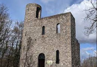
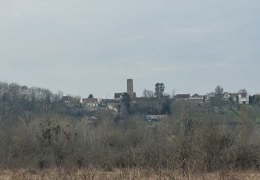
Trail Walking of 17 km to be discovered at Ile-de-France, Seine-et-Marne, Saint-Fargeau-Ponthierry. This trail is proposed by c.chehere.
Description
Parking à la mairie de St Fargeau.
Pas de difficultés particulières sinon les chemins un peu "gras" avec les pluies des derniers jours.
Déjeuner sur des tables dans la parc municipal de Pringy
Positioning
Country:
France
Region :
Ile-de-France
Department/Province :
Seine-et-Marne
Municipality :
Saint-Fargeau-Ponthierry
Location:
Unknown
Start:(Dec)
Start:(UTM)
465040 ; 5375842 (31U) N.
Comments
Trails nearby
![Trail Walking Savigny-le-Temple - Entre Savigny-le-Temple et Seine-Port - Photo](https://media.geolcdn.com/t/375/260/bf4e2a57-0e1f-461a-a57c-e80897282f7a.jpg&format=jpg&maxdim=2)
![Walking Walking](https://static1.geolcdn.com/sitytour/trail-icons/101.png)
Entre Savigny-le-Temple et Seine-Port
Walking
Very easy
(1)
Savigny-le-Temple,
Ile-de-France,
Seine-et-Marne,
France
![](/images/other/stat-length.png)
11 km | 12.8 km-effort
2h 59min
![](https://static1.geolcdn.com/siteimages/upload/files/16400158638029165_repeat_loop_refresh_sync_direction_icon.png)
No
![Trail Walking Champcueil - JC 51 - 18,4 km - 320m - Champcueil, Les Grands Avaux - 23 km Effort - Photo](https://media.geolcdn.com/t/375/260/489ffccc-38be-45b9-b302-6ec46034b0a7.jpg&format=jpg&maxdim=2)
![Walking Walking](https://static1.geolcdn.com/sitytour/trail-icons/101.png)
JC 51 - 18,4 km - 320m - Champcueil, Les Grands Avaux - 23 km Effort
Walking
Difficult
(2)
Champcueil,
Ile-de-France,
Essonne,
France
![](/images/other/stat-length.png)
17.7 km | 22 km-effort
4h 58min
![](https://static1.geolcdn.com/siteimages/upload/files/16400158638029165_repeat_loop_refresh_sync_direction_icon.png)
Yes
![Trail Running Seine-Port - Fore?t de Rougeau et bords de Seine - Photo](https://media.geolcdn.com/t/375/260/ext.jpg?maxdim=2&url=https%3A%2F%2Fservices.sitytrail.com%2FGeolivesWS%2FDownloadMedia.ashx%3FTrailID%3D105548%26Media%3D9311_1.jpg)
![Running Running](https://static1.geolcdn.com/sitytour/trail-icons/103.png)
Fore?t de Rougeau et bords de Seine
Running
Very difficult
(2)
Seine-Port,
Ile-de-France,
Seine-et-Marne,
France
![](/images/other/stat-length.png)
28 km | 32 km-effort
3h 30min
![](https://static1.geolcdn.com/siteimages/upload/files/16400158638029165_repeat_loop_refresh_sync_direction_icon.png)
No
![Trail Walking Saint-Fargeau-Ponthierry - Boucle 20 km Saint Fargeau - Photo](https://media.geolcdn.com/t/375/260/1121cafc-c79f-4e4a-a841-485665e96120.jpg&format=jpg&maxdim=2)
![Walking Walking](https://static1.geolcdn.com/sitytour/trail-icons/101.png)
Boucle 20 km Saint Fargeau
Walking
Easy
Saint-Fargeau-Ponthierry,
Ile-de-France,
Seine-et-Marne,
France
![](/images/other/stat-length.png)
21 km | 23 km-effort
4h 34min
![](https://static1.geolcdn.com/siteimages/upload/files/16400158638029165_repeat_loop_refresh_sync_direction_icon.png)
Yes
![Trail On foot Seine-Port - L 52 Les sentes de Seine Port - Photo](https://media.geolcdn.com/t/375/260/ext.jpg?maxdim=2&url=https%3A%2F%2Fstatic1.geolcdn.com%2Fsiteimages%2Fupload%2Ffiles%2F1545311037marcheuse_200dpi.jpg)
![On foot On foot](https://static1.geolcdn.com/sitytour/trail-icons/100.png)
L 52 Les sentes de Seine Port
On foot
Easy
(1)
Seine-Port,
Ile-de-France,
Seine-et-Marne,
France
![](/images/other/stat-length.png)
7.3 km | 8.8 km-effort
2h 0min
![](https://static1.geolcdn.com/siteimages/upload/files/16400158638029165_repeat_loop_refresh_sync_direction_icon.png)
Yes
![Trail Walking Boissise-la-Bertrand - Boucle Boissise la BERTRAND 30 km - Photo](https://media.geolcdn.com/t/375/260/6730328b-3210-43a6-9f84-f1c044935aa5.jpg&format=jpg&maxdim=2)
![Walking Walking](https://static1.geolcdn.com/sitytour/trail-icons/101.png)
Boucle Boissise la BERTRAND 30 km
Walking
Very difficult
Boissise-la-Bertrand,
Ile-de-France,
Seine-et-Marne,
France
![](/images/other/stat-length.png)
32 km | 36 km-effort
6h 36min
![](https://static1.geolcdn.com/siteimages/upload/files/16400158638029165_repeat_loop_refresh_sync_direction_icon.png)
Yes
![Trail On foot Champcueil - Boucle Beauvais 28 km - Photo](https://media.geolcdn.com/t/375/260/e36d05bc-8349-4259-9130-b9f8c6d20d01.jpg&format=jpg&maxdim=2)
![On foot On foot](https://static1.geolcdn.com/sitytour/trail-icons/100.png)
Boucle Beauvais 28 km
On foot
Medium
Champcueil,
Ile-de-France,
Essonne,
France
![](/images/other/stat-length.png)
28 km | 34 km-effort
7h 41min
![](https://static1.geolcdn.com/siteimages/upload/files/16400158638029165_repeat_loop_refresh_sync_direction_icon.png)
Yes
![Trail Walking Seine-Port - Boucle autour de Seine Port - Photo](https://media.geolcdn.com/t/375/260/b70a8046-66e0-4a4e-815c-b510f5b883d5.jpg&format=jpg&maxdim=2)
![Walking Walking](https://static1.geolcdn.com/sitytour/trail-icons/101.png)
Boucle autour de Seine Port
Walking
Very easy
Seine-Port,
Ile-de-France,
Seine-et-Marne,
France
![](/images/other/stat-length.png)
22 km | 25 km-effort
4h 48min
![](https://static1.geolcdn.com/siteimages/upload/files/16400158638029165_repeat_loop_refresh_sync_direction_icon.png)
Yes
![Trail Walking Saint-Sauveur-sur-École - Autour de St Sauveur l'Ecole - Photo](https://media.geolcdn.com/t/375/260/60d05cfc-695b-4981-a344-8a4aca4564fc.jpg&format=jpg&maxdim=2)
![Walking Walking](https://static1.geolcdn.com/sitytour/trail-icons/101.png)
Autour de St Sauveur l'Ecole
Walking
Very easy
Saint-Sauveur-sur-École,
Ile-de-France,
Seine-et-Marne,
France
![](/images/other/stat-length.png)
23 km | 26 km-effort
5h 13min
![](https://static1.geolcdn.com/siteimages/upload/files/16400158638029165_repeat_loop_refresh_sync_direction_icon.png)
Yes