


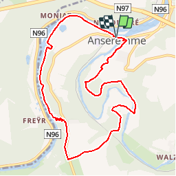


19.3 km | 26 km-effort


User


FREE GPS app for hiking
 SityTrail
IGN / Geographical institutes
SityTrail World
The world is yours!
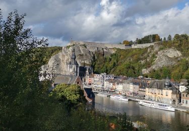
Trail On foot of 9.3 km to be discovered at Wallonia, Namur, Dinant. This trail is proposed by GerardBouche.
Très belle randonnée par la rive droite de Meuse. La montée depuis la Tête de Lion par les Rochers de Freyr est un chouïa physique. Un magnifique petit sentier par le Tienne Hubaille jusqu'au Pont St-Jean.

Walking

Walking

Walking

Walking

Walking

Walking

Walking

Walking
Walking