Trail Mountain bike Le Versoud - VTT château de Montfort - Photo

VTT château de Montfort

 druilhe
druilhe

User

© OpenStreetMap contributors
Length
Length
32 km
Max alt
Max alt
380 m
Uphill gradient
Uphill gradient
416 m
Km-Effort
Km-Effort  
37 km
Min alt
Min alt
218 m
Downhill gradient
Downhill gradient
415 m
Boucle
Boucle
Yes
Creation date :
2014-12-10 00:00:00.0
Updated on :
2014-12-10 00:00:00.0

(0 Reviews)

Mountain bike
Mountain bike
3h38
Difficulty : Easy

Scan this QR Code to open this trail in the SityTrail application

FREE GPS app for hiking

Logo SityTrail SityTrail

IGN / Geographical institutes

Download SityTrail from the App Store Download SityTrail from Google Play

Logo SityTrail SityTrail World

The world is yours!

Download SityTrail from the App Store Download SityTrail from Google Play Download SityTrail on Huawei AppGallery

About

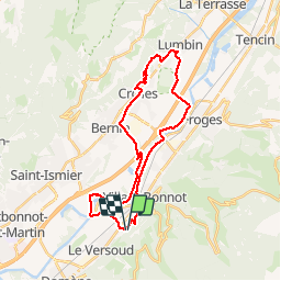
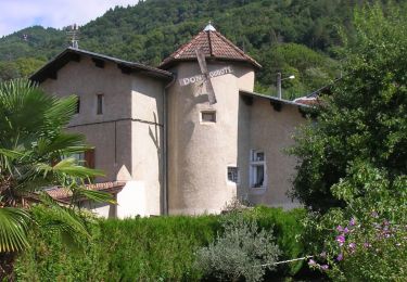
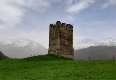
Trail Mountain bike of 32 km to be discovered at Auvergne-Rhône-Alpes, Isère, Le Versoud. This trail is proposed by druilhe.

Description

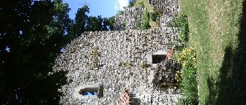
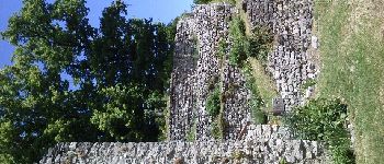
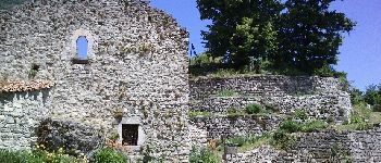
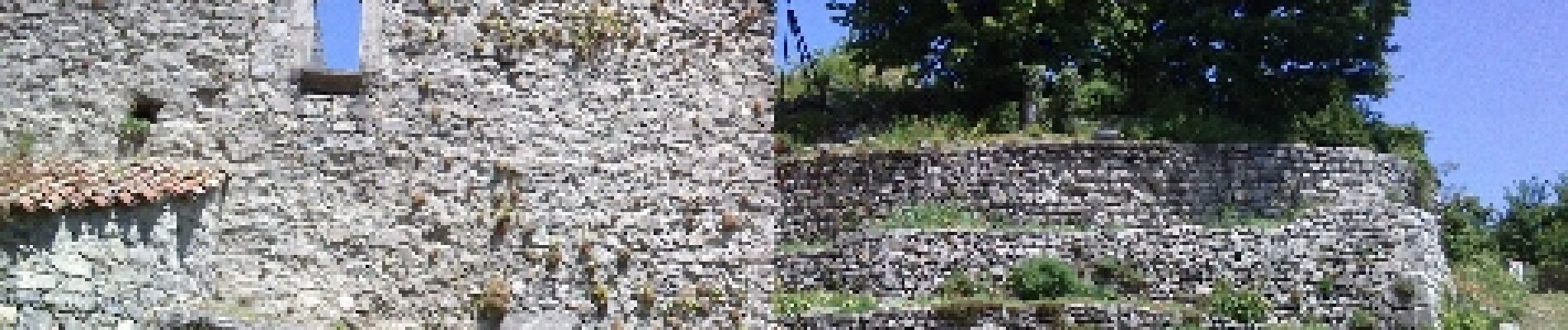
le Versoud Crolles château de Montfort

Elevation profile

Photos

Points of interest

Point of interest Crolles - passerelle - Photo
druilhe
CROLLES 
Point of interest Crolles - Panneau - Photo
druilhe
CROLLES 
Point of interest Crolles - château monfort - Photo
druilhe
Point of interest Crolles - château monfort - Photo
druilhe
Point of interest Crolles - château montfort - Photo
druilhe

Positioning

Country:
France
Region :
Auvergne-Rhône-Alpes
Department/Province :
Isère
Municipality :
Le Versoud
Location:
Unknown
Start:(UTM)
725881 ; 5011905 (31T) N.

Trails nearby

Trail On foot La Combe-de-Lancey - Chemin de Découverte (boucle Basse) - Photo
On foot
GUIDE+

On foot

Easy
La Combe-de-Lancey, Auvergne-Rhône-Alpes, Isère, France
3.5 km | 5.1 km-effort
1h 9min
Yes
Trail On foot La Combe-de-Lancey - Chemin de Découverte (boucle Haute) - Photo
On foot
GUIDE+

On foot

Easy
La Combe-de-Lancey, Auvergne-Rhône-Alpes, Isère, France
3.5 km | 5.4 km-effort
1h 13min
Yes
Trail On foot Domène - Domène à Murianette, par les rives de l'Isère - Photo
On foot
GUIDE+

On foot

Easy
Domène, Auvergne-Rhône-Alpes, Isère, France
6.4 km | 7 km-effort
1h 35min
No
Trail On foot Domène - Circuit de Beauregard - Photo
On foot
GUIDE+

On foot

Easy
Domène, Auvergne-Rhône-Alpes, Isère, France
3.6 km | 7 km-effort
1h 35min
Yes
Trail On foot Domène - Circuit de la Monta - Photo
On foot
GUIDE+

On foot

Easy
Domène, Auvergne-Rhône-Alpes, Isère, France
9.9 km | 15.4 km-effort
3h 29min
Yes
Trail On foot Saint-Jean-le-Vieux - La Tour de Revel (par le Mollard) - Photo
On foot
GUIDE+

On foot

Easy
Saint-Jean-le-Vieux, Auvergne-Rhône-Alpes, Isère, France
7.9 km | 13.4 km-effort
3h 2min
No
Trail Mountain bike Domène - Domène, grande boucle : la Bourjat - bois de l'envers - grands bois - Photo
Mountain bike
xexedi

Mountain bike

Medium
(1)
Domène, Auvergne-Rhône-Alpes, Isère, France
10.9 km | 17.5 km-effort
1h 5min
Yes
Trail Walking La Combe-de-Lancey - Col du Pré du Molard - Photo
Walking
flip38

Walking

Difficult
La Combe-de-Lancey, Auvergne-Rhône-Alpes, Isère, France
17.8 km | 33 km-effort
5h 19min
Yes
Trail Walking Laval-en-Belledonne - Boucle Laval - Sainte-Agnès - Photo
Walking
flip38

Walking

Medium
Laval-en-Belledonne, Auvergne-Rhône-Alpes, Isère, France
17.7 km | 29 km-effort
4h 28min
Yes


Close
My subscriptions