
9155336-Bonarme

GilGry
User

Length
28 km

Max alt
1289 m

Uphill gradient
1124 m

Km-Effort
43 km

Min alt
793 m

Downhill gradient
1135 m
Boucle
Yes
Creation date :
2018-09-24 15:04:28.713
Updated on :
2019-03-26 15:08:43.2
8h50
Difficulty : Very difficult

FREE GPS app for hiking
About
Trail Walking of 28 km to be discovered at Auvergne-Rhône-Alpes, Cantal, Molèdes. This trail is proposed by GilGry.
Description
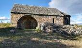
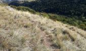
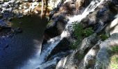
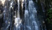
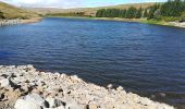
Roche du Renard; Brèche de Giniol; Lac de Sianne; Cascade de Terrisse; Chapelle de Chanet
Quelques passages sous les barbelés. Attention à l'accès par le haut de la cascade. Il existe un fléchage rouge plus sécurisé (descente et remontée) par le pierrier. Possibilité de passer par la route. ( Mais bon c'est de la route)
Positioning
Country:
France
Region :
Auvergne-Rhône-Alpes
Department/Province :
Cantal
Municipality :
Molèdes
Location:
Unknown
Start:(Dec)
Start:(UTM)
502654 ; 5010392 (31T) N.
Comments
Trails nearby

Sentier des mines


Walking
Medium
Molèdes,
Auvergne-Rhône-Alpes,
Cantal,
France

13 km | 19.2 km-effort
4h 57min
Yes

vallée de la sienne (a/r)


Walking
Easy
Vèze,
Auvergne-Rhône-Alpes,
Cantal,
France

7.8 km | 11.1 km-effort
2h 30min
No

Veze 31 05 2019


Walking
Easy
Vèze,
Auvergne-Rhône-Alpes,
Cantal,
France

9.1 km | 13.2 km-effort
5h 18min
Yes


 SityTrail


