

Tour de Plogoff

ilur56
User

Length
19.6 km

Max alt
68 m

Uphill gradient
405 m

Km-Effort
25 km

Min alt
4 m

Downhill gradient
405 m
Boucle
Yes
Creation date :
2018-09-07 07:25:40.74
Updated on :
2018-09-17 10:42:01.726
6h03
Difficulty : Easy

FREE GPS app for hiking
About
Trail Walking of 19.6 km to be discovered at Brittany, Finistère, Plogoff. This trail is proposed by ilur56.
Description
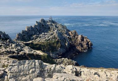
Au départ du centre bourg, suivre le parcours VTT n°11 jusqu'à la chapelle Notre Dame de bon voyage, puis rejoindre le GR34 jusqu'à la pointe du Raz et la baie des Emigrés. Retour vers le bourg.
Positioning
Country:
France
Region :
Brittany
Department/Province :
Finistère
Municipality :
Plogoff
Location:
Unknown
Start:(Dec)
Start:(UTM)
375882 ; 5321798 (30U) N.
Comments
Trails nearby
GR34 Pointe de Brézelec -- Cléden-Cap-Sizun (Pointe du Raz)


Walking
Very difficult
Cléden-Cap-Sizun,
Brittany,
Finistère,
France

23 km | 30 km-effort
6h 54min
No
TREK RCY GR34 J4 2022 Pointe du Raz/ baie des trépassés


Walking
Easy
Plogoff,
Brittany,
Finistère,
France

13.9 km | 18.3 km-effort
3h 42min
No
Pointe du Van - Pointe du Raz par le GR34 - 13.5km 310m 4h10 (40mn) - 2019 09 04


Walking
Medium
Cléden-Cap-Sizun,
Brittany,
Finistère,
France

13.5 km | 17.6 km-effort
4h 10min
Yes
la pointe du Raz


Walking
Difficult
Plogoff,
Brittany,
Finistère,
France

5.3 km | 7 km-effort
2h 56min
Yes

plogoff loual


Walking
Easy
(1)
Plogoff,
Brittany,
Finistère,
France

4.1 km | 5 km-effort
1h 8min
Yes

la pointe du raz Bretagne


Walking
Very easy
(1)
Plogoff,
Brittany,
Finistère,
France

6.8 km | 9 km-effort
2h 19min
Yes

point du van


Walking
Medium
(1)
Cléden-Cap-Sizun,
Brittany,
Finistère,
France

10.6 km | 13.9 km-effort
Unknown
Yes

Gr34 Cléden-Cap-Sizun -- Audierne


Walking
Very difficult
Cléden-Cap-Sizun,
Brittany,
Finistère,
France

21 km | 25 km-effort
5h 36min
No
POINTE DU RAZ


Walking
Easy
Cléden-Cap-Sizun,
Brittany,
Finistère,
France

15.7 km | 20 km-effort
4h 38min
Yes


 SityTrail


