Trail Walking Châtillon-en-Diois - Archiane - Le Sentier des Vautours  - Photo

Archiane - Le Sentier des Vautours

 patjobou
patjobou

User

© OpenStreetMap contributors
Length
Length
6.5 km
Max alt
Max alt
1134 m
Uphill gradient
Uphill gradient
389 m
Km-Effort
Km-Effort  
11.7 km
Min alt
Min alt
755 m
Downhill gradient
Downhill gradient
394 m
Boucle
Boucle
Yes
Creation date :
2018-09-02 11:28:55.495
Updated on :
2018-09-02 20:28:54.705

(0 Reviews)

Walking
Walking
3h00
Difficulty : Easy

Scan this QR Code to open this trail in the SityTrail application

FREE GPS app for hiking

Logo SityTrail SityTrail

IGN / Geographical institutes

Download SityTrail from the App Store Download SityTrail from Google Play

Logo SityTrail SityTrail World

The world is yours!

Download SityTrail from the App Store Download SityTrail from Google Play Download SityTrail on Huawei AppGallery

About

Trail Walking of 6.5 km to be discovered at Auvergne-Rhône-Alpes, Drôme, Châtillon-en-Diois. This trail is proposed by patjobou.

Description

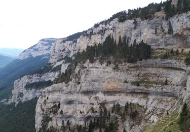
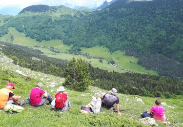
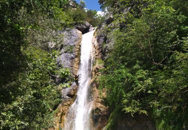
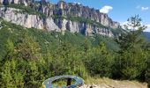
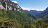
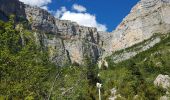
Une boucle de 2h30 à 3h en marchant tranquillement, et en prenant le temps d'observer les vautours; en effet: à Pédane, en s'éloignant de 20 m du sentier vers le torrent, on trouve une longue vue qui permet d'observer les nids de vautours. Un carte, mise à jour régulièrement,  permet de situer les nids sur la falaise ! Et effectivement, on les voit très bien ! Belle initative !

Elevation profile

Photos

Positioning

Country:
France
Region :
Auvergne-Rhône-Alpes
Department/Province :
Drôme
Municipality :
Châtillon-en-Diois
Location:
Treschenu-Creyers
Start:(UTM)
698473 ; 4957691 (31T) N.

Trails nearby

Trail Walking Châtillon-en-Diois - 2015-05-30 11:51 - Photo
Walking
randochu

Walking

Very difficult
(1)
Châtillon-en-Diois, Auvergne-Rhône-Alpes, Drôme, France
13 km | 28 km-effort
6h 20min
Yes
Trail Walking Châtillon-en-Diois - F26 Combau Fontaine Pourrie - Photo
Walking
ageo

Walking

Medium
(1)
Châtillon-en-Diois, Auvergne-Rhône-Alpes, Drôme, France
17 km | 29 km-effort
6h 9min
Yes
Trail Walking Châtillon-en-Diois - 26 vallon combeau - Photo
Walking
GUIDE
randodyssée

Walking

Medium
Châtillon-en-Diois, Auvergne-Rhône-Alpes, Drôme, France
13.3 km | 24 km-effort
6h 48min
Yes
Trail Walking Châtillon-en-Diois - Les crêtes du cirque d'Archiane - Photo
Walking
GUIDE
nadd73

Walking

Difficult
Châtillon-en-Diois, Auvergne-Rhône-Alpes, Drôme, France
23 km | 41 km-effort
6h 35min
Yes
Trail Walking Châtillon-en-Diois - 2017-06-04 15:45:22 - Photo
Walking
randochu

Walking

Medium
(1)
Châtillon-en-Diois, Auvergne-Rhône-Alpes, Drôme, France
11.4 km | 19.9 km-effort
Unknown
Yes
Trail Walking Châtillon-en-Diois - Vercors - Archiane - Cirque par les crêtes 21km D+1260m - Photo
Walking
manumax

Walking

Very difficult
(2)
Châtillon-en-Diois, Auvergne-Rhône-Alpes, Drôme, France
21 km | 38 km-effort
7h 55min
Yes
Trail Walking Châtillon-en-Diois - Carnets d'Archiane - Photo
Walking
dominiq

Walking

Easy
(1)
Châtillon-en-Diois, Auvergne-Rhône-Alpes, Drôme, France
4.9 km | 9.7 km-effort
2h 1min
No
Trail Walking Châtillon-en-Diois - 26 nonieres zel sabot venus 12.06.24 - Photo
Walking
GUIDE
randodyssée

Walking

Medium
Châtillon-en-Diois, Auvergne-Rhône-Alpes, Drôme, France
15 km | 24 km-effort
6h 44min
Yes
Trail Walking Châtillon-en-Diois - Cabane de Chatillon  - Photo
Walking
Atchoum26

Walking

Medium
Châtillon-en-Diois, Auvergne-Rhône-Alpes, Drôme, France
17.6 km | 37 km-effort
6h 4min
No


Close
My subscriptions