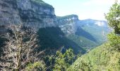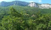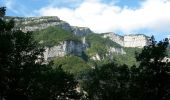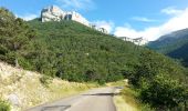

GTA 2018 - ETAPE 9

lagardienne
User

Length
217 km

Max alt
1431 m

Uphill gradient
6196 m

Km-Effort
300 km

Min alt
201 m

Downhill gradient
6207 m
Boucle
No
Creation date :
2018-07-24 08:50:13.393
Updated on :
2018-07-24 09:29:14.033
9h30
Difficulty : Easy

FREE GPS app for hiking
About
Trail Motorbike of 217 km to be discovered at Auvergne-Rhône-Alpes, Drôme, Die. This trail is proposed by lagardienne.
Description
Grande traversée des Alpes et Petites Routes du Soleil effectuées en moto.
Plus de détail sur http://lejardindelolo.fr/
3079 km en 12 jours, avec une Varadéro 125.
Positioning
Country:
France
Region :
Auvergne-Rhône-Alpes
Department/Province :
Drôme
Municipality :
Die
Location:
Unknown
Start:(Dec)
Start:(UTM)
687068 ; 4957985 (31T) N.
Comments
Trails nearby
20/12/2015 Pierre plats


Nordic walking
Easy
(1)
Ponet-et-Saint-Auban,
Auvergne-Rhône-Alpes,
Drôme,
France

6.9 km | 11.1 km-effort
1h 46min
Yes
26 belle justine


Walking
Medium
Die,
Auvergne-Rhône-Alpes,
Drôme,
France

14.1 km | 24 km-effort
7h 18min
No

Chapia Belle Justine


Walking
Medium
(1)
Die,
Auvergne-Rhône-Alpes,
Drôme,
France

10.7 km | 17.1 km-effort
3h 47min
Yes
Marignac - But de l'Aiglette - Col de Vassieux


Walking
Difficult
Marignac-en-Diois,
Auvergne-Rhône-Alpes,
Drôme,
France

15.4 km | 29 km-effort
5h 15min
Yes
Col de Bergu


Walking
Medium
Die,
Auvergne-Rhône-Alpes,
Drôme,
France

6.2 km | 10.2 km-effort
2h 15min
Yes
Croix de Justin , Ausson


sport
Very easy
Die,
Auvergne-Rhône-Alpes,
Drôme,
France

14.7 km | 24 km-effort
Unknown
Yes
Autour de Die balade


Walking
Easy
Die,
Auvergne-Rhône-Alpes,
Drôme,
France

8.9 km | 11.7 km-effort
1h 56min
Yes
Tour Abbaye Val Croissant


Walking
Difficult
Die,
Auvergne-Rhône-Alpes,
Drôme,
France

11.5 km | 18.9 km-effort
1h 58min
No
la Belle Justine ( rando Asptt)


Walking
Medium
Die,
Auvergne-Rhône-Alpes,
Drôme,
France

14.8 km | 24 km-effort
5h 36min
Yes


 SityTrail


