![](/images/other/stat-length.png)
![Trail Walking Jonchères - 2016-04-09 Jonchères - Montagne de Praloubeau - Photo](https://media.geolcdn.com/t/1900/400/a518ec77-466d-41c1-88e2-175223c4e0e5.jpg&format=pjpeg&maxdim=2)
2016-04-09 Jonchères - Montagne de Praloubeau
Philindy26
User
![Length](/images/other/stat-length.png)
![Max alt](https://static1.geolcdn.com/siteimages/upload/files/1508320355ic_sort_altitude_max_24dp.png)
![Uphill gradient](https://static1.geolcdn.com/siteimages/upload/files/1508320355ic_sort_den_pos_24dp.png)
![Km-Effort](/images/other/stat-length.png)
![Min alt](https://static1.geolcdn.com/siteimages/upload/files/1508320355ic_sort_altitude_min_24dp.png)
![Downhill gradient](https://static1.geolcdn.com/siteimages/upload/files/1508320355ic_sort_den_neg_24dp.png)
![Boucle](https://static1.geolcdn.com/siteimages/upload/files/16400158638029165_repeat_loop_refresh_sync_direction_icon.png)
![Walking](https://static1.geolcdn.com/sitytour/trail-icons/101.png)
4h03
Difficulty : Difficult
![Scan this QR Code to open this trail in the SityTrail application](https://capi.geolives.com/qq0zvz2zws4bq2lad0pu/sitytour/trails/2003198/qr.png?size=200)
FREE GPS app for hiking
About
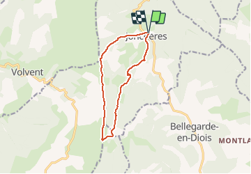
Trail Walking of 11.4 km to be discovered at Auvergne-Rhône-Alpes, Drôme, Jonchères. This trail is proposed by Philindy26.
Description
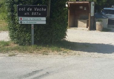
Départ du village de Jonchères, D61 entre Luc-en-Diois et Bellegarde-en-Diois...
Géolocalisation (Google Maps) : https://goo.gl/maps/eNQWPZutMPWTvBJq8 .
Montée par le col de Volvent (1427 m),
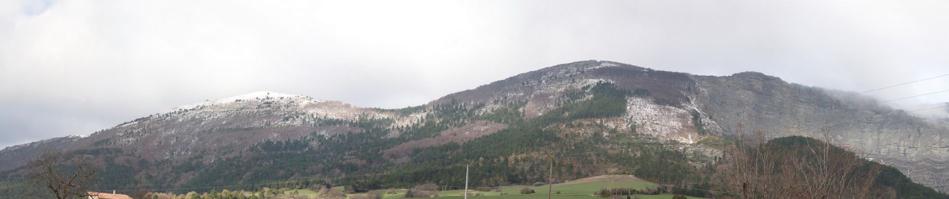
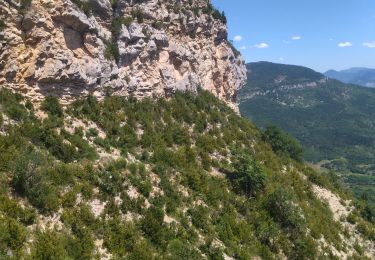
Suivre les crêtes de la montagne de Praloubeau,
Descente par le col de la Motte (1431 m).
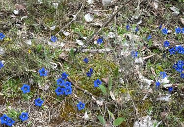
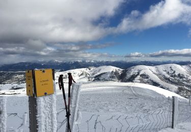
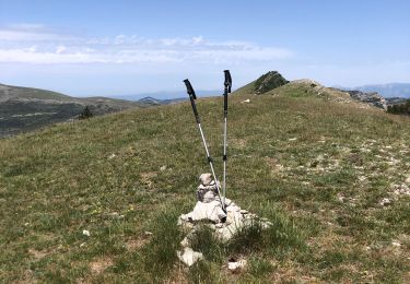
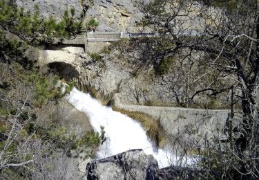
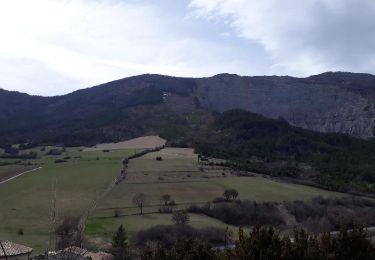
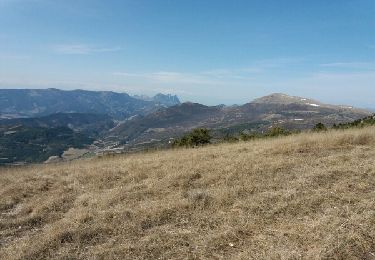
Positioning
Comments
Trails nearby
![Trail Walking Volvent - 26 chalencon eyriau zel - Photo](https://media.geolcdn.com/t/375/260/153502c6-6d0b-49a9-b8eb-15eb863bb322.jpg&format=jpg&maxdim=2)
![Walking Walking](https://static1.geolcdn.com/sitytour/trail-icons/101.png)
Walking
![](/images/other/stat-length.png)
![](https://static1.geolcdn.com/siteimages/upload/files/16400158638029165_repeat_loop_refresh_sync_direction_icon.png)
![Trail sport Luc-en-Diois - Pic de Luc retour ravin de la Rochette - Photo](https://media.geolcdn.com/t/375/260/7286e91d-5a1f-4b10-a4ac-7266325160f9.jpg&format=jpg&maxdim=2)
sport
![](/images/other/stat-length.png)
![](https://static1.geolcdn.com/siteimages/upload/files/16400158638029165_repeat_loop_refresh_sync_direction_icon.png)
![Trail sport Jonchères - Jonchères Pivoines 2024 - Photo](https://media.geolcdn.com/t/375/260/8e0f4411-93b1-42ac-a4c2-86b49062ded0.jpg&format=jpg&maxdim=2)
sport
![](/images/other/stat-length.png)
![](https://static1.geolcdn.com/siteimages/upload/files/16400158638029165_repeat_loop_refresh_sync_direction_icon.png)
![Trail Snowshoes Volvent - Servelle de Brette - Photo](https://media.geolcdn.com/t/375/260/049a8df2-2b16-40b5-a9d0-094d00ba47da.jpg&format=jpg&maxdim=2)
![Snowshoes Snowshoes](https://static1.geolcdn.com/sitytour/trail-icons/504.png)
Snowshoes
![](/images/other/stat-length.png)
![](https://static1.geolcdn.com/siteimages/upload/files/16400158638029165_repeat_loop_refresh_sync_direction_icon.png)
![Trail Walking Jonchères - Jonchères - Photo](https://media.geolcdn.com/t/375/260/157e7856-5eaf-40e9-be95-2ba6b62b45b6.jpg&format=jpg&maxdim=2)
![Walking Walking](https://static1.geolcdn.com/sitytour/trail-icons/101.png)
Walking
![](/images/other/stat-length.png)
![](https://static1.geolcdn.com/siteimages/upload/files/16400158638029165_repeat_loop_refresh_sync_direction_icon.png)
![Trail Walking Volvent - col de la vache - praloubeau - sous la brèche et retour - Photo](https://media.geolcdn.com/t/375/260/ec2bfbb5-c45f-4e6d-af7f-d9dcdf368739.jpg&format=jpg&maxdim=2)
![Walking Walking](https://static1.geolcdn.com/sitytour/trail-icons/101.png)
Walking
![](/images/other/stat-length.png)
![](https://static1.geolcdn.com/siteimages/upload/files/16400158638029165_repeat_loop_refresh_sync_direction_icon.png)
![Trail Walking Luc-en-Diois - saut de la Drôme... le claps - Photo](https://media.geolcdn.com/t/375/260/ext.jpg?maxdim=2&url=https%3A%2F%2Fservices.sitytrail.com%2FGeolivesWS%2FDownloadMedia.ashx%3FTrailID%3D947160%26Media%3Dfix__20180419165035.jpg)
![Walking Walking](https://static1.geolcdn.com/sitytour/trail-icons/101.png)
Walking
![](/images/other/stat-length.png)
![](https://static1.geolcdn.com/siteimages/upload/files/16400158638029165_repeat_loop_refresh_sync_direction_icon.png)
![Trail Walking Jonchères - Les crêtes de Jonchères - Photo](https://media.geolcdn.com/t/375/260/ext.jpg?maxdim=2&url=https%3A%2F%2Fservices.sitytrail.com%2FGeolivesWS%2FDownloadMedia.ashx%3FTrailID%3D938621%26Media%3Dfe2b9ce4-f237-4dfc-8e96-7944381d8614.jpg)
![Walking Walking](https://static1.geolcdn.com/sitytour/trail-icons/101.png)
Walking
![](/images/other/stat-length.png)
![](https://static1.geolcdn.com/siteimages/upload/files/16400158638029165_repeat_loop_refresh_sync_direction_icon.png)
![Trail Walking Volvent - crête de praloubeau - Photo](https://media.geolcdn.com/t/375/260/ext.jpg?maxdim=2&url=https%3A%2F%2Fservices.sitytrail.com%2FGeolivesWS%2FDownloadMedia.ashx%3FTrailID%3D712861%26Media%3Dfix__20170312133518.jpg)
![Walking Walking](https://static1.geolcdn.com/sitytour/trail-icons/101.png)
Walking
![](/images/other/stat-length.png)
![](https://static1.geolcdn.com/siteimages/upload/files/16400158638029165_repeat_loop_refresh_sync_direction_icon.png)