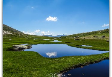
Trail Walking Bastelica - pozzi et pozzines - Photo

pozzi et pozzines

 David2a
David2a

User

© OpenStreetMap contributors
Length
Length
11.9 km
Max alt
Max alt
1947 m
Uphill gradient
Uphill gradient
514 m
Km-Effort
Km-Effort  
18.7 km
Min alt
Min alt
1614 m
Downhill gradient
Downhill gradient
515 m
Boucle
Boucle
Yes
Creation date :
2014-12-10 00:00:00.0
Updated on :
2014-12-10 00:00:00.0

(1 Reviews)

Walking
Walking
3h54
Difficulty : Medium

Scan this QR Code to open this trail in the SityTrail application

FREE GPS app for hiking

Logo SityTrail SityTrail

IGN / Geographical institutes

Download SityTrail from the App Store Download SityTrail from Google Play

Logo SityTrail SityTrail World

The world is yours!

Download SityTrail from the App Store Download SityTrail from Google Play Download SityTrail on Huawei AppGallery

About

Trail Walking of 11.9 km to be discovered at Corsica, South Corsica, Bastelica. This trail is proposed by David2a.

Description

POZZI et ses Pozzine

Difficulté : moyenne aller et facile retour

Départ assez dur (belle montée qui coupe les jambes au niveau du remonte fesse... attention, le dernier sur la droite, tout dernier sur la droite ...il y en a 3)

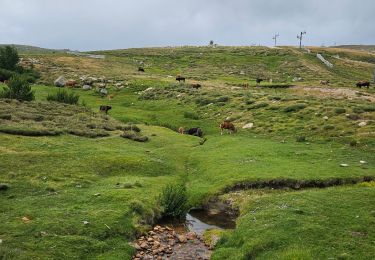
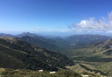
Trajet Aller : Très pittoresque, haute montagne, assez venteux, assez bien délimité par les cairns et traces orange. Attention toutefois car possibilité en haut de la montagne de prendre mauvaise direction !!!

Trajet retour : super sympa, difficulté facile, beaucoup plus plat et traversée sympathique dans des bois, plaines et petits sentiers abruptes (mais largement négociables)

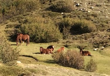
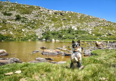
Randonnée sympa . Ne pas y aller que pour POZZI (sympa mais bon) mais pour tout le reste : Ce magnifique paysage.

Attention également : randonnée faite le 15 juin 2013 - présence de quelques portions de glace à traverser.

Elevation profile

Positioning

Country:
France
Region :
Corsica
Department/Province :
South Corsica
Municipality :
Bastelica
Location:
Unknown
Start:(UTM)
510209 ; 4649676 (32T) N.

Comments

Please log in to post a review or rate the element


Très belle rando effectuée le 1er mai et il y avait encore beaucoup de plaques de neige et les pozzines n avaient pas encore leur belle couleur verte...de plus le retour étant assez mal balisé nous nous sommes malheureusement souvent éloignés du bon chemin. conclusion : à refaire plus tard dans la saison merci


Trails nearby

Trail Walking Bastelica - Bergeries des Pozzi, 1746m - Photo
Walking
tracegps

Walking

Difficult
(5)
Bastelica, Corsica, South Corsica, France
14.1 km | 21 km-effort
4h 30min
Yes
Trail Walking Bastelica - LesBergeries des Pozzines - Photo
Walking
corsinou

Walking

Medium
(2)
Bastelica, Corsica, South Corsica, France
13.2 km | 23 km-effort
4h 36min
Yes
Trail Walking Bastelica - I Pozzi en partant du val d'Eze  - Photo
Walking
FSantoni

Walking

Very easy
Bastelica, Corsica, South Corsica, France
13.1 km | 20 km-effort
6h 59min
Yes
Trail Walking Bastelica - Pozzi du val d’eze  - Photo
Walking
GUIDE
antignacs

Walking

Easy
Bastelica, Corsica, South Corsica, France
14.3 km | 21 km-effort
5h 32min
Yes
Trail Walking Bastelica - LAC de RINA - Photo
Walking
cathymac20

Walking

Very difficult
Bastelica, Corsica, South Corsica, France
21 km | 36 km-effort
7h 14min
Yes
Trail Walking Bastelica - ECZ 1 Val d'Ese - E Capanelle - Photo
Walking
Samuel Roelants

Walking

Very difficult
Bastelica, Corsica, South Corsica, France
13.6 km | 26 km-effort
5h 12min
No
Trail Walking Bastelica - Val d’Ese - Photo
Walking
pchat

Walking

Medium
(1)
Bastelica, Corsica, South Corsica, France
11.2 km | 18.7 km-effort
3h 47min
No
Trail Walking Bastelica - les Pozzi - Bastelica(cat2a) - Photo
Walking
thierry2a

Walking

Very difficult
Bastelica, Corsica, South Corsica, France
14.8 km | 25 km-effort
5h 8min
Yes
Trail Walking Bastelica - Tour d'I Pozzi de la station Val d'Ese - Photo
Walking
zazie

Walking

Difficult
Bastelica, Corsica, South Corsica, France
12 km | 19 km-effort
3h 57min
Yes


Close
My subscriptions