Trail Bicycle tourism Vic-Fezensac - B - Vic Fezensac - A la découverte du bâtit Gersois - Photo

B - Vic Fezensac - A la découverte du bâtit Gersois

 potofe
potofe

User

© OpenStreetMap contributors
Length
Length
101 km
Max alt
Max alt
240 m
Uphill gradient
Uphill gradient
1427 m
Km-Effort
Km-Effort  
120 km
Min alt
Min alt
111 m
Downhill gradient
Downhill gradient
1421 m
Boucle
Boucle
Yes
Creation date :
2018-09-07 19:24:34.024
Updated on :
2018-11-01 10:00:47.022

(0 Reviews)

Bicycle tourism
Bicycle tourism
--
Difficulty : Medium

Scan this QR Code to open this trail in the SityTrail application

FREE GPS app for hiking

Logo SityTrail SityTrail

IGN / Geographical institutes

Download SityTrail from the App Store Download SityTrail from Google Play

Logo SityTrail SityTrail World

The world is yours!

Download SityTrail from the App Store Download SityTrail from Google Play Download SityTrail on Huawei AppGallery

About

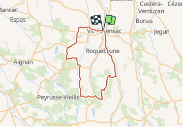
Trail Bicycle tourism of 101 km to be discovered at Occitania, Gers, Vic-Fezensac. This trail is proposed by potofe.

Description

Vic Fezensac

Elevation profile

Positioning

Country:
France
Region :
Occitania
Department/Province :
Gers
Municipality :
Vic-Fezensac
Location:
Unknown
Start:(UTM)
282882 ; 4848619 (31T) N.

Trails nearby

Trail Other activity Vic-Fezensac - 2012-05-22 17h05m50 - Photo
Other activity
louis42600

Other activity

Very easy
Vic-Fezensac, Occitania, Gers, France
30 km | 34 km-effort
36min
No
Trail Walking Vic-Fezensac - vic - Photo
Walking
landrein

Walking

Medium
Vic-Fezensac, Occitania, Gers, France
8.6 km | 10.2 km-effort
2h 57min
No
Trail Mountain bike Vic-Fezensac - vic - flaran - Photo
Mountain bike
xenkod

Mountain bike

Medium
Vic-Fezensac, Occitania, Gers, France
44 km | 54 km-effort
3h 28min
Yes


Close
My subscriptions