![](/images/other/stat-length.png)
![Trail Other activity Unterschächen - UR / klausenpass - fisetenpass - Photo](https://media.geolcdn.com/t/1900/400/ext.pjpeg?maxdim=2&url=https%3A%2F%2Fstatic1.geolcdn.com%2Fsiteimages%2Fupload%2Ffiles%2F1545311037marcheuse_200dpi.jpg)
UR / klausenpass - fisetenpass
denisewanderige
User
![Length](/images/other/stat-length.png)
Length
8.2 km
![Max alt](https://static1.geolcdn.com/siteimages/upload/files/1508320355ic_sort_altitude_max_24dp.png)
Max alt
2128 m
![Uphill gradient](https://static1.geolcdn.com/siteimages/upload/files/1508320355ic_sort_den_pos_24dp.png)
Uphill gradient
379 m
![Km-Effort](/images/other/stat-length.png)
Km-Effort
13.1 km
![Min alt](https://static1.geolcdn.com/siteimages/upload/files/1508320355ic_sort_altitude_min_24dp.png)
Min alt
1945 m
![Downhill gradient](https://static1.geolcdn.com/siteimages/upload/files/1508320355ic_sort_den_neg_24dp.png)
Downhill gradient
312 m
![Boucle](https://static1.geolcdn.com/siteimages/upload/files/16400158638029165_repeat_loop_refresh_sync_direction_icon.png)
Boucle
No
Creation date :
2014-12-11 00:00:00.0
Updated on :
2014-12-11 00:00:00.0
![Other activity](https://static1.geolcdn.com/sitytour/trail-icons/900.png)
--
Difficulty : Unknown
![Scan this QR Code to open this trail in the SityTrail application](https://capi.geolives.com/qq0zvz2zws4bq2lad0pu/sitytour/trails/19468/qr.png?size=200)
FREE GPS app for hiking
About
Trail Other activity of 8.2 km to be discovered at Uri, Unknown, Unterschächen. This trail is proposed by denisewanderige.
Description
Details (Wanderbeschrieb, Fotos, Dauer, Links, usw.) siehe unter:
http://www.wanderige.ch/wanderige_toure/2006/fisetenpas/fisetenpass.htm
Positioning
Country:
Switzerland
Region :
Uri
Department/Province :
Unknown
Municipality :
Unterschächen
Location:
Unknown
Start:(Dec)
Start:(UTM)
488938 ; 5190511 (32T) N.
Comments
Trails nearby
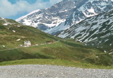
![Trail On foot Unterschächen - Höhenweg Schächental - Photo](https://media.geolcdn.com/t/375/260/35352a6a-a2dd-4bc3-99a2-5c7040e737d8.jpeg&format=jpg&maxdim=2)
![On foot On foot](https://static1.geolcdn.com/sitytour/trail-icons/100.png)
Höhenweg Schächental
On foot
Easy
Unterschächen,
Uri,
Unknown,
Switzerland
![](/images/other/stat-length.png)
7.8 km | 11.6 km-effort
2h 38min
![](https://static1.geolcdn.com/siteimages/upload/files/16400158638029165_repeat_loop_refresh_sync_direction_icon.png)
No
![Trail On foot Spiringen - Klausenpass - fixme - Photo](https://media.geolcdn.com/t/375/260/cc00c18f-b825-463b-a888-6df2f8ba96d5.jpeg&format=jpg&maxdim=2)
![On foot On foot](https://static1.geolcdn.com/sitytour/trail-icons/100.png)
Klausenpass - fixme
On foot
Easy
Spiringen,
Uri,
Unknown,
Switzerland
![](/images/other/stat-length.png)
5.2 km | 8.2 km-effort
1h 52min
![](https://static1.geolcdn.com/siteimages/upload/files/16400158638029165_repeat_loop_refresh_sync_direction_icon.png)
No
![Trail On foot Unterschächen - Naturkundlicher Höhenweg Schächental - Photo](https://media.geolcdn.com/t/375/260/d23146af-fd02-4eed-8383-de3c1baeff3e.jpeg&format=jpg&maxdim=2)
![On foot On foot](https://static1.geolcdn.com/sitytour/trail-icons/100.png)
Naturkundlicher Höhenweg Schächental
On foot
Easy
Unterschächen,
Uri,
Unknown,
Switzerland
![](/images/other/stat-length.png)
4.6 km | 7.8 km-effort
1h 45min
![](https://static1.geolcdn.com/siteimages/upload/files/16400158638029165_repeat_loop_refresh_sync_direction_icon.png)
No
![Trail Walking Unterschächen - passKlausen2 - Photo](https://media.geolcdn.com/t/375/260/ext.jpg?maxdim=2&url=https%3A%2F%2Fstatic1.geolcdn.com%2Fsiteimages%2Fupload%2Ffiles%2F1553511878bg_sport_marche.png)
![Walking Walking](https://static1.geolcdn.com/sitytour/trail-icons/101.png)
passKlausen2
Walking
Very easy
Unterschächen,
Uri,
Unknown,
Switzerland
![](/images/other/stat-length.png)
25 km | 31 km-effort
Unknown
![](https://static1.geolcdn.com/siteimages/upload/files/16400158638029165_repeat_loop_refresh_sync_direction_icon.png)
No
![Trail Other activity Spiringen - Glatten - Photo](https://media.geolcdn.com/t/375/260/ext.jpg?maxdim=2&url=https%3A%2F%2Fstatic1.geolcdn.com%2Fsiteimages%2Fupload%2Ffiles%2F1545311037marcheuse_200dpi.jpg)
![Other activity Other activity](https://static1.geolcdn.com/sitytour/trail-icons/900.png)
Glatten
Other activity
Very easy
Spiringen,
Uri,
Unknown,
Switzerland
![](/images/other/stat-length.png)
19.1 km | 53 km-effort
Unknown
![](https://static1.geolcdn.com/siteimages/upload/files/16400158638029165_repeat_loop_refresh_sync_direction_icon.png)
Yes
![Trail Other activity Spiringen - Rando 08 - Photo](https://media.geolcdn.com/t/375/260/ext.jpg?maxdim=2&url=https%3A%2F%2Fstatic1.geolcdn.com%2Fsiteimages%2Fupload%2Ffiles%2F1545311037marcheuse_200dpi.jpg)
![Other activity Other activity](https://static1.geolcdn.com/sitytour/trail-icons/900.png)
Rando 08
Other activity
Very easy
Spiringen,
Uri,
Unknown,
Switzerland
![](/images/other/stat-length.png)
48 km | 119 km-effort
Unknown
![](https://static1.geolcdn.com/siteimages/upload/files/16400158638029165_repeat_loop_refresh_sync_direction_icon.png)
No
![Trail Other activity Unterschächen - Schächentaler Höhenweg - Photo](https://media.geolcdn.com/t/375/260/ext.jpg?maxdim=2&url=https%3A%2F%2Fstatic1.geolcdn.com%2Fsiteimages%2Fupload%2Ffiles%2F1545311037marcheuse_200dpi.jpg)
![Other activity Other activity](https://static1.geolcdn.com/sitytour/trail-icons/900.png)
Schächentaler Höhenweg
Other activity
Very easy
Unterschächen,
Uri,
Unknown,
Switzerland
![](/images/other/stat-length.png)
11.7 km | 18.2 km-effort
Unknown
![](https://static1.geolcdn.com/siteimages/upload/files/16400158638029165_repeat_loop_refresh_sync_direction_icon.png)
No