![](/images/other/stat-length.png)
![Trail Other activity Kerns - OW / stöckalp - älggi - abgschütz - melchsee-frutt - Photo](https://media.geolcdn.com/t/1900/400/ext.pjpeg?maxdim=2&url=https%3A%2F%2Fstatic1.geolcdn.com%2Fsiteimages%2Fupload%2Ffiles%2F1545311037marcheuse_200dpi.jpg)
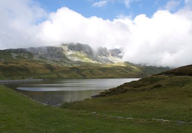
OW / stöckalp - älggi - abgschütz - melchsee-frutt
denisewanderige
User
![Length](/images/other/stat-length.png)
Length
14.2 km
![Max alt](https://static1.geolcdn.com/siteimages/upload/files/1508320355ic_sort_altitude_max_24dp.png)
Max alt
2249 m
![Uphill gradient](https://static1.geolcdn.com/siteimages/upload/files/1508320355ic_sort_den_pos_24dp.png)
Uphill gradient
1489 m
![Km-Effort](/images/other/stat-length.png)
Km-Effort
31 km
![Min alt](https://static1.geolcdn.com/siteimages/upload/files/1508320355ic_sort_altitude_min_24dp.png)
Min alt
1071 m
![Downhill gradient](https://static1.geolcdn.com/siteimages/upload/files/1508320355ic_sort_den_neg_24dp.png)
Downhill gradient
657 m
![Boucle](https://static1.geolcdn.com/siteimages/upload/files/16400158638029165_repeat_loop_refresh_sync_direction_icon.png)
Boucle
No
Creation date :
2014-12-11 00:00:00.0
Updated on :
2014-12-11 00:00:00.0
![Other activity](https://static1.geolcdn.com/sitytour/trail-icons/900.png)
--
Difficulty : Unknown
![Scan this QR Code to open this trail in the SityTrail application](https://capi.geolives.com/qq0zvz2zws4bq2lad0pu/sitytour/trails/19464/qr.png?size=200)
FREE GPS app for hiking
About
Trail Other activity of 14.2 km to be discovered at Obwalden, Unknown, Kerns. This trail is proposed by denisewanderige.
Description
Details (Wanderbeschrieb, Fotos, Dauer, Links, usw.) siehe unter:
http://www.wanderige.ch/wanderige_toure/2006/melchsee_frutt/melchsee.htm
Positioning
Country:
Switzerland
Region :
Obwalden
Department/Province :
Unknown
Municipality :
Kerns
Location:
Unknown
Start:(Dec)
Start:(UTM)
444999 ; 5183500 (32T) N.
Comments
Trails nearby
![Trail On foot - Melchsee-Frutt - Tannenalp - Photo](https://media.geolcdn.com/t/375/260/bfee4433-5179-4382-bf74-cd024a3ea3aa.jpeg&format=jpg&maxdim=2)
![On foot On foot](https://static1.geolcdn.com/sitytour/trail-icons/100.png)
Melchsee-Frutt - Tannenalp
On foot
Easy
,
Obwalden,
,
Switzerland
![](/images/other/stat-length.png)
4.3 km | 6.2 km-effort
1h 23min
![](https://static1.geolcdn.com/siteimages/upload/files/16400158638029165_repeat_loop_refresh_sync_direction_icon.png)
No
![Trail On foot Kerns - Vier-Seen-Wanderung - Photo](https://media.geolcdn.com/t/375/260/ext.jpg?maxdim=2&url=https%3A%2F%2Fupload.wikimedia.org%2Fwikipedia%2Fcommons%2Fthumb%2F3%2F3c%2FFrom_Tannensee_to_Melchsee_%252C_Switzerland_-_panoramio_%25286%2529.jpg%2F2000px-From_Tannensee_to_Melchsee_%252C_Switzerland_-_panoramio_%25286%2529.jpg)
![On foot On foot](https://static1.geolcdn.com/sitytour/trail-icons/100.png)
Vier-Seen-Wanderung
On foot
Easy
Kerns,
Obwalden,
Unknown,
Switzerland
![](/images/other/stat-length.png)
11.6 km | 18.8 km-effort
4h 17min
![](https://static1.geolcdn.com/siteimages/upload/files/16400158638029165_repeat_loop_refresh_sync_direction_icon.png)
No
![Trail On foot Kerns - HöWa - Photo](https://media.geolcdn.com/t/375/260/6d9a77dd-5dda-44af-ac02-034e26b996a7.jpeg&format=jpg&maxdim=2)
![On foot On foot](https://static1.geolcdn.com/sitytour/trail-icons/100.png)
![Trail Walking - sf10_e6b_schlechtwetter - Photo](https://media.geolcdn.com/t/375/260/ext.jpg?maxdim=2&url=https%3A%2F%2Fstatic1.geolcdn.com%2Fsiteimages%2Fupload%2Ffiles%2F1553511878bg_sport_marche.png)
![Walking Walking](https://static1.geolcdn.com/sitytour/trail-icons/101.png)
sf10_e6b_schlechtwetter
Walking
Very easy
,
Obwalden,
,
Switzerland
![](/images/other/stat-length.png)
23 km | 32 km-effort
7h 23min
![](https://static1.geolcdn.com/siteimages/upload/files/16400158638029165_repeat_loop_refresh_sync_direction_icon.png)
No
![Trail Walking - sf10_e6b - Photo](https://media.geolcdn.com/t/375/260/ext.jpg?maxdim=2&url=https%3A%2F%2Fstatic1.geolcdn.com%2Fsiteimages%2Fupload%2Ffiles%2F1553511878bg_sport_marche.png)
![Walking Walking](https://static1.geolcdn.com/sitytour/trail-icons/101.png)
![Trail Walking Innertkirchen - y10_engstlen_taelli - Photo](https://media.geolcdn.com/t/375/260/ext.jpg?maxdim=2&url=https%3A%2F%2Fstatic1.geolcdn.com%2Fsiteimages%2Fupload%2Ffiles%2F1553511878bg_sport_marche.png)
![Walking Walking](https://static1.geolcdn.com/sitytour/trail-icons/101.png)
y10_engstlen_taelli
Walking
Very easy
Innertkirchen,
Bern,
Interlaken-Oberhasli administrative district,
Switzerland
![](/images/other/stat-length.png)
7.2 km | 12.5 km-effort
2h 54min
![](https://static1.geolcdn.com/siteimages/upload/files/16400158638029165_repeat_loop_refresh_sync_direction_icon.png)
No
![Trail Walking - Mittelpunkt Schweiz - Photo](https://media.geolcdn.com/t/375/260/ext.jpg?maxdim=2&url=https%3A%2F%2Fstatic1.geolcdn.com%2Fsiteimages%2Fupload%2Ffiles%2F1553511878bg_sport_marche.png)
![Walking Walking](https://static1.geolcdn.com/sitytour/trail-icons/101.png)
![Trail Walking - vv_melchsee_round - Photo](https://media.geolcdn.com/t/375/260/ext.jpg?maxdim=2&url=https%3A%2F%2Fstatic1.geolcdn.com%2Fsiteimages%2Fupload%2Ffiles%2F1553511878bg_sport_marche.png)
![Walking Walking](https://static1.geolcdn.com/sitytour/trail-icons/101.png)
![Trail Walking Innertkirchen - YHH110 Stans à Ponte (4e jour) - Photo](https://media.geolcdn.com/t/375/260/ext.jpg?maxdim=2&url=https%3A%2F%2Fstatic1.geolcdn.com%2Fsiteimages%2Fupload%2Ffiles%2F1553511878bg_sport_marche.png)
![Walking Walking](https://static1.geolcdn.com/sitytour/trail-icons/101.png)
YHH110 Stans à Ponte (4e jour)
Walking
Very difficult
Innertkirchen,
Bern,
Interlaken-Oberhasli administrative district,
Switzerland
![](/images/other/stat-length.png)
22 km | 33 km-effort
4h 0min
![](https://static1.geolcdn.com/siteimages/upload/files/16400158638029165_repeat_loop_refresh_sync_direction_icon.png)
No